 AppGoblin
New Zealand Maps - NZ Topo Map

0★
Ratings:
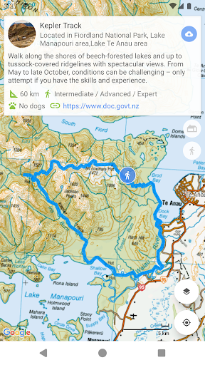
Screenshots


App Description
Offline NZ Topo50 maps. Import, edit & record GPX. Find DOC huts, tracks & camps
Topographic map of New Zealand with no limitations:
• Fully functional for free!
• View and cache topographic tiles and satellite imagery
• Download topographic tiles in a visible region and below (for offline availability)
• Add unlimited map markers
• Import GPX / KML / FIT waypoints, tracks and routes
• Import GeoJSON areas (including DOC Open Hunting overlay)
• Plan, create and edit tracks with a powerful GPX editor
• Record routes or follow imported tracks
• Export and share tracks and markers
• View track / route elevation profile (with interactive graph)
• Search and view DOC tracks (import tracks for offline availability)
• Search and view DOC huts and campsites (tap a hut marker for up-to-date information)
• Relief shading support (giving the topography depth)
• Measure distance (in a straight line) between multiple points and markers
• Search for places of interest (supports Decimal, DMS, NZTM2000 and UTM coordinates)
• Topographic imagery for Antipodes, Auckland, Bounty, Campbell, Chatham, Kermadec and Snares Islands
• Paper map reference (Topo50 sheet index) for markers (when viewing NZTM2000 coordinates)
• Group markers by tag for easy organisation (change colours, toggle visibility)
• Battery conscious (for those that can't recharge every day)
• Space conscious (for those that don't have gigabytes to spare; external SD card support; full tile cache control)
• Stay up-to-date with the latest imagery (no dependency on application updates)
• Navigate with Google Maps interactions (pinch zoom, scroll, rotate, drop marker, drag marker etc)
New Zealand Maps - NZ Topo Map is intended for outdoor enthusiasts who want to mark locations visited, create markers to visit, follow imported tracks or create their own. It's designed to be lightweight, intuitive, responsive, battery conscious and totally free.
This app is perfect for tramping, hiking, walking, biking, mountain biking, running, hunting and any outdoor activity that requires topographic and satellite imagery available offline. Integrated with DOC (Department of Conservation) you can get the latest hut, campsite and track information.
Developed by an adventurous Kiwi for adventurous Kiwis!
Topographic Map Tiles
The Topo50 map series provides topog