Georgia State Roads
Georgia State Roads Summary
Georgia State Roads is a mobile iOS app in Travel And Local by Coderun Technologies Ltd. Released in Feb 2017 (9 years ago). It has 12 ratings with a 1.33★ (poor) average. Based on AppGoblin estimates, it reaches roughly 32 monthly active users . Store metadata: updated Dec 16, 2025.
Store info: Last updated on App Store on Dec 16, 2025 .
1.33★
Ratings: 12
Screenshots
App Description
Live traffic reports and video cameras for Georgia including Atlanta, Columbus, and Augusta. One time purchase, no subscription required. The app was updated December 2025.
KEY FEATURES:
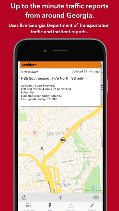
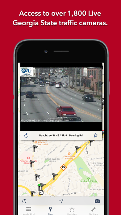
Live data from The Georgia Department of Transportation (GDOT):
- 1,812 traffic video cameras covering Georgia State.
- Today screen widget to show at a glance the nearest current traffic incidents
- Optimised for all iPhone and iPad models.
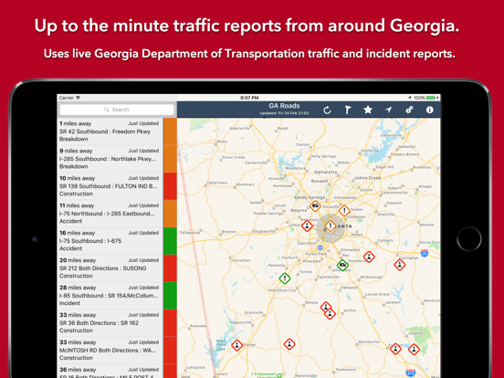
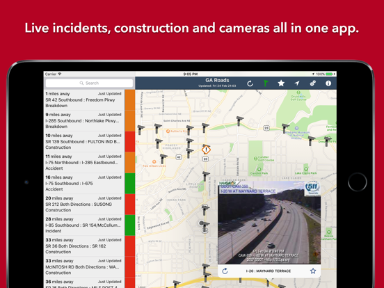
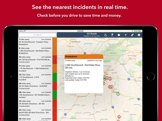
MAP VIEW
- Shows current incidents and traffic cams
- Each incident is color coded as well as being represented by an icon showing the incident type.
- Clicking on an incident displays more detail right there on the map.
- The map view can also show live traffic camera images.
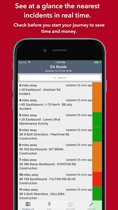
LIST VIEW
- Shows current incidents in order of distance from your current location (closest incidents are shown first).
- Each incident is color-coded to indicate the severity of the delay.
- You can quickly see the distance the incident is from you, the road name and the type of incident.
- The detail view shows the description together with a map showing the location.
- Full search functionality, works across both the list and map views.
TRAFFIC CAM FAVORITES
- Save your favorite cameras for quick access to see how clear/congested your usual routes are.
TODAY WIDGET
- Shows at a glance the nearest current traffic incidents without launching the app.
PERSONALISE
- Toggle traffic information on the map.
- Toggle auto refresh of camera images (will refresh every 10 seconds).
- Toggle always show map on app launch.
- Toggle construction on/off.
- You can configure which incidents are displayed according to the severity of the delay caused.
- Miles or KM setting.
CONTACT
- Email me for feature requests/bug reports etc. I would love to hear from you!
Data courtesy of The Georgia Department of Transportation (GDOT).