AeroChart
AeroChart Summary
AeroChart is a with in-app purchases iOS app in Maps And Navigation by DataAppz Tecnologia Ltda. Released in Dec 2017 (8 years ago). It has 582 ratings with a 4.62★ (excellent) average. Based on AppGoblin estimates, it reaches roughly 1.5K monthly active users and generates around $<10K monthly revenue (100% IAP / 0% ads). Store metadata: updated Apr 20, 2026, version 1.
Data tracking: SDKs and third-party integrations were last analyzed on May 7, 2026.
Store info: Last updated on App Store on Apr 20, 2026 (version 1).
4.62★
Ratings: 582
Screenshots
App Description
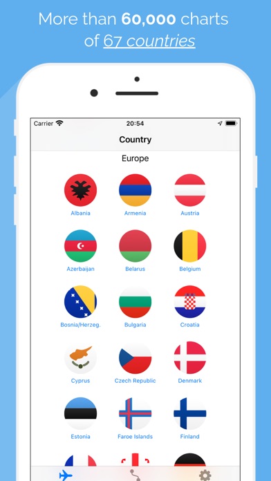
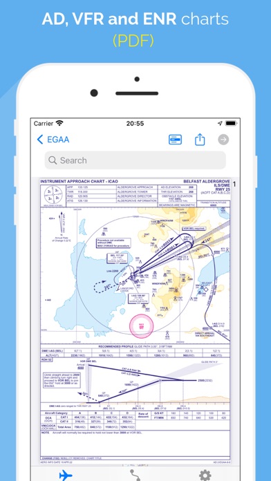
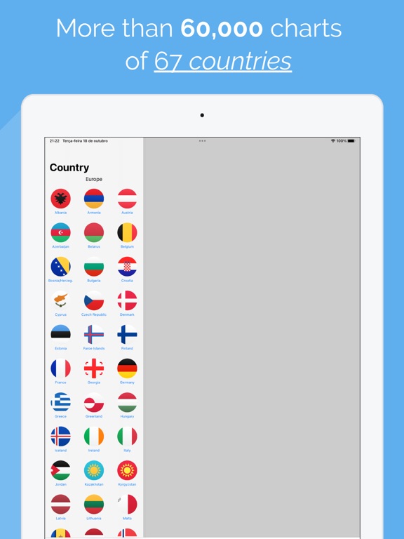
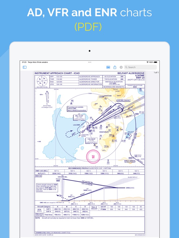
• 60,000 aeronautical charts
• 30,000 worldwide aerodromes
• 100,000 waypoints (United States and Brazil)
• 67 countries
AeroChart is an application designed for pilots and aviation enthusiasts. It is a pioneer in the segment. AeroChart is an aggregator and content organizer, focused on commercial aviation, which aids in navigation and allows the visualization of navigation charts. This app facilitates access of pilots to charts - formerly accomplished via PDF through generic readers . Adapted for mobile device access just getting more practical and organized.
REGIONS / SUBSCRIPTIONS (name, description with length of subscription)
• ASIA (Bangladesh, China, Hong Kong, India, Japan, Macau, Malaysia, Mongolia, Philippines, Singapore, South Korea, Taiwan and Thailand)
- Asia 1 month-Aero Charts Asia 1 month
- Asia 6 months-Aero Charts Asia 6 months
• BRAZIL
- Brazil 1 month-Aero Charts Brazil 1 month
- Brazil 1 month Plus-Aero Charts Brazil 1 month + GeoRef
- Brazil 6 months-Aero Charts Brazil 6 months
- Brazil 6 months Plus-Aero Charts Brazil 6 months + GeoRef
• EUROPE
- Europe 1 month-Aero Charts Europe 1 month
- Europe 1 month Plus-Aero Charts Europe 1 month + GeoRef
- Europe 6 months-Aero Charts Europe 6 months
- Europe 6 months Plus-Aero Charts Europe 6 months + GeoRef
• MIDDLE EAST(Bahrain, Cyprus, Jordan, Qatar, Saudi Arabia, Turkey and United Arab Emirates)
- MidEast 1 month-Aero Charts MidEast 1 month
- MidEast 6 months-Aero Charts MidEast 6 months
• OCEANIA (New Zealand only)
- Oceania 1 month-Aero Charts Oceania 1 month
- Oceania 6 months-Aero Charts Oceania 6 months
• RUSSIA (Russian Federation, Tajikistan and Turkmenistan)
- Russia 1 month-Aero Charts Russia 1 month
- Russia 6 months-Aero Charts Russia 6 months
• USA (UNITED STATES OF AMERICA)
- USA 1 month-Aero Charts USA 1 month
- USA 1 month Plus-Aero Charts USA 1 month + GeoRef
- USA 6 months-Aero Charts USA 6 months
- USA 6 months Plus-Aero Charts USA 6 months + GeoRef
ATTENTION: All the above subscriptions are also available in the [Premium] version. See conditions below.
• Aero Charts means a limited time access package to the aeronautical charts (IFR, VFR and ENR) of the region informed of official and public Aeronautical Information Publications (AIP) with possibility of offline use and updates.
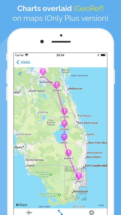
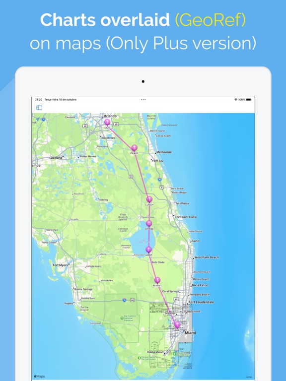
• GeoRef means providing the overlay capabilities of the a