Australian Geology Travel Maps
Australian Geology Travel Maps Summary
Australian Geology Travel Maps is a with in-app purchases iOS app in Travel And Local by David Collins. Released in Apr 2018 (7 years ago). It has 140 ratings with a 3.47★ (mixed) average. Based on AppGoblin estimates, it reaches roughly 393 monthly active users and generates around $<10K monthly revenue (100% IAP / 0% ads). Store metadata: updated Jan 22, 2026, version 116.
Data tracking: SDKs and third-party integrations were last analyzed on Feb 18, 2026.
Store info: Last updated on App Store on Jan 22, 2026 (version 116).
Australian Geology Travel Maps was last scanned for SDKs 2026-02-18. Below is the overview of third party companies detected in the app. The full list of raw SDKs, app permissions and unknown SDKs is available here.
3.47★
Ratings: 140
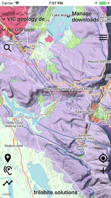
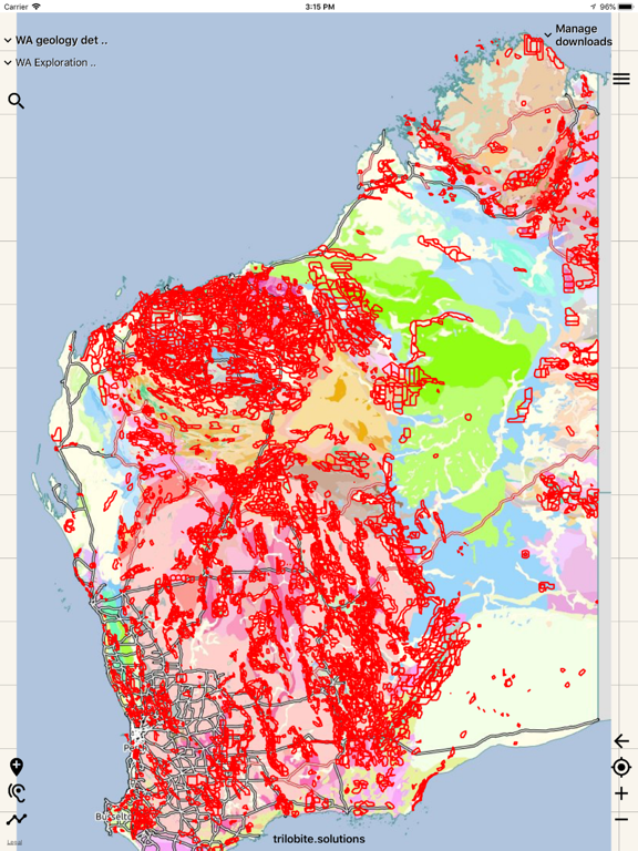
Screenshots


App Description
Australian Geology Travel Maps is a field app that displays the best available data from the government geological surveys in interactive maps created by Trilobite Solutions. It does not have any reliance on cell phone reception in the field, and uses GPS so your location is always marked on the map. Maps are downloaded to your phone when have an internet connection, and from that point on, you are independent of the internet.
The simple geology maps are rich with contextual data - including shaded relief, roads, towns, tracks, rivers, lakes, geographic names, indigenous land, national parks & provincial parks.
App development, system maintenance and user support is fully-funded by subscriptions - there is no in-app advertising and your data is absolutely PRIVATE.
Overview video: http://trilobite.solutions/maps/videos/
App subscription
- $11.99/year for Australians (1-week FREE trial)
- required by ALL app users to run the app
FUNCTIONALITIES
• record your trails and write notes on marked locations
• geology is spoken when you cross a boundary while driving
• overlay any map semi-transparently over any other map
• export trails and marked locations to Google Earth or your GIS
• import trails and marked locations from Google Earth
• import geojson data and mbtiles maps (videos on web-site)
• draw straight line to target destination
All AUSTRALIAN states:
• simple geology
• detailed geology
• symbolised resource map
• aero-magnetics imagery
• recorded locations for many resource types
• mining and lease boundaries
NEW ZEALAND:
• geology map
• earth resources
• earthquakes overlay
WA prospector subscription
- $17.99/year for Australians (1-week FREE trial)
- access to specialised prospecting maps
• live/pending tenement boundaries (updated after every working day)
• map of gold resources
• drill holes overlay
• display selected WA tenements
• 1:250k topo maps for all of WA
• graticular blocks overlay
QLD, NSW & VIC gold subscription
- each $7.99/year for Australians (1-week FREE trial)
• symbolised gold map for the state (updated 3-monthly)
Subscriptions cover all your iPhones & iPads.
When in the field, please PUT YOUR PHONE INTO FLIGHT MODE. This greatly extends your phone's battery life.
Warning: iPads without SIM sockets do not have GPS hardware, so will NOT determine