BRMB Maps by Backroad Maps
BRMB Maps by Backroad Maps Summary
BRMB Maps by Backroad Maps is a with in-app purchases iOS app in the Maps And Navigation category, developed by Mussio Ventures Ltd.. First released 5 years ago(Oct 2020), the app has 1.5K ratings with a 4.49★ (good) average rating.
Data tracking: SDKs and third-party integrations were last analyzed on Nov 10, 2025.
Store info: Last updated on App Store on Sep 19, 2025 (version 3).
BRMB Maps by Backroad Maps was last scanned for SDKs 2025-11-10. Below is the overview of third party companies detected in the app. The full list of raw SDKs, app permissions and unknown SDKs is available here.
4.49★
Ratings: 1.5K
Screenshots
App Description
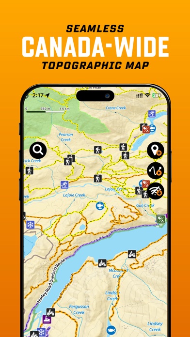
Canada’s #1 App for Hunting, Fishing, Camping & Outdoor Adventure
Explore Canada’s outdoors with confidence using BRMB Maps, the most detailed and trusted GPS navigation app for the backcountry. Built from the award-winning Backroad Mapbooks series, BRMB Maps combines detailed topographic maps with over 900,000 searchable Points of Interest across every province and territory.
Whether fishing, camping, hiking, hunting, paddling, ATVing, snowmobiling or wildlife viewing, BRMB Maps has everything you need to plan, navigate and explore – online or offline.
Key Features
-Topographic GPS Maps – View relief shading, contour lines, backroads, parks and geographic features
-Current Location Tracking – Use your phone’s GPS to navigate in real time
-Cross-Device Access – Use on smartphone, tablet and desktop with a single account
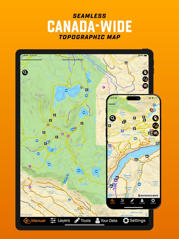
-Canada-Wide Basemap – Includes a seamless Backroad Maps basemap across Canada
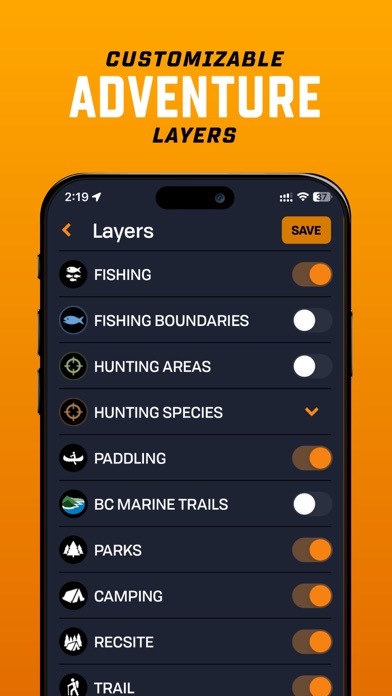
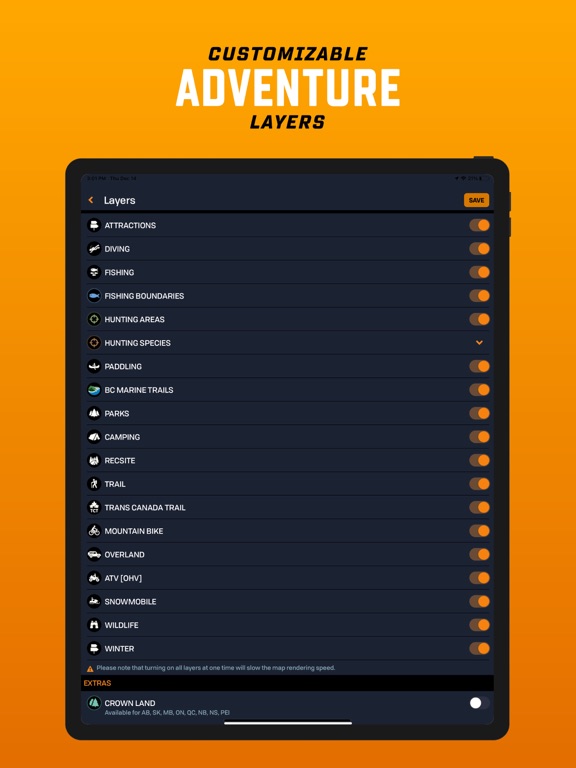
-Custom Adventure Layers (PRO) – Enable fishing, hunting, trails, paddling, Crown land & more
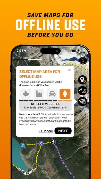
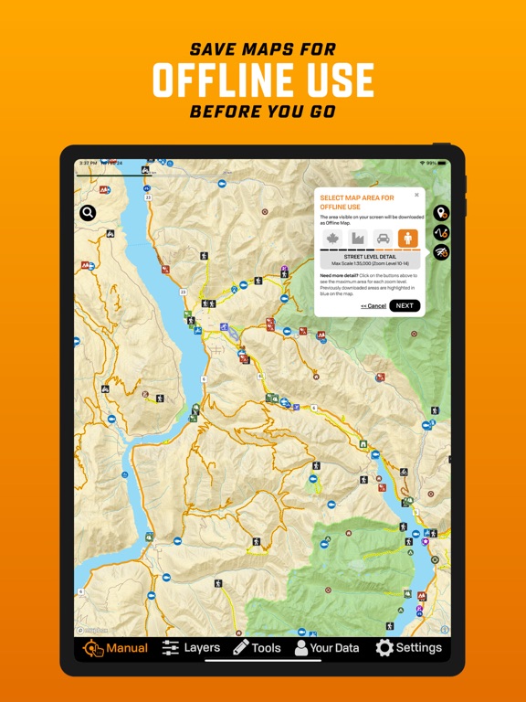
-Offline Maps (PRO) – Download maps and all POI details for off-grid navigation
-Satellite Imagery (PRO) – Overlay roads, trails and features on high-res satellite maps
-Trip Recording & Custom Waypoints – Track routes, mark campsites and save locations
-Printable Custom Maps (PRO) – Create and print stunning maps from brmbmaps.com
Explore Over 150,000 Adventures
Fishing
-22,000+ lakes, rivers, creeks & ocean fishing areas
-Bathymetry (lake & ocean depths), fish species, stocked lakes, boat launches & marinas
-Boundaries & regulations
Hunting
-3,500+ hunting areas (WMU, WMZ, species-specific zones)
-Species details, boundaries & regulations
-Crown land & private land layers
Camping & Parks
-20,000 national, provincial, regional, urban and natural parks
-Campsites, picnic areas, backcountry campsites, huts & cabins
-Private campgrounds, resorts & lodges, amenities & services
Hiking, Biking & Horseback Trails
-130,000+ km of multi-use trails with trailheads, difficulty, distance & elevation gain
-Includes hiking, mountain biking, horseback riding, backpacking and multi-use
-Separate Trans-Canada Trail layer with trailheads, pavilions and alternate routes
Paddling (Canoeing & Kayaking)
-107,000+ km of routes with access points, difficulty, distance & grading
-Features lake circuits, river and ocean paddling routes, whitewater & more
-Paddlin