SityTrail+ GPS hike bike ski
4★
Ratings: 1
Screenshots


App Description
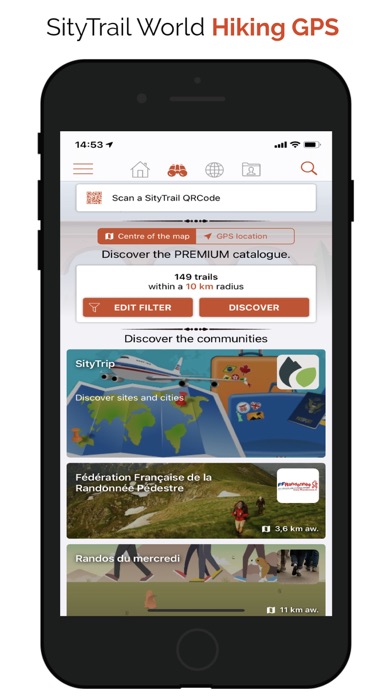
DISCOVER OUR FREE FREEMIUM FEATURES:
RECORD YOUR ADVENTURES:
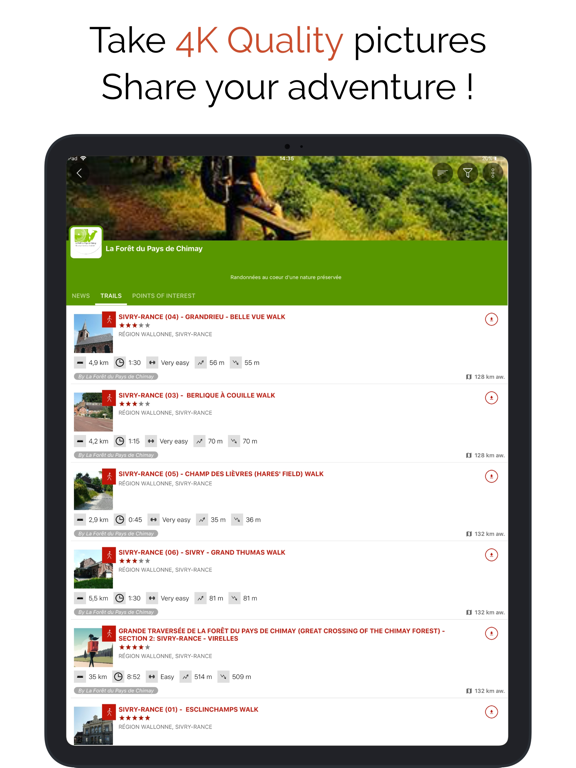
• Save your hikes with geotagged photos.
• Track your performance: distance, effort in Km, average speed, pace, calories burned.
NAVIGATE SAFELY:
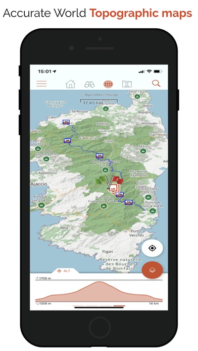
• Accurate altimeter with interactive altitude profile.
• Automatic alert if you stray from your route to prevent getting lost.
• Automatic triggering of points of interest with vocal descriptions.
EASILY PLAN AND SHARE:
• Create and edit your trails and points of interest directly from our website.
• Access your projects online and instantly retrieve them on your iPhone.
• Sort and organize your favorite routes in personal lists.
UNIVERSAL ACCESS:
• Create a free account to sync your data across all your devices.
• Discreet ads displayed solely to finance our free servers.
UPGRADE TO PREMIUM FOR LIMITLESS ADVENTURES:
PREMIUM MAPS AND OFFLINE MODE:
• Download detailed topographic maps by area (IGN France, SwissTopo, Luxembourg, United Kingdom, and worldwide Geolives topographic maps).
• Access the best hiking networks (GR, PR, European routes, Saint-Jacques de Compostelle).
• Discover cycling paths (Voies vertes in France, Ravel in Belgium, Node networks in the Netherlands).
• Easily identify ski slopes by their colors and names.
OPTIMIZED GUIDANCE AND SAFETY:
• Benefit from advanced GPS vocal guidance with precise Roadbook symbol generation.
• Let yourself be guided effortlessly with clear visual symbols displayed at each intersection or direction change. Always know exactly which trail to follow, no technical knowledge needed!
• Easily estimate remaining distance and time with clear and realistic display.
ACTIVE AND COLLABORATIVE COMMUNITY:
• Explore the public catalog of favorite community trails.
• Transform your hikes into rich multimedia guides with texts, photos, videos, and share them with other users.
• Create your own communities, easily manage members, and share news.
ADVANCED EDITING AND PRINTING FEATURES:
• Precisely edit your trails through our web platform.
• Easily print your trail maps in PDF (A4 or A3 format) with integrated QR Code.
COMPATIBLE WITH YOUR GARMIN:
• Record and follow your trails directly from your Garmin smartwatch, including remaining time estimates and realistic visual guidance with precise Roadbook symbols.
• With SityTrail, fully experience your outdoor