Ant tracker, GPS-phototracker
Ant tracker, GPS-phototracker Summary
Ant tracker, GPS-phototracker is a with in-app purchases iOS app in Maps And Navigation by Vladimir Tezin. Released in May 2021 (5 years ago). It has 1.00 ratings with a 5.00★ (excellent) average. Based on AppGoblin estimates, it reaches roughly 4.00 monthly active users and generates around $<10K monthly revenue (100% IAP / 0% ads). Store metadata: updated Apr 12, 2026.
Store info: Last updated on App Store on Apr 12, 2026 .
5★
Ratings: 1.00
Screenshots

App Description
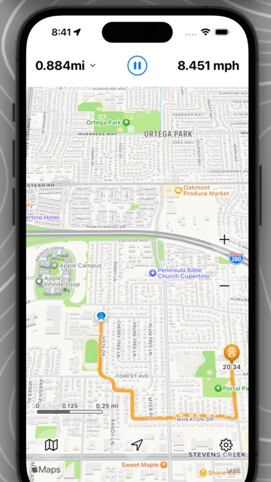
Ant is more than just a GPS tracker. It's a photo tracker.
An ant is smaller than a human but smarter than a regular GPS tracker. An ant is a photo tracker.
While standard track recording and viewing are made convenient and simple here.
You won't find half the screen filled with running numbers for latitude, longitude, and other deviations from the azimuth like in Terminator's head ))
Ant is designed for people who love to travel, take photos, and share their adventures with others.
Only here will you see not only where you've been and how far you've traveled but also what you photographed along the way.
Walk, travel, ride your bike, and take photos with your phone as you usually do.
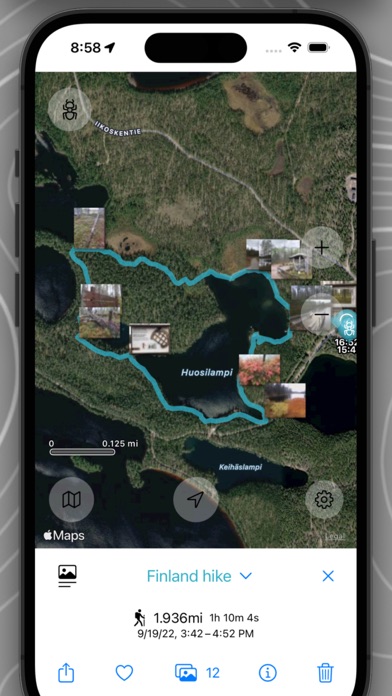
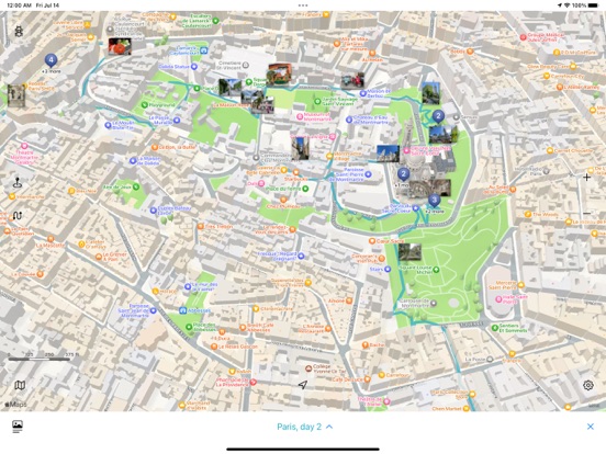
If Ant was recording a track at that time, your photos will be automatically added to the track. Right on the map and exactly where they were taken.
No need to open the app to take photos from within it—that's inconvenient and strange. Just grant access to your photos, and Ant will display everything itself.
Enjoy your travels and the world around you, not unnecessary communication with complex features.
You can and should share your recorded tracks. The developed .phototrack file format allows you to transmit complete information about a track in a single file. With descriptions and photos.
Saved tracks are easy to find and view. They are organized by activity (running, cycling, walking, etc.), chronology, countries, and regions.
You can also combine tracks into your own groups (e.g., "Vacation in the mountains in August," "Morning runs," etc.).
There are also favorite tracks—your masterpieces should always be at hand.
And of course, the functionality for working with favorite places on the map is implemented. Mark, describe, photograph, and share.
Quick execution of standard actions: marking the current position on the map, starting/stopping track recording, adding a point by taking a photo, dark/light mode, etc.
All application data is stored exclusively on your device.
Your adventures are your adventures))