GoGoEarth - Custom map source
GoGoEarth - Custom map source Summary
GoGoEarth - Custom map source is a ad-supported, with in-app purchases iOS app in Maps And Navigation by 大靖 刘. Released in May 2022 (3 years ago). It has 187 ratings with a 4.41★ (good) average. Based on AppGoblin estimates, it reaches roughly 792 monthly active users and generates around $<10K monthly revenue (37% IAP / 63% ads). Store metadata: updated Mar 8, 2026.
Recent activity: 1.00 new ratings this week View trends →
Data tracking: SDKs and third-party integrations were last analyzed on Feb 8, 2025.
Store info: Last updated on App Store on Mar 8, 2026 .
4.41★
Ratings: 187
Screenshots


App Description
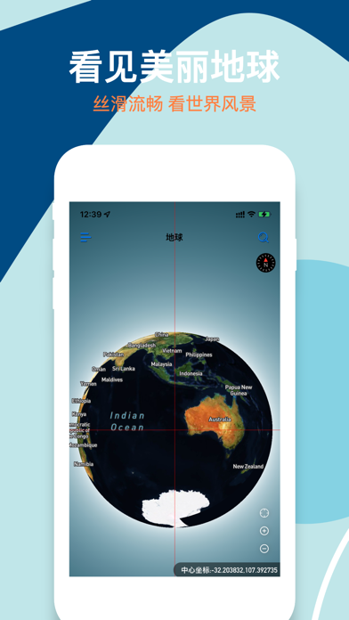
Many people have dreamed of traveling the world and choose to bury their dreams for a variety of reasons. Come and visit the Globe Earth~
Globe Earth allows you to hold a magical globe, which is as smooth and small as a globe, and as real and clear as our earth.
Globe Earth provides map zoom levels 0-22, using de-cloud data from NASA MODIS satellites at zoom levels 0-8.
Maxar satellite imagery and NASA/USGS Landsat 5 and 7 imagery are mainly used in limited locations at zoom levels 9-12.
Use a combination of open and proprietary sources at zoom level 13+, including Maxar's Vivid product for most of the world, Nearmap aerial imagery of US cities, and open aerial imagery from Denmark, France, Germany, and elsewhere.
Globe Earth satellite images come from a variety of sources, and the original images are color corrected to look realistic.
In addition to ultra-high-definition satellite images, we also provide other easy-to-use features:
- Search: Search anywhere in the world at will
- World Street View: HD panoramic street view maps of more than 200 countries and regions around the world
- Classic building models: For some scenic spots, we provide 3D models based on real buildings, look for them~
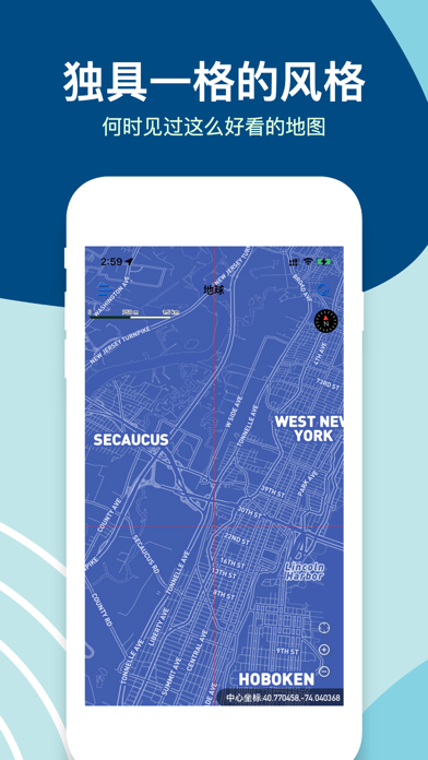
- Map style switching: Tired of satellite images? There are other styles for you to switch, and we will provide more styles in the future
- Navigation: Although this is not our main purpose, we still provide a complete basic navigation function for the convenience of users.
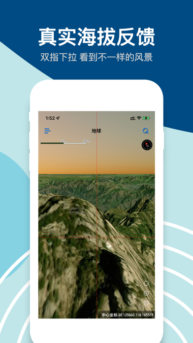
- Real altitude: When you are in satellite image mode, pull down with two fingers to switch the camera from the sky to the ground. During the sliding process, the altitude will be reflected in the map in real time, try it out~
- Supports multiple latitude and longitude formats: copied a latitude and longitude from somewhere else? Feel free to paste in the search bar and we'll automatically recognize the different formats and show you the point.
- Favorite places: During your browsing process, if you come across an interesting place that you like, long press to save it, and you can view and go to it at any time in the future.
- A variety of custom settings: We provide a lot of custom content, you can set them according to your situation.
The surprises that Globe Earth brings to you may not only stop there, but there may also be shortcomings. Users are welcome to give us feedback in a timely mann