LeadNav GPS
LeadNav GPS Summary
LeadNav GPS is a with in-app purchases iOS app in Maps And Navigation by LeadNav Systems LLC. Released in Oct 2013 (12 years ago). It has 108 ratings with a 3.73★ (average) average. Based on AppGoblin estimates, it reaches roughly 440 monthly active users and generates around $<10K monthly revenue (100% IAP / 0% ads). Store metadata: updated Jan 28, 2026.
Store info: Last updated on App Store on Jan 28, 2026 .
3.73★
Ratings: 108
Screenshots

App Description
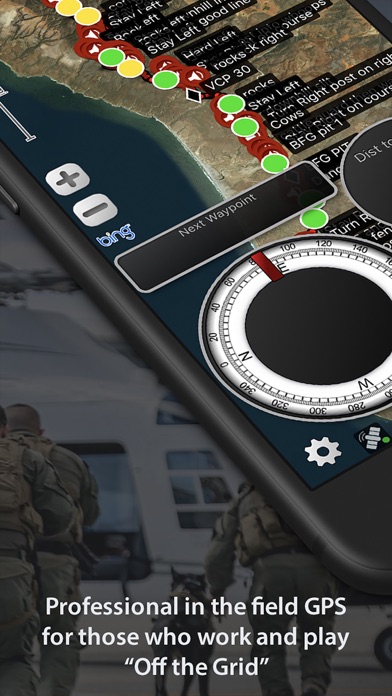
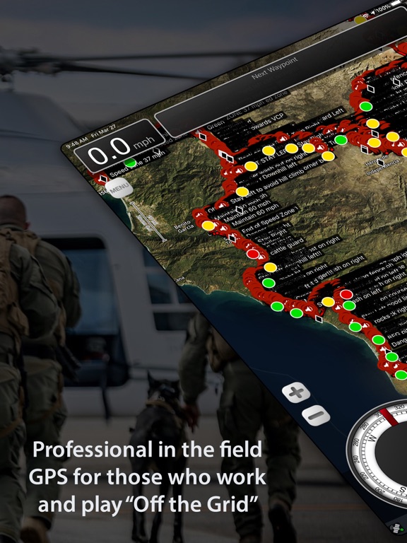
Mission Planning, Coordination, Communication and GPS Navigation for those who Work and Play "Off the Grid”
Built by operators for operators, with decades of experience leading technology innovation in the field.
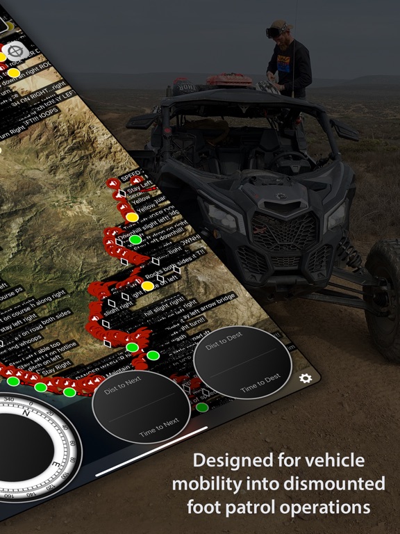
Focused on mobility into dismounted foot patrol operations, LEADNAV currently provides full mission packages in the form of Software, Hardware, Training and Consulting for those operating in some of the harshest conditions and environments imaginable.
Used by many, to include off-roaders, security and response teams and other Professional Organizations World Wide!
More Powerful than any other GPS on the Market!
Features:
• Plan, Organize, Coordinate and Execute Trips, Events and other Professional Operations.
• Create or Import Collections of Routes, Tracks, and Markers for different events. (Baja 1000 2019, Mining Expedition 2020)
• Share individual Routes, Tracks, and Markers amongst your Team or Group.
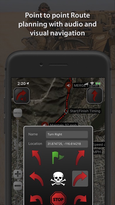
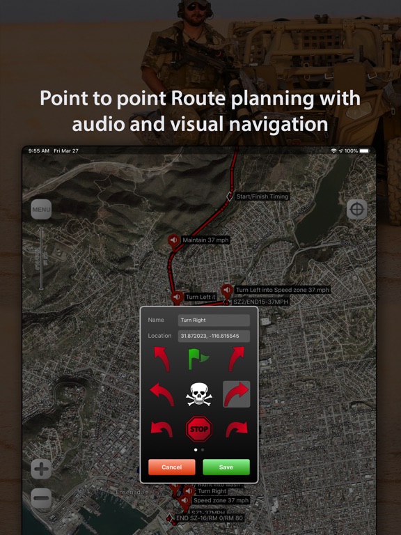
• Easy to use point to point Route Planning Interface. Plan your route and go!
• Drop audible warnings and non-audible Serpentine points to keep you on track.
• Record tracks to display where you have been. So you can hit the trail again or find your way back. You can also convert your tracks to routes. Track Stats for each trip.
• Highly advanced Team Location Tracking through our cellular/wifi, preprogrammed Iridium GO! units (Satellite device and our service plans) and other specialized equipment under contract.
• Reverse your routes. Hike to the top and then reverse the route to hike back down!
• Drop Markers to identify places of interest or to document the experience as you go. Vehicle, rally point, boat dock, deer, or anything else you want to find again.
• System functions on the GPX file standard
• Free online Map Sources include Bing, OpenStreetMap, USGS Satellite and USGS Topo
• Support of offline mapping options like MBTiles and overlays with our Pro Pack subscription and contracted services.
• Subscriptions allow access to additional features and maps (Mapbox Satellite, Mapbox Terrain, Mapbox Streets), and access to your own URL entry (Part of the Pro Subscription). Create, cache, and delete maps with your custom URLs. *Maps subject to change by the providers
• Offline Mapping for areas with no cellular coverage. (yearly subscriptions) Select and store desired