Altimeter GPS Offline Altitude
Altimeter GPS Offline Altitude Summary
Altimeter GPS Offline Altitude is a Android app in the Maps And Navigation category, developed by Foxpoi. First released 2 years ago(Apr 2023), the app has accumulated 46.8K+ total installs and 93 ratings with a 2.50★ (poor) average rating.
Recent activity: 106 installs this week (644 over 4 weeks) showing declining growth , and 1 new ratings this week (4 over 4 weeks) with stable momentum. View trends →
Store info: Last updated on Google Play on Apr 9, 2024 .
2.5★
Ratings: 93
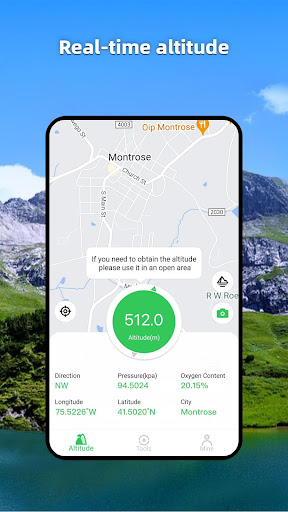
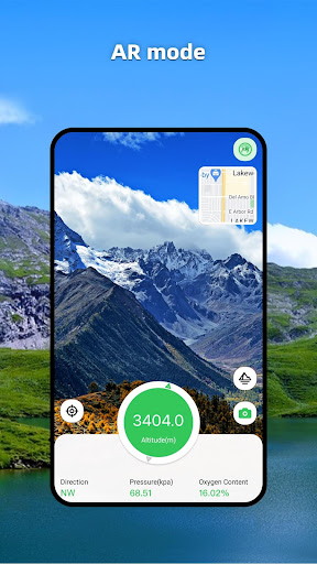
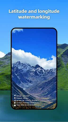
Screenshots

App Description
Outdoor essential GPS offline altitude mapper&elevation meter
The Altimeter GPS Offline Altitude is a necessary app for outdoor people, including information such as geographical location, GPS, altitude, oxygen content, atmospheric pressure, and direction; It can be used when measuring and recording geographic information during travel and work, and it can also take photos with information such as height, longitude, and latitude.
[Function]
1. Altitude: Display the current altitude information accurately and in real time.
2. Query altitude: View other locations to measure altitude.
3. Compass and level: Accurate and real-time display of current direction.
Locator: Displays the current longitude, latitude, and address information, and displays it on the map.
5. Social sharing: You can take photos with height, longitude, latitude, and other information to share.
The format of longitude and latitude is as follows:
-DMS degrees, minutes, seconds hex
-DD Decimal
The height format is as follows:
-Meters
-Feet
The air pressure format is as follows:
- kpa
- mbar
- atm
- mmHg
-GPS does not work well indoors.
-GPS accuracy depends on the receiver in your device.
-Air pressure data depends on the presence or absence of air pressure sensors in your device.