Live Earth Map: Satellite View
Live Earth Map: Satellite View Summary
Live Earth Map: Satellite View is a ad-supported Android app in the Maps And Navigation category, developed by FreeFun Studios. First released 4 months ago(Aug 2025), the app has accumulated 21.7K+ total installs
Recent activity: 509 installs this week (5.5K over 4 weeks) showing above average growth View trends →
Store info: Last updated on Google Play on Aug 28, 2025 .
0★
Ratings:
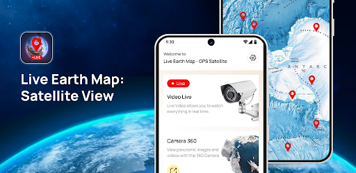
Screenshots


App Description
Explore 3D Earth maps, GPS, live traffic & satellite view with smart tools!
🌍 Explore the World Smarter with Live Earth Map: Satellite View!
Why settle for static maps when you can experience the world in motion? Live Earth Map combines satellite view, GPS navigation, real-time traffic updates, 3D Earth exploration, and smart travel tools into one powerful app. Whether you’re a traveler, driver, or simply curious about the world, this all-in-one earth map app transforms the way you navigate, explore, and stay informed.
📌 With Live Earth Map: Satellite View, you’re no longer limited to basic navigation. This app gives you interactive maps, real-time data, and 360° camera views to help you explore like never before. From tracking live traffic to checking air quality and accessing a global world clock, this map app with GPS and satellite imagery puts the world in your hands.
✨ Key Features You’ll Love:
🎥 Live Video View – Get a real-time perspective of locations with a live camera view, powered by GPS and satellite data.
📸 360° Camera Lens – Spin around in every direction and explore places with a street-level 360° view.
🌍 3D Earth Explorer – Zoom in, tilt, and rotate the globe with immersive 3D earth maps and satellite imagery.
📌 GPS Go View – Instantly find, tag, and save any location with smart GPS location tracking.
🚦 Real-Time Traffic – Avoid delays with up-to-date traffic maps, routes, and road conditions.
🌫 Air Quality Check – Stay safe by checking air quality index (AQI) for your location and destinations.
🕒 Global World Clock – Keep track of world time zones with an accurate, easy-to-use clock.
🧭 Smart Compass – Navigate with precision using the built-in digital compass.
💡 Why Choose Live Earth Map: Satellite View?
✔️ All-in-One Mapping Solution – Combines GPS navigation, 3D maps, satellite view, traffic updates, and more.
✔️ Accurate & Real-Time Data – Reliable information for travel, driving, or daily use.
✔️ User-Friendly Interface – Easy navigation for everyone, from beginners to travelers.
✔️ Global Coverage – Explore any place in the world, from major cities to remote areas.
✔️ Smart Travel Companion – More than just a map — it’s your personal earth explorer app.
🚀 Get Started Today!
Try Live Earth Map: Satellite View and transform the way you explore. From 3D earth maps to real-time traffic updates, this app is your go-to tool for smarter, safer, and more exciting journeys. 🌍✨