GPS Satellite Map Navigation
GPS Satellite Map Navigation Summary
GPS Satellite Map Navigation is a ad-supported, with in-app purchases Android app in Maps And Navigation by Orcas Tech. Released in Jan 2023 (3 years ago). It has about 578.9K+ installs and 750 ratings with a 4.25★ (good) average. Based on AppGoblin estimates, it reaches roughly 104.2K monthly active users and generates around $10K+ monthly revenue (67% IAP / 33% ads). Store metadata: updated Mar 9, 2026, version 23.
Recent activity: 35.8K installs this week (132.6K over 4 weeks) showing steady growth , and 63 new ratings this week View trends →
Data tracking: SDKs and third-party integrations were last analyzed on Mar 3, 2026. The app's network data flows (API traffic to/from the app and its SDKs) were last crawled on Jan 1, 2026.
Store info: Last updated on Google Play on Mar 9, 2026 (version 23).
GPS Satellite Map Navigation was last scanned for SDKs 2026-03-03. Below is the overview of third party companies detected in the app. The full list of raw SDKs, app permissions and unknown SDKs is available here.
4.25★
Ratings: 750
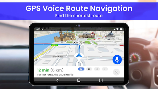
Screenshots


App Description
Find your driving directions with this satellite view map navigation app
GPS Satellite Map Navigation - Have The World with Satellite view In Your Hands!
For anyone who wants real-time views from satellite view of different places on Earth, the Live World Map with 3D view App offers a great experience with GPS satellite views that are immersive, accompanied with high-resolution imagery and advanced GPS tracking. The Live Earth map of world can be explored with accurate 3D different GPS maps and active satellites. Explore Nearby Places of earth map can be explored easily with the best of satellite technology and 3D imaging with the Live earth Map & GPS satellite app.
Key Points of GPS Satellite Map Navigation App:
🌍 Current Location in 3D, real-time;
🌍 Satellite Imagery available with Live Map Earth: Satellite View;
🌍 Live Earth Camera from word
🌍 Live Street View 360 in your pocket
🌍 GPS Earth Map Satellite view allows you to explore different places with few clicks
🌍 Navigate your route anywhere with 3D Earth Map
🌍 Live GPS Satellite Map App best fast app
🌍 GPS World Map has find Live Location with accuracy
🌍 Full 360 panoramas with Live Earth Map: Street View
🌍 Live satellite view data makes it usable worldwide!
Now it is easier than ever to explore the world with satellite mapping precision. Live Earth Map: Street View goes beyond basic visuals to deliver an enhanced viewing experience. With smooth and accurate GPS-navigated routes, Live Map Earth: Satellite View helps users navigate cities, tourist destinations, and even unexplored paths with confidence. Live Earth Map: Street View provides an instant and immersive connection to your surroundings.
🗺️ Find the Routes via Traffic Map:
Plan better routes using smart GPS map functionality. Whether you're avoiding traffic or seeking shortcuts, the real-time traffic map ensures efficient GPS navigation with live updates and accurate driving directions.
📷 Capture Moments with GPS Camera:
Take stunning pictures and embed real-time location tags using the GPS camera. With earth cam and live map support, it's perfect for travelers and geo tagging fans.
The Live World Map - GPS satellite App offers users a clear, round CCTV view of the planet, giving users the experience of floating above the Earth’s landmarks, walking the streets, and everything in between with GPS Map: Live GPS Satellite Map App.
GPS Navigation has gotten easier:
Navigate smarter and faster with GPS World Map: Live Location, designed to help users find Route accurately and avoid wrong destination issues. The advanced GPS Map with real-time Live Location tracking supports smooth navigation across the world map. With Live Street View: GPS Earth Map Satellite and gps satellite view, users can visually explore Globe, experience real-time street walking, and understand routes clearly for daily travel, tourism, and location discovery.
See the World from Every Angle:
Experience the planet like never before with 3d Earth Map: Live GPS Satellite Map App, designed to bring iconic landmarks, mountains, rivers, and cities to life. Using Live GPS, this advanced Earth Map lets users enjoy a realistic 3d Earth Map live view with smooth Street View and detailed Satellite View. By combining Live Earth Map: Street View and Live Map Earth: Satellite View, users can Explore the globe, travel virtually, and truly see the world from every angle. This powerful Live GPS satellite map app makes it easy to explore the planet with satellite view and real-world accuracy.
Start Exploring with Live Map Earth: Satellite View Now!
The Live World Map 3D App, Live Earth Map: Street View, 3D Earth Map, and Live Satellite Map App combine cutting-edge technology, real-time travel insights, and interactive mapping to give you the ultimate navigation and exploration experience. With GPS World Map: Live Location and Live Street View: GPS Earth Map Satellite, you can explore world map like never before, enjoy immersive 3D globe views, and experience virtual travel across cities, rivers, and landmarks