 AppGoblin
MA GPX: Create, Edit GPS track
MA GPX: Create, Edit GPS track was last scanned for SDKs 2025-10-06. Below is the overview of third party companies detected in the app. The full list of raw SDKs, app permissions and unknown SDKs is available here.
2.4★
Ratings: 164
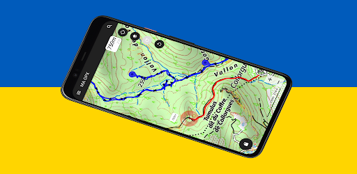
Screenshots


App Description
MA GPX is a hiking GPS that reads, edits, modifies, records all of your tracks
Better than a hiking GPS, MA GPX is the complete hiking application.
# Prepare your GPS tracks
You import your tracks from KML or GPX files and modify them as you want.
You draw the track, instantly obtain the distance and then the measurement of the elevation.
To create the track, you draw the track with your finger, you can stretch it, delete sections, cut it, add sections,...
Your tracks are stored in the tracks history. You can then resume each of the tracks.
You display your tracks on the map, share them with your friends, or simply display profiles and statistics.
# Offline Maps (outdoor activities)
To be guaranteed to get the necessary maps of outdoor activities, you download maps by advance.
You download the maps from a predefined area on the map or simply from a track to follow.
The cache containing the downloaded maps can be viewed to obtain the size rate.
# Outdoors
Thanks to the quality screen of your smartphone MA GPX replaces any hiking GPS, as you can:
- see on the map your position at any time.
- display the tracks of your choice.
- display statistical data (altitudes, distances, breaks, speeds, percentage of slopes and instantaneous speed)
- save your road.
- save points of interest (POI) on your track.
- Make a sight line with the compass of your device to obtain the point in sight. The azimuth will be plotted on the map at the target point.
And from the voice guide, you are able to:
- to be guided by the sound assistance to follow a route.
- to listen to the directions and the deviations from the trajectory.
- to suspend or resume guidance at any time.
- to change the route to follow at any time.
# Maps
Many quality maps are available such as Swiss, France, Belgian, Spanish maps and many more.
You have access to specific layers (overlay maps) allowing
- to obtain the inclination of the terrain
- to obtain the OpenStreetMap paths
- to obtain the European paths of great hikes
# Other features
Useful feature are available such as:
- Share your position by SMS or email (In an emergency, for example).
- Save or restore all your tracks in a single operation.
- Obtain the geographic coordinates of a point and share it.
- Search a geographic position on the map from latitude and longitude or place name.
- View or edit the track(s) of your choice when the GPX file contains seve