 AppGoblin
Természetjáró, a túratervező
341.8K installs
+710
weekly installs
trend steady
+1.7K
monthly installs
trend steady
SDKs, Trackers & Permissions
Természetjáró, a túratervező was last scanned for SDKs 2025-11-02. Below is the overview of third party companies detected in the app. The full list of raw SDKs, app permissions and unknown SDKs is available here.
App Details
Store ID: com.outdooractive.mtsz
First Released: 2018-11-22
Store Last Updated: 2025-10-16
In-App Purchases: Yes
Ads: No
Website: outdooractive.com
App Store
Crawl Status: Success
Store First Crawled: 2021-02-06
Store Last Crawled: 2025-10-31
Ads & App-Ads.txt
Ads.txt Last Crawled: 2025-10-19
Ads.txt Crawl Status: Success
SDK Tracking Status
Successful Last Crawled: 2025-11-02
Last Crawled: 2025-11-02
Last Crawl Status: Success
0★
Ratings: 0
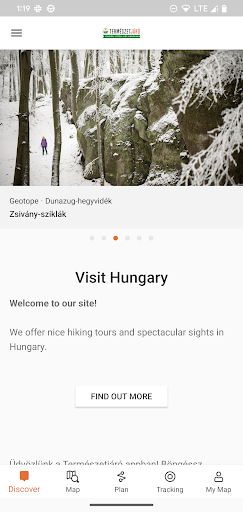
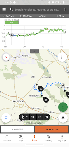
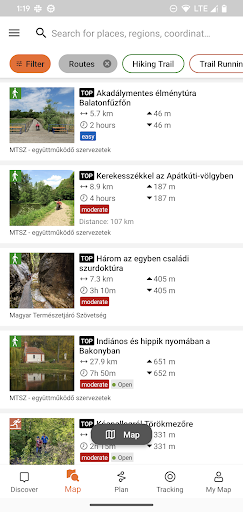
Screenshots

App Description
Hundreds of recommended tours and thousands of POIs
The online tourist guide of Hungary, specially developed for hikers, bikers, trailrunners, rockclimbers and water sports lovers, featuring a built-in tour planner, as well as hundreds of recommended tours and thousands of sights, all with detailed descriptions and plenty of photographs, comfortably viewable on an interactive map. Available for free, with a subscription option for extended functionality.
<u>Features</u>
• Various interactive, zoomable, vectorized, <b>worldwide hiking maps<b> with all the marked trails, showing your current position
• A convenient way to <b>plan your own<b> tour on the map, and get length, duration and elevation profile immediately
• More than a thousand <b>recommended tours<b> for hikers, bikers, trail runners and canoers, with practical data, detailed description of the best sights nearby, natural and cultural background, good quality photographs and information on how to get there
• Thousands of <b>recommended sights<b> in Hungary, including lookout towers, natural panorama points, forest trains, fortresses and museums, with detailed description, good quality photographs, plus information on how to get there
• Hundreds of <b>accommodations<b>, including huts, tourist hotels and apartments, near marked trails
• <b>Useful collections<b> with map view: beaches around lake Balaton, ice-skating arenas, botenical gardens, the best trail-running routes, rock-climbing places, tours for people living with disabilities etc.
• Notices, warnings and <b>closures<b>
• <b>Download<b> map sections, tours and sights <b>for offline use<b>
• On-the-fly <b>navigation<b> along the route with a live elevation profile and voice instructions
• <b>Record your route<b>
• <b>BuddyBeacon<b>: share your positon with friends live
• The complete <b>Hungarian Blue Tour<b>, with official sections and route, POIs and accomodations
• <b>Synchronise all your content<b> between computer and mobile devices running the app
• Check the local <b>weather forecast<b>
• <b>3D-flight<b>: a virtual bird’s eye view of the tour
• Useful tools built in, such as <b>peak finder<b>(Skyline) and <b>compass<b> with your current position
• Community services: rate and share contents with your friends
<u>Smartwatches with Wear OS from Google</u>
With a glance at your Smartwatch, you get information about your GPS posi