Naturfreunde Tourenportal
Naturfreunde Tourenportal Summary
Naturfreunde Tourenportal is a ad-supported, with in-app purchases Android app in the Travel And Local category, developed by Outdooractive AG. First released 6 years ago(Dec 2019), the app has accumulated 13.2K+ total installs
Recent activity: 35 installs this week (134 over 4 weeks) showing steady growth View trends →
Store info: Last updated on Google Play on Dec 18, 2025 .
0★
Ratings:
Screenshots

App Description
Tour planning & orientation
Tourenportal.at – The Naturfreunde Austria app provides the perfect navigation for your outdoor activities.
Whether hiking, mountaineering, climbing, ski touring, or freeriding, the app provides worldwide tour suggestions, tour descriptions, information on huts, weather and avalanche information, or you can plan your own route in just a few steps.
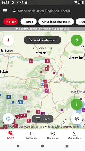
State-of-the-art vector maps provide precise information on hiking trails, bike paths, via ferratas, and protected areas, as well as details for many other outdoor activities.
The app works synchronously with the Naturfreunde Tour Portal web portal. This means that tours planned and searched for on a PC/laptop automatically appear in the app, which you can use with a GPS device on your tour.
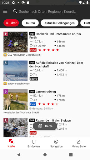
WORLDWIDE TOUR DATABASE
In the Naturfreunde Tour Portal, you'll find great tour suggestions for most sporting summer and winter activities, such as hiking, snowshoeing, ski touring, alpine tours, mountain biking, climbing, or freeriding. Discover popular tours near you – great classics or insider tips from the community.
TOUR PLANNING ON YOUR SMARTPHONE
No matter where you are or what sport you practice: With the tour planner, you can easily create routes tailored to your needs and plan your individual tour. You can add text and photos to your own tours using the app, or save them as a personal tour log. You can publish them to the community or share them privately with friends.
RECORD YOUR OWN TRACKS
Start the track recording and off you go: During your tour, the app shows you where you are and which interesting destinations are nearby. The tracking function allows you to record your own routes, including duration, distance, elevation gain, and an interactive elevation profile.
STATE-OF-THE-ART MAP TECHNOLOGY
Thanks to state-of-the-art vector maps, you can enjoy razor-sharp views at all zoom levels. Our digital summer and winter maps are provided by OSM. All maps can be freely panned, allowing you the best possible orientation in nature.
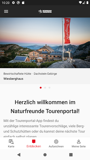
LARGE MOUNTAIN HUTS DIRECTORY
Opening hours, sleeping accommodations, availability, and prices, as well as other information about mountain huts, are available in the large hut directory.
FAST SYNCHRONIZATION
Access your tours and lists planned on your PC at any time via the app. Thanks to synchronization between the app and the web, your data is always up to date on all devices.
Smartwatches with WEAR OS by Google:
With a glance at your smartwatch, you get information about your position on the GPS map. You can record routes, view your tracking data, and switch between different map types.
Exclusively for Pro
Best maps:
You also get detailed topo maps from official data sources for all of Germany, Austria, Northern Italy, and Switzerland, as well as the unique Outdooractive map with over 30 activity trail networks.
Offline storage:
Download tours and digital maps directly to your smartphone for offline use. Be well-equipped for excursions – whether in the mountains, abroad, or in regions with poor network coverage.
Create your own lists:
Whether it's tours, places, or sights: Collect interesting finds in your own personal lists or share them as tips for the community.
Exclusively for Pro+
With IGN for France, you get maps with official data, the official map series of the Alpine Clubs, as well as premium maps from KOMPASS and certified premium tours from KOMPASS, Schall Verlag, and ADAC hiking guides.