GeoFotoUTM
0★
Ratings:
Screenshots


App Description
Georeferenced photographs for archaeology, paleontology, wildlife and other purposes
GeoFotoUTM is designed for professionals working in the field in archaeology, paleontology, flora and fauna surveys, baseline studies, environmental impact assessments, soil studies, cadastral mapping, and project monitoring.
The app allows you to take photographs with complete geographic information integrated into the image metadata, in a consistent and traceable way for use in reports and databases. For advanced customization, you can use our desktop app, also called GeoFotoUTM (available for macOS and Windows).
Each photo stores:
- GPS coordinates (latitude, longitude, altitude, and accuracy).
- Compass orientation (azimuth).
- Device tilt and orientation.
- Automatic conversion to UTM coordinates.
- EXIF metadata with associated geographic information.
Field Workflow
- Camera preview with real-time geospatial data.
- Configurable overlay on the image (text, coordinates, institution or consulting firm logo).
- Date and time stamp with time zone.
- Use of the device's focusing and stabilization capabilities.
GeoFotoUTM aims to reduce subsequent manual work: coordinates, orientation, and altitude are already embedded in the photo, ready for use in reports, land surveys, or GIS systems.
Geospatial Data
- GPS reading with accuracy indicator.
- Calibratable compass with signal quality indicator.
- 3D orientation (device pitch, roll, and heading).
- Coordinates in decimal, DMS (degrees, minutes, seconds), and UTM (zone and hemisphere).
User Experience
- Interface designed for continuous outdoor use.
- Light and dark themes depending on lighting conditions.
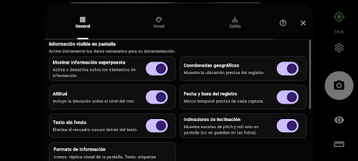
- Configuration of which information is displayed on the screen.
- Adjustment of the size and position of overlaid information.
Use Cases in Chile
- Archaeology: recording sites, findings, and structures with exact coordinates and documented orientation.
- Paleontology: documentation of findings, profiles, and stratigraphic contexts with precise location.
- Flora: photographic record of plots, transects, species, and sampling points in the field.
- Fauna: documentation of sightings, traps, camera traps, and monitoring points.
- Topography and Cadastre: photographic support for surveys, delimitations, and review of areas of interest.
- Geological and Biodiversity Studies: documentation of sampling points, outcrops, stations, and surveys.
Privacy and Permissions
GeoFoto UTM saves photos and their metadata only on your device. We do not send or store your information on external servers.
Required Permissions:
- Camera: to take photos.
- Location: to obtain GPS coordinates.
- Storage: to save images.
- Sensors (compass, accelerometer, and gyroscope): for device orientation and tilt.
- Vibration: for haptic feedback.
Technical Requirements
- Android 7 or higher / iOS 16 or higher
- GPS and magnetometer (compass)
- Accelerometer and gyroscope for tilt data
- Best performed outdoors with a clear view of the sky
Tips for Improved Accuracy
1. Use the app outdoors with a clear view of the sky.
2. Calibrate the compass periodically from within the app.
3. Wait for the GPS to reach reasonable accuracy before taking a picture.
4. Keep the device away from metal objects or magnets.
Supported Formats
- Coordinates: Decimal, DMS (degrees-minutes-seconds), and UTM. - Images: JPEG with full EXIF metadata
- Reference system: WGS84 (GPS) with automatic conversion to UTM
--- GeoFotoUTM helps you document your fieldwork with photos that already include the geographic information you need, without any extra steps after taking the picture.