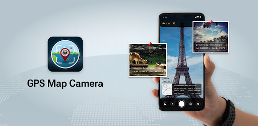
GPS Map Camera - GeoLens
GPS Map Camera - GeoLens Summary
GPS Map Camera - GeoLens is a ad-supported, with in-app purchases Android app in the Photo And Video category, developed by ViPrak Web Solutions. First released 8 months ago(May 2025), the app has accumulated 322+ total installs
Recent activity: 1 installs this week (3 over 4 weeks) showing below average growth View trends →
Store info: Last updated on Google Play on May 26, 2025 .
0★
Ratings:
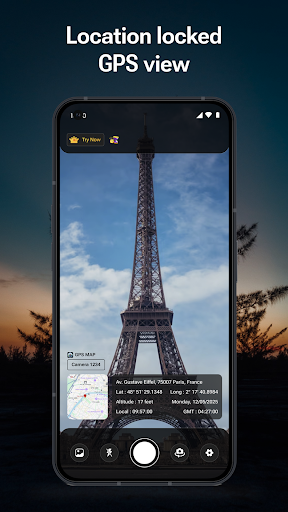
Screenshots


App Description
Capture photos with GPS, timestamp, and location stamps effortlessly.
GPS Map Camera - GeoLens: Capture, Tag & Explore Your World
Frame Your Journey with Precision
Discover a whole new way to capture and document your travels with **GPS Map Camera - GeoLens**, the perfect companion for explorers, professionals, and memory-makers. Whether you're trekking through scenic landscapes, documenting business locations, or simply sharing moments with geo-tagged photos, **GeoLens** empowers you to snap, tag, and navigate effortlessly.
Capture with GPS Precision
Your photos are more than just snapshots; they are memories with a location. With **GeoLens**, every photo you take is seamlessly stamped with precise **GPS coordinates, location address, date, time, and more**. Ideal for travelers, journalists, photographers, and professionals needing accurate geotagged images.
Key Features
Auto GPS Tagging
- Instantly embed latitude, longitude, altitude, and compass direction into your photos.
- Capture exact location details, including city, street name, and area.
- Works globally—whether you're exploring bustling cities or serene landscapes.
Customizable Stamps
- Personalize your photos with date, time, address, weather info, and altitude.
- Choose from multiple stylish stamp designs to suit your purpose.
- Adjust fonts, colors, and stamp position for a professional touch.
Weather & Environment Data
- Embed real-time weather conditions including temperature, humidity, and atmospheric pressure.
- Showcase your surroundings with detailed environmental insights.
Professional Utility
- Perfect for real estate agents, field professionals, and surveyors to document locations.
- Supports businesses requiring proof of visit, travel bloggers, and explorers.
- Create location-based photo reports with ease.
Offline & Sync Features
- Capture geo-tagged photos without an internet connection—data syncs when online.
- Save photos in high resolution with embedded GPS metadata.
- Export and share images via email, social media, or cloud storage.
Simple, Intuitive & User-Friendly
With an easy-to-use interface, **GPS Map Camera - GeoLens** makes geotagging seamless for everyone.
1. Open the app and point your camera.
2. Capture the moment—location details are auto-stamped.
3. Customize your tags and share your masterpiece instantly.
Who Benefits from GeoLens?
- Travel Enthusiasts: Stamp your travel experiences with precise locations.
- Real Estate Agents: Showcase properties with accurate GPS stamps.
- Field Professionals: Document surveys and inspections efficiently.
- Bloggers & Photographers: Add authenticity to your captures.
Share & Impress
Post geo-tagged images directly on Facebook, Instagram, WhatsApp, and more to let your friends and followers explore your journey.
---
Download GPS Map Camera - GeoLens Today
Take photos that tell a story—beyond just an image, with embedded location data.
Capture, tag, and explore effortlessly—**GeoLens is your ultimate GPS camera.**