 AppGoblin
Wavve Boating: Marine Boat GPS
Wavve Boating: Marine Boat GPS was last scanned for SDKs 2025-09-25. Below is the overview of third party companies detected in the app. The full list of raw SDKs, app permissions and unknown SDKs is available here.
4.49★
Ratings: 4219
Screenshots
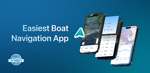
App Description
Boat Navigation, Nautical Charts, Map, Weather, Tides, Water, Depths, Marine GPS
When it comes to marine navigation, nautical charts, and boating maps, The Wavve Boating App is an easy choice. Wavve Boating improved outdated marine navigation apps, tide charts, and depth finders by combining them into one tool. Stay updated on current boating conditions, like marine weather, wave heights, water depths, and tides without a weather app. Access sea maps for your boat, water depths, marine traffic, boat ramps, and other boating tools from the boat navigation app. Don’t waste money on pro chart plotters, depth finders, or Navionics. Boat, sail, ski, and fish with your android phone with the top rated marine GPS in the US, Australia, Canada, and UK.
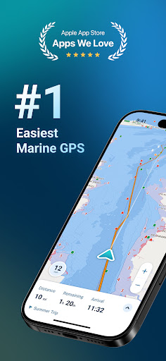
🧭 SEAMLESS MARINE NAVIGATION
Forget crowded nautical charts and confusing boat maps; with Wavve Boating GPS, it’s easy to get boat directions and view water depths the moment you leave the boat ramp. Plan to navigate out on a lake, river, sea, or ocean? Leverage offline planning to route your next trip. See why sailors and captains call us Google Maps for Boating!
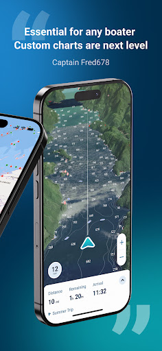
🗺️ CUSTOMIZED MARINE CHARTS
Wavve Boating customizes 15,000+ nautical charts based on your boat's draft. Our Marine App use chartplotter data specific to your vessel. Gone are the days of marine navigation with cluttered chart plotters and buying marine charts piece by piece like in Navionics Boating. Wavve has integrated marine charts into one map for all your boat GPS needs. Marine charts are available in the USA, Canada, Australia, and UK.
🚤 LARGEST BOATING COMMUNITY
Similar to Waze for boats, easily view other drivers on the map and add them as friends. Discover unique boating destinations only available on the water. Wave goodbye to other apps like Navionics, Savvy Navvy, and C-Map and see top rated fishing spots, boat ramps, marinas, moorings, fuel, beaches, islands, sandbars, restaurants, dock and dines, and more! Share insightful boating knowledge and marked points of interest with a community of boaters...or keep them private and hide your ship tracking at any time 🏴☠️
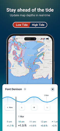
🌊 TIDES
Stay ahead of the tide and avoid shallow waters. The Wavve Boating map automatically adjusts to display current water levels based on tide charts and tidal changes near you. Quickly view hourly tide levels up to 3 days in advance. Wavve takes the stress out of high and low tide a