Desert Maps Navigator GPS Nav
Desert Maps Navigator GPS Nav Summary
Desert Maps Navigator GPS Nav is a with in-app purchases Android app in Travel And Local by خرائط البر. Released in May 2019 (6 years ago). It has about 24.8K+ installs and 2.1K ratings with a 3.79★ (average) average. Based on AppGoblin estimates, it reaches roughly 764 monthly active users and generates around $<10K monthly revenue (100% IAP / 0% ads). Store metadata: updated Feb 26, 2026, version 25091502.
Recent activity: 94 installs this week (608 over 4 weeks) showing steady growth , and 3.00 new ratings this week View trends →
Data tracking: SDKs and third-party integrations were last analyzed on Feb 7, 2026. The app's network data flows (API traffic to/from the app and its SDKs) were last crawled on Nov 24, 2025.
Store info: Last updated on Google Play on Feb 26, 2026 (version 25091502).
Desert Maps Navigator GPS Nav was last scanned for SDKs 2026-02-07. Below is the overview of third party companies detected in the app. The full list of raw SDKs, app permissions and unknown SDKs is available here.
3.79★
Ratings: 2.1K
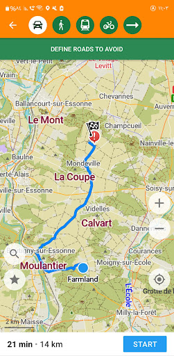
Screenshots


App Description
For desert hiking, outdoor activities, and adventurers, it works offline
Desert Maps – Your Ideal Companion for Desert and Remote Area Exploration
The new and improved version of the Desert Maps app is the perfect guide for all lovers of outdoor adventures, exploration, and desert trips. It provides you with a reliable navigation experience without the need for an internet connection, specifically designed to offer safety and confidence while exploring the vast desert. Whether you're in the heart of the desert or on the city outskirts, you'll find the tools and information you need to stay on track.
Features of the Desert Maps App:
■ Offline and Tower-Free Operation: Efficiently works in both deserts and cities without the need for an internet connection or mobile network coverage.
■ Alternative to Traditional Navigation Devices: Replaces traditional navigation devices, offering a smooth and integrated navigation experience.
■ Detailed Offline Maps: Available for all countries with locations not found on other maps, thanks to the OpenStreetMap community, which allows you to easily contribute and add new locations.
■ Save and Retrieve Locations: Save important locations and access them easily at any time.
■ Trip Tracking: Record your trip’s path so you can safely and comfortably return via the same route.
■ Support for All Coordinate Types: Supports the input and sharing of all types of coordinates for easy navigation and planning.
■ Distance Measurement: An integrated tool to measure distances between locations with high accuracy.
■ Contour Lines and Elevation Profiles: Get clear details of peaks, slopes, and contour lines.
■ Import and Export Data: Import and export landmarks and maps in various formats like KML, KMZ, GPX.
■ Comprehensive Routing: Complete navigation via roadways, direct line, or compass-based navigation according to your preference.
■ Weather and Terrain (Coming Soon): Features like weather updates, rain radar, spring detection radar, and satellite imagery will soon be added, making the app even more comprehensive. We are open to suggestions for adding more features.
■ Comprehensive Coverage: The maps cover all countries worldwide.
■ Paid Features: Enjoy a 3-day free trial to explore the app, and then subscribe to the paid package to access professional features.
The Desert Maps app makes your outdoor trips safe and enjoyable, thanks