Field Navigator
Field Navigator Summary
Field Navigator is a ad-supported, with in-app purchases Android app in the Tools category, developed by Farmis. First released 8 years ago(Mar 2017), the app has accumulated 2.5M+ total installs and 21.9K ratings with a 4.65★ (excellent) average rating.
Recent activity: 1.9K installs this week (15.5K over 4 weeks) showing below average growth , and 57 new ratings this week (274 over 4 weeks) with slowing momentum. View trends →
Data tracking: SDKs and third-party integrations were last analyzed on Nov 23, 2025. The app's network data flows (API traffic to/from the app and its SDKs) were last crawled on Jun 18, 2025.
Store info: Last updated on Google Play on Aug 12, 2025 (version 185).
Field Navigator was last scanned for SDKs 2025-11-23. Below is the overview of third party companies detected in the app. The full list of raw SDKs, app permissions and unknown SDKs is available here.
4.65★
Ratings: 21.9K
Screenshots


App Description
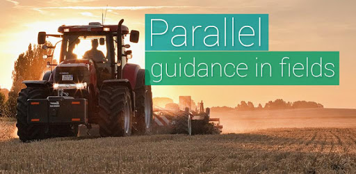
Auto guidance parallel lines in the field while driving tractor or harvester
Being the most popular parallel driving application for Precision Agriculture, it can save money by just installing - no need for additional expensive equipment. Measure the size of your farm, field or grassland easily and hassle-free, even in poor conditions or low visibility.
Save field data, borders and guidance lines, mark obstacles and create a database of your requirement. With Field Navigator Steering Assistance driving to parallel tracks is much easier, reducing the workload, size of untreated areas and avoiding overlaps.
Field Navigator includes the use of Straight AB parallel lines while navigating in the field.
This app is perfect for large and small farm owners, practitioners, learners and professionals of Precision Agriculture.
❖ RECOMMENDATIONS
If built-in GPS receiver is not accurate enough, the connection of external Bluetooth GPS receiver is advised.
❖ FEATURES
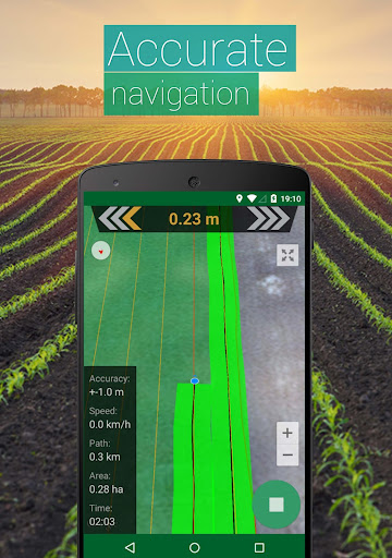
➜ Navigate in parallel lines while driving in the field
➜ Navigate and create tracks on Google Maps in satellite view
➜ Create fields database by using GPS or manually
➜ Measure field area and perimeter by using GPS or manually by selecting points on the map
➜ Import field data in *.shp / *.kml formats
➜ Export field data in *.kml format
➜ Share field data
❖ SOON:
➜ AB Curve
➜ Headland
➜ Obstacle positions
➜ Farming activities database
➜ Driving assistance in 3D mode without maps
➜ Night mode for farming at night time
❖ HOW TO USE:
1. To start parallel driving you have to create a field (irregular hexagon icon at top right corner)
2. Choose implement width and parallel navigation lines creating mode
3. Click "Start" and further steps will be displayed on the top navigation panel
❖ We are also recommending our other app:
➜ GPS Fields Area Measure PRO
goo.gl/dxKHXJ
Farming meanings: RTK, GPS, GLONAS, GARMIN, external gps receiver, parallel driving, automatic steering, SECTION-Control BOX and ISOBUS machine control, farming app, fields, field note, farmers, farmer union, ministry of agriculture, crop protection products, pesticides, herbicides, fungicides, insecticides, tractor, steering tractor, steering harvester, guidance, auto guidance in the field, variable fertilizing rate, variable spraying rate, seeding rate. Field Navigator parallel driving useful tool while harvesting cereal, grain, maize, corn, wheat, soybean, barley, cotton and other agricultural cultures in farm fields. Good for farm contractors, tractor rent companies who is working with john deere, new holland, case, class, agco, laverda, waderstad, simba, krone, kuhn, amazone, kverneland, hardi and other farming equipment. driving Trajectory, field boundaries, Autosteering, Guidance, Accuracy, Seeding, Planting, Spraying, Spreading, Crop Sensing, Harvest, Grassfield, Farm, Measuring, Perimeter, Area Measuring.