TREEO - the tree tracking app
TREEO - the tree tracking app Summary
TREEO - the tree tracking app is a mobile Android app in Tools by TREEO | Fairventures Digital GmbH. Released in Mar 2022 (4 years ago). It has about 3.2K+ installs Based on AppGoblin estimates, it reaches roughly 196 monthly active users . Store metadata: updated Feb 25, 2026.
Recent activity: 32 installs this week (70 over 4 weeks) showing above average growth View trends →
Store info: Last updated on Google Play on Feb 25, 2026 .
0★
Ratings: 0
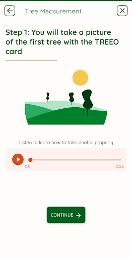
Screenshots


App Description
Reliable data about every single tree for trusted nature-based carbon removals
Note: Please first register with a TPI (Tree Planting Initiative) to fully use the TREEO App or create a trial account to test the app.
TREEO connects balancers with tree growers worldwide to reliably remove CO2 from the atmosphere. Our easy-to-use app provides accurate and verified data about carbon storage from every single tree, bringing credibility and transparency to the voluntary carbon market.
The TREEO app is a digital tool that enables small-holder farmers to plant trees in agroforestry systems, calculate their value, and retrieve best practice recommendations for agroforestry plantations. The app works on simple, affordable, and older Android smartphones. It allows 100% offline use, including field and tree monitoring, timber value estimation, and coaching material. Today the TREEO app supports farmers in three use cases:
Single tree monitoring
Using the TREEO app, farmers can monitor each of their trees individually, tracking details such as tree species, health, and precise location with GPS accuracy. The app's mapping feature helps farmers easily locate specific plots for monitoring. For larger trees (over 1 meter in height), farmers can measure the Diameter at Breast Height (DBH) using the TREEO tree scanner. For smaller trees, they capture a photo of the tree to record its data.
Land surveys
With the land survey component, farmers can map their land. In doing so, they can link surveyed trees to an area to establish the traceability and origin of the trees. Associated Tree Planting Partners (TPPs) can check whether the area meets our regulations for eligible land (e.g. robust land ownership, land status, location, soil quality).
Tree scanning
The farmer takes a picture of the tree. Through imagery analysis, the TREEO algorithm measures the diameter, documents it in a file, and assigns it to a specific plot of land. At each measurement, the GPS location is stored to confirm that the tree is on that plot. With the automatic measurement calibrated with the TREEO card, the Diameter at Breast Height (DBH) and the CO2 removed from the atmosphere are calculated for each individual tree and entire tree stands.
Guiding and training material for farmers
TREEO provides a work plan for farmers with due dates and training material. To-do lists and audio guides assist farmers during every activity. This helps farmers to implement best