i-Boating: Canada & USA - Marine / Nautical Navigation Charts for fishing & sailing
i-Boating: Canada & USA - Marine / Nautical Navigation Charts for fishing & sailing Summary
i-Boating: Canada & USA - Marine / Nautical Navigation Charts for fishing & sailing is a mobile iOS app in Maps And Navigation by Bist LLC. Released in Aug 2015 (10 years ago). It has 25 ratings with a 3.72★ (average) average. Based on AppGoblin estimates, it reaches roughly 43 monthly active users . Store metadata: updated Jun 22, 2016.
Store info: Last updated on App Store on Jun 22, 2016 .
3.72★
Ratings: 25
Screenshots
App Description
This App offers access to CHS marine vector & raster charts. First marine GPS app to have route assistance with Voice Prompts for marine navigation. You can create new boating routes or import existing GPX/KML routes. It supports Nautical Charts course up orientation. Includes Tide & Currents prediction.
(Includes coverage for Trent Severn Waterway incl. lake Simcoe etc.)
►FEATURES
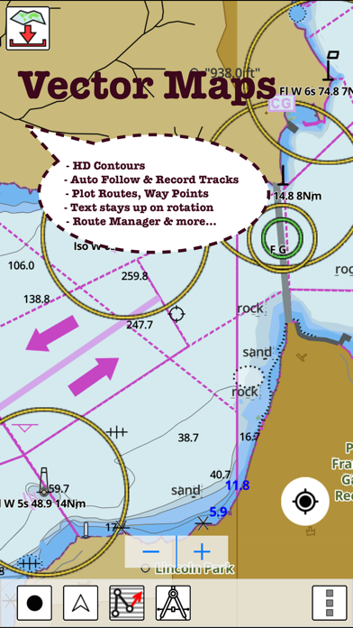
√ Beautiful and detailed Hardware/GPU accelerated vector charts (text stays upright on rotation)
√ Long press to query the details of Marine object (Buoy, Lights, Obstruction etc).
√ Customizable depth(Ft/Fathom/Meter) and distance units (km/mi/NM)
√ Customizable Shallow Depth.
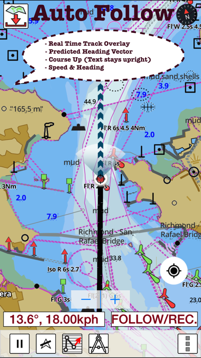
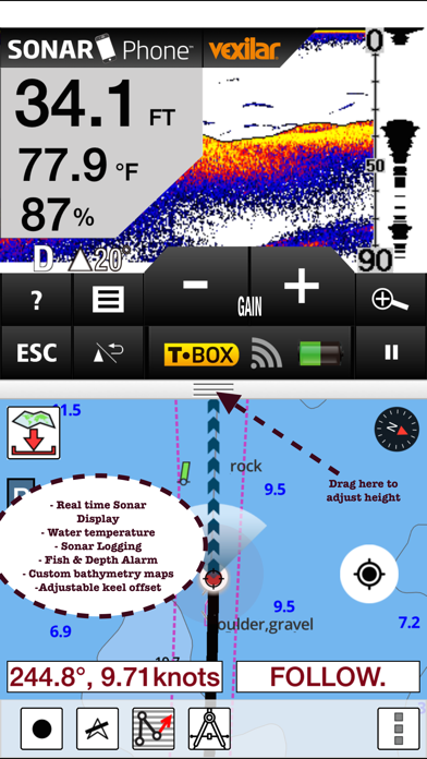
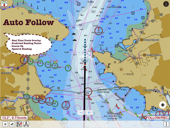
√ Record tracks, Autofollow with real-time track overlay & predicted path vector.
√ Voice Prompts for marine navigation (requires GPS )
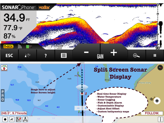
√ 1ft / 3ft depth contour maps for anglers for selected lake maps.
√ Supports GPX/KML for boating route editing/import.
√ Tide & Currents prediction.
√ Seamless chart quilting of marine charts
√ Enter or import Waypoints.
► MAPS
The maps include coverage of Pacific Coast, Central Canada(incl. Great Lakes, Trent Severn Waterway, Ontario Lakes), Atlantic coast derived from CHS data.
►ROUTE MANAGEMENT / TRIP PLANNING
√ Create New Route/Edit Existing Routes
√ Move Points
√ Add points to an existing route leg
√ Delete / Rename points
√ Import GPX, KML & KMZ files
√ Plot/Edit Routes
√ Enter Waypoints
√ Share/Export Routes, Tracks & Markers
√ Reverse Routes
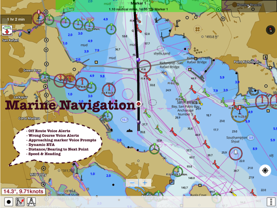
►GPS FEATURES
√ Auto Follow
* Real Time Track Overlay
* Predicted Path Vector
* Course Up (Text stays upright)
* Speed & Heading
√ Route Assistance With Voice Prompts
* Prompts when approaching a boating route marker
* Continous distance and ETA updates
* Alerts when sailing/boating off route
* Alerts when boating in wrong direction
√ Record Tracks
►TIDE & CURRENTS
* For US, Canada, UK, Germany & New Zealand
* High/Low Tides
* Tidal Current Prediction
* Active Current Stations
►Instrumentation
√ Marine AIS & (NMEA AIS and GPS over TCP/UDP)
√ Wind direction & Speed,Sonar depth,Water temperature
► SHARING
* Share tracks/routes/markers on Facebook & Twitter
* Export tracks/routes/markers as compressed GPX files.
Sample Nautical Charts
►Rainy Lake and Lake of the Woods
►Quebec to Anticosti