i-Boating:Sweden Marine Charts
i-Boating:Sweden Marine Charts Summary
i-Boating:Sweden Marine Charts is a mobile iOS app in Maps And Navigation by Bist LLC. Released in Mar 2016 (10 years ago). Store last updated Nov 3, 2022
i-Boating:Sweden Marine Charts SDKs Summary
App not yet scanned for SDKs.
0★
Ratings:
Screenshots
App Description
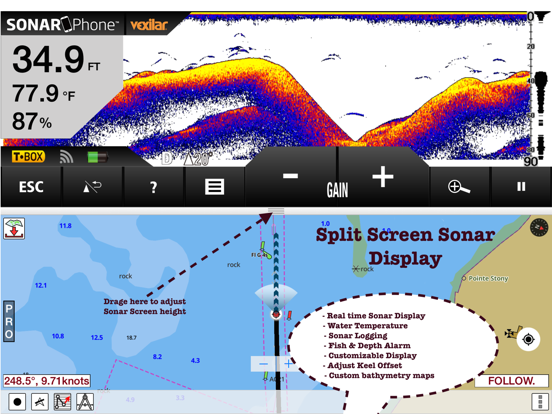
This App offers offline nautical charts,lake & river navigation maps covering Sweden/Sverige for fishing,kayaking,boating & sailing. Coverage includes marine vector charts,freshwater lake maps & inland river maps. First marine GPS app to have route assistance with Voice Prompts for marine navigation. You can create new boating routes or import existing GPX/KML routes. It supports Nautical Charts course up orientation. Includes Tide & Currents prediction.
►FEATURES
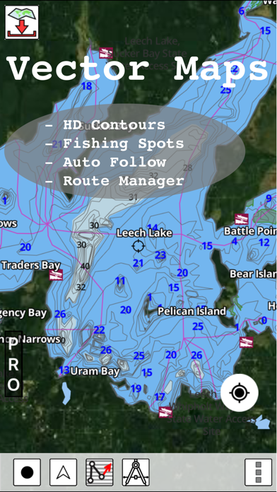
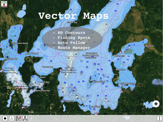
√ Beautiful & detailed Hardware/GPU accelerated vector charts (text stays upright on rotation)
√ Query details of Marine object (Buoy,Lights,Obstruction etc).
√ Customizable depth(Ft/Fathom/Meter) & distance units (km/mi/NM)
√ Customizable Shallow Depth.
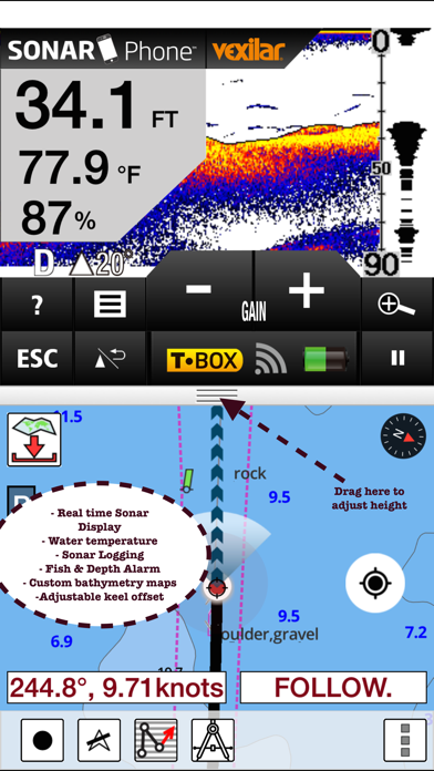
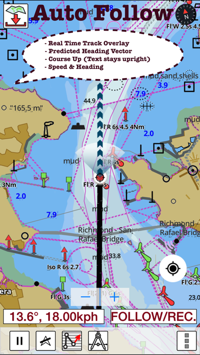
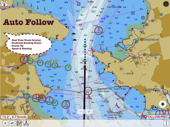
√ Record tracks,Autofollow with real-time track overlay & predicted path vector.
√ Voice Prompts for marine navigation (requires GPS )
√ Supports GPX/KML for boating route editing/import.
√ Tide & Currents prediction.
√ Seamless chart quilting. Map details from Coastal,Approaches,Harbour,Inland
Encs(rivers)& general ENC charts are automatically mapped to correct zoomlevel
√ Enter or import Waypoints.
► MAPS
Get all the details that you find in your chart plotters!
Includes unlimited updates for 1 year.
Sweden
►ROUTE MANAGEMENT / TRIP PLANNING
√ Create New Route/Edit Routes
√ Reverse Routes
√ Enter,Move,Add,Delete,Rename Waypoints
√ Import GPX,KML & KMZ files
√ Plot/Edit Routes
√ Share/Export Routes,Tracks & Markers
►GPS FEATURES
√ Auto Follow
* Real Time Track Overlay
* Predicted Path Vector
* Course Up (Text stays upright)
* Speed & Heading
√ Route Assistance With Voice Prompts
* Prompts when approaching a boating route marker
* Continous distance & ETA updates
* Alerts when sailing/boating off route
* Alerts when boating in wrong direction
√ Record Tracks
►TIDE & CURRENTS
* For US,Canada,UK,Germany&New Zealand
* High/Low Tides
* Tidal Current Prediction
* Active Current Stations
► SHARING
* Share tracks/routes/markers on Facebook & Twitter
* Export as compressed GPX files.
Sample Charts
Almagrundet
Argos grund
Arholma
Arild
Arkö
Arkö
Askö
Asplången
Aspöja
Baltic Sea
Bay of Bothnia
Berg
Bergkvara
Blackan
Blidö
Bockholmssundet
Bokösund
Bollsta
Borgholm
Brandalsund
Brofjorden
Bråviken
Bullerön
Byxelkrok
Bålsön
Båstad
Böda
Dalbosjön
Dalslands Kanal
Degerhamn
Djursö
Djurö
Dämm