Hiking Map Poland
Hiking Map Poland Summary
Hiking Map Poland is a with in-app purchases iOS app in Travel And Local by Mapa Turystyczna sp. z o.o.. Released in Jun 2016 (9 years ago). It has 103 ratings with a 4.82★ (excellent) average. Based on AppGoblin estimates, it reaches roughly 177 monthly active users and generates around $<10K monthly revenue (100% IAP / 0% ads). Store metadata: updated Feb 26, 2026.
Store info: Last updated on App Store on Feb 26, 2026 .
4.82★
Ratings: 103
Screenshots
App Description
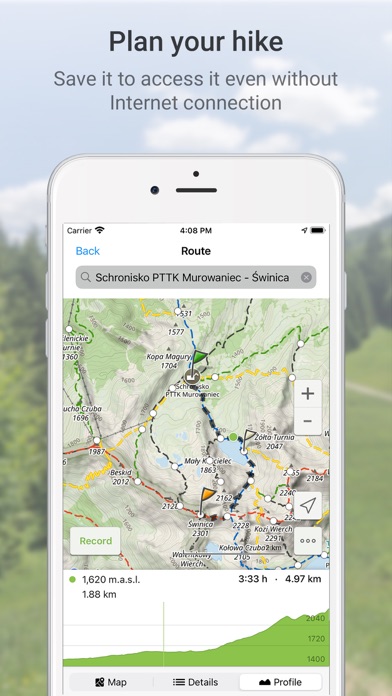
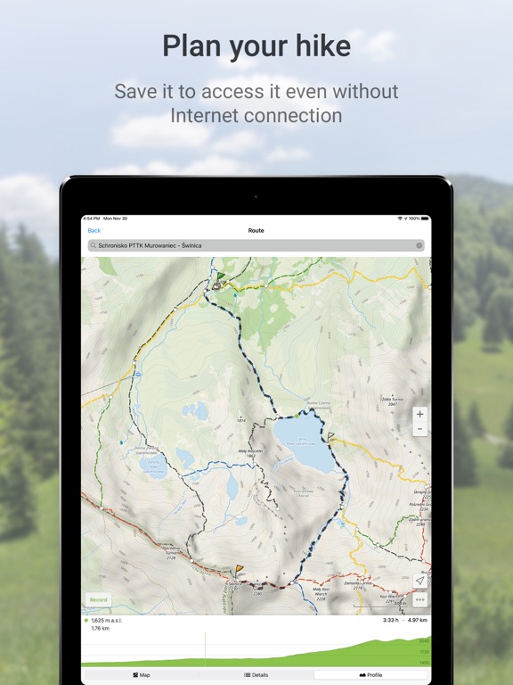
Route planning
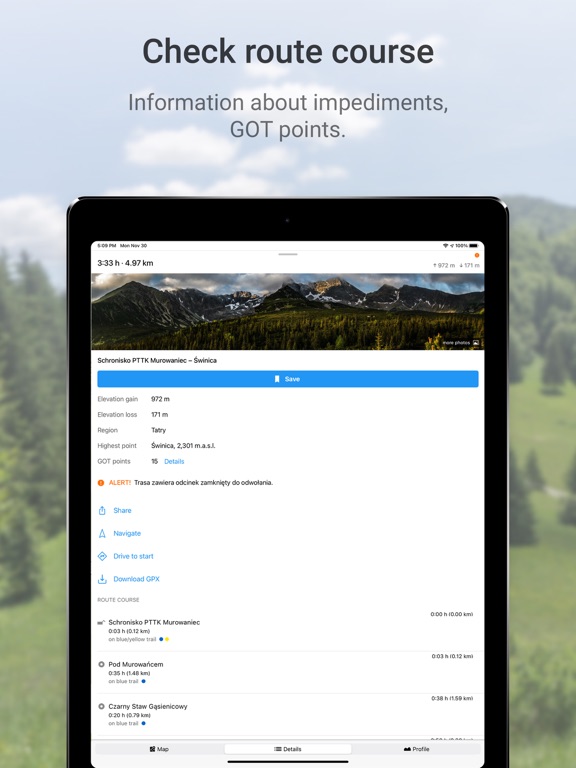
The main functionality is planning routes leading along official hiking trails in the mountains and foothills of Poland. The app finds a route quick and easy, displays it on a map, shows its length, estimated time, detailed course and elevation profile. It also shows your current location.
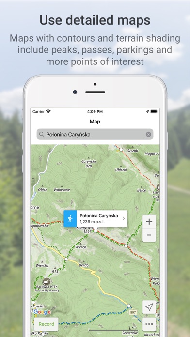
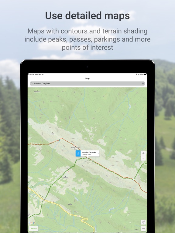
Routes are displayed on detailed Touristic map layer with contours and terrain shading, which contains peaks, passes, parkings and other points of interest. It's also possible to download maps of regions listed further in this description and use them offline.
Tracks recording
Second main functionality is recording tracks. You can then share it with your friends!
Interesting places
The app also displays information about points of interest: photos and opinions taken from the mapa-turystyczna.pl website.
Detailed functionalities:
- planning routes based on given points; points can be chosen from map or found using the search box,
- intelligent search suggestions, considering spots closest to your location and those most popular,
- displaying routes on a map along with their length, estimated time, route details (spots and trails) and elevation profile,
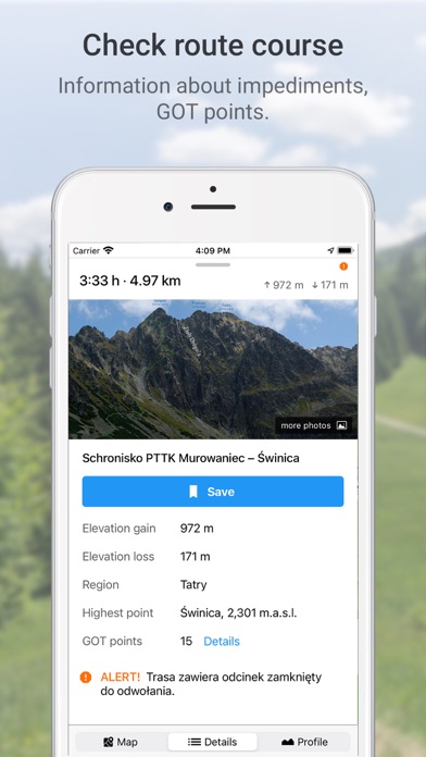
- information about impediments on route,
- GOT points for planned route,
- showing your current location on the map,
- compass,
- track recording, showing elapsing distance and time,
- list of recorded tracks,
- searching for places and showing them on the map,
- displaying information about places your searched for: photos and opinions taken from mapa-turystyczna.pl website,
- navigation on planned route,
- detailed touristic maps layer, also available for download.
Available trails from regions:
* Beskidy
** Beskid Makowski
** Beskid Mały
** Beskid Niski
** Beskid Sądecki
** Beskid Śląski
** Beskid Śląsko-Morawski
** Beskid Wyspowy
** Beskid Żywiecki
** Bieszczady
** Gorce
* Sudety (Sudeten)
** Góry Bardzkie
** Góry Bystrzyckie
** Góry Orlickie
** Góry Izerskie
** Góry Kaczawskie
** Góry Kamienne
** Góry Opawskie
** Góry Sowie
** Góry Stołowe (Table Mountains)
** Góry Wałbrzyskie
** Góry Złote
** Góry Bialskie
** Karkonosze
** Kotlina Jeleniogórska
** Masyw Śnieżnika
** Rudawy Janowickie
* Pogórze Sudeckie
** Pogórze Izerskie
** Pogórze Kaczawskie
* Przedgórze Sudeckie
** Masyw Ślęży
** Przedgórze Paczkowskie
** Równina Świdnicka