GPS Altimeter - Altitude & Map
GPS Altimeter - Altitude & Map Summary
GPS Altimeter - Altitude & Map is a with in-app purchases iOS app in Sports by ExaMobile S.A.. Released in Jul 2016 (9 years ago). It has 374 ratings with a 4.75★ (excellent) average. Based on AppGoblin estimates, it reaches roughly 2.6K monthly active users and generates around $<10K monthly revenue (100% IAP / 0% ads). Store metadata: updated Sep 10, 2025, version 3.3.0.1.
Data tracking: SDKs and third-party integrations were last analyzed on May 5, 2026.
Store info: Last updated on App Store on Sep 10, 2025 (version 3.3.0.1).
SDKs, Trackers & Permissions
GPS Altimeter - Altitude & Map was last scanned for SDKs 2026-05-05. Below is the overview of third party companies detected in the app. The full list of raw SDKs, app permissions and unknown SDKs is available here.
App Details
App Store
Ads & App-Ads.txt
AppGoblin SDK Scans
4.75★
Ratings: 374
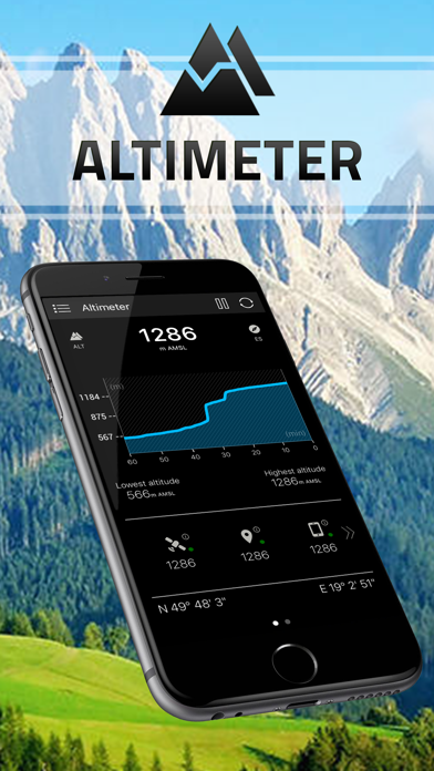
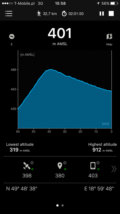
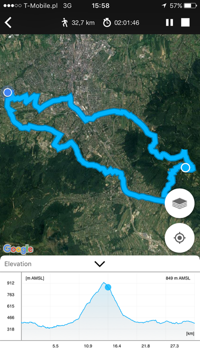
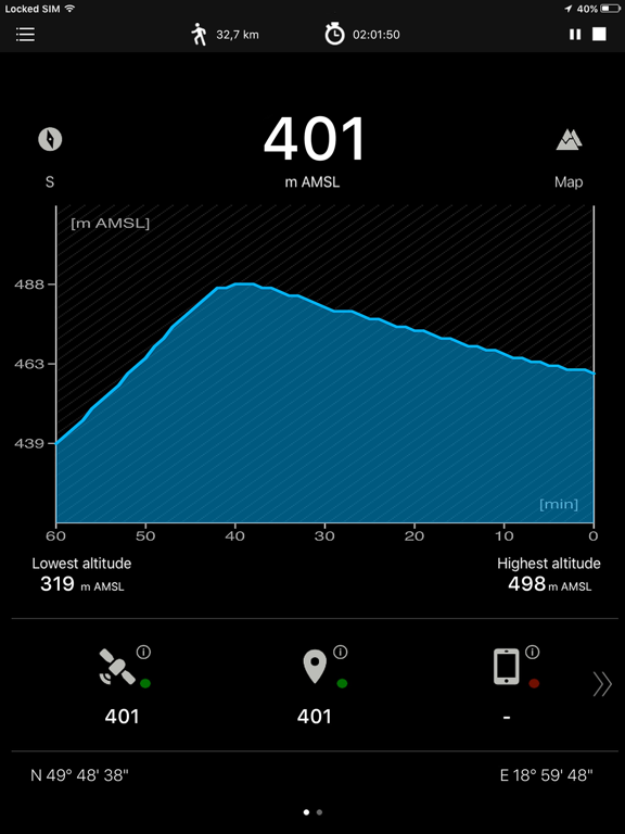
Screenshots
App Description
Altimeter is a smart tracking devices, used to altitude measure. It is perfect app for people who love hiking, skiing, mountain biking and other outdoor activities. Any time and with high precision you can check altitude, elevation or localization coordinates. It works online and offline.
This altimeter app, to measure altitude uses:
- GPS satellites triangulation - works without internet connection,
- barometer pressure sensor (if available in your device) - high accurate data; if internet connection is available it calibrates itself to improve accuracy,
- online networks location services (wifi and other) - need internet connection.
You can use each sensor separate or all together.
App altitude meter includes the following features:
- accurate measurement of altitude - indication in meters or feet
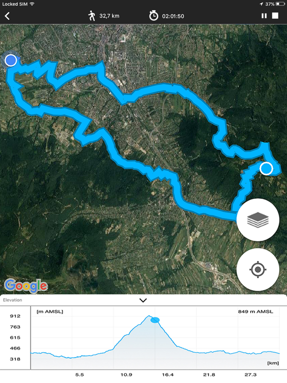
- recording sports activities with a map of the route traveled
- record of: lowest (low), highest (max) altitude
- smart mini compass
- full GPS coordinates - latitude and longitude
- current localization name and state
- results of measurements are shown in the chart
- ability to stop and record the results of measurements at any time
- invert background color (black and white)
- sharing with others your achievements (photo taking function with the current altitude above sea level)
You can activate in app the Premium version which includes:
- No ads in the entire application
- Activity stats (speed, calories, etc.)
- Checkpoints
- Analog drum-type aircraft altimeter
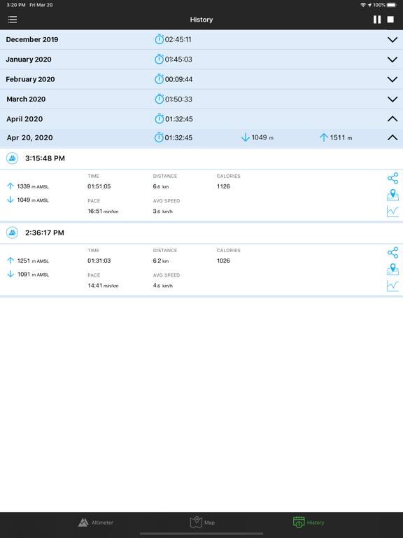
- Full history and archives of measurements
- Tracking map with altitude chart
- Sunrise and sunset times
- No watermark on the picture
- Copying and sharing coordinates and map link
Check altitude wherever you are!
Information:
This apps works in the background to proper operation uses GPS. Continued use of GPS running in the background can dramatically decrease battery life.
Enjoy with this altimeter app !