RunwayMap - #1 Pilot Community
RunwayMap - #1 Pilot Community Summary
RunwayMap - #1 Pilot Community is a with in-app purchases iOS app in Weather by RedDev GmbH. Released in Jun 2017 (8 years ago). It has 1K ratings with a 4.66★ (excellent) average. Based on AppGoblin estimates, it reaches roughly 2.7K monthly active users and generates around $<10K monthly revenue (100% IAP / 0% ads). Store metadata: updated Feb 18, 2026, version 13727.
Data tracking: SDKs and third-party integrations were last analyzed on Jun 1, 2026.
Store info: Last updated on App Store on Feb 18, 2026 (version 13727).
4.66★
Ratings: 1K
Screenshots

App Description
The interactive map gives you an overview of the airports. We have collected important information on every airport:
• Aviation Weather Forecasts
• 3D Approach View and 3D Airport Surroundings View
• NOTAM and Runways
• Airport Restaurants
• Webcams and much more
Download the versatile pilot app while you are at it.
Features:
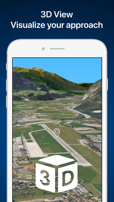
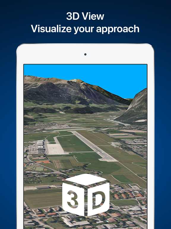
VISUALIZE YOUR APPROACH AND LANDING IN 3D
The 3D feature is available for over 20,000 airports. Get a 3D approach view and a 3D airport surroundings view. With 3D PLUS you can preview your approach like you're right there in the cockpit. You can set your distance from the runway and adjust your glide path.
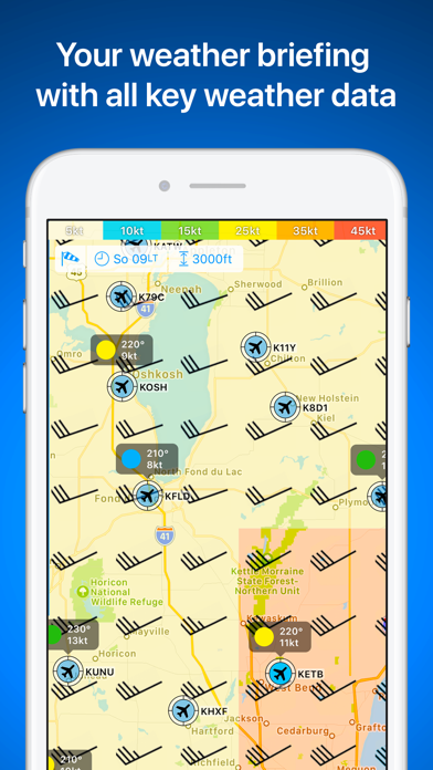
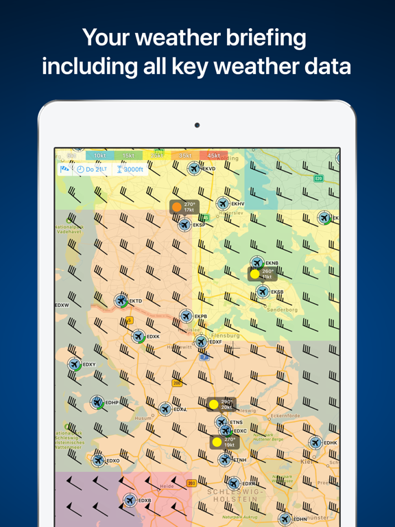
AVIATION WEATHER
See a visual display of the METAR and flight conditions on the map. In addition, you can see the decoded METAR with wind, clouds, gusts, and visibility on the airport's detail page.
Sunrise and sunset
On each airport's detail page, you can find the times for sunrise and sunset as well as the beginning and end of civil twilight.
Winds aloft
See winds displayed on the map at 6 different levels, from surface winds up to FL 150.
Weather PLUS
Based on the wind data from METAR or the forecast, the best runway for landing and the crosswind component will be displayed for the desired time.
For GAFOR and the weather parameters, you see the forecast for the next 5 days in 3-hour increments.
Check winds aloft, cloud cover, precipitation volume, and temperatures as well as the icing conditions.
MAP
Search by name or ICAO to discover new airports. Receive important information such as the address, position, runways, and airport restaurants. Mark and save what airports you’ve already flown to or those you’d like to fly to next. Save your personal notes for every airport.
AIRPORT RESTAURANTS
Where can you call in an order over the radio while you’re still up in the air? Which airport restaurant has a great sun deck with a view of the runway? In RunwayMap, you’ll find restaurants at and near airports. Easily find the restaurant’s opening times and contact info and see how far it is from the airport.
DOCUMENTS
With just a few clicks, add your flight documents, such as the Jeppesen approach charts, FAA terminal procedures and airport diagrams, ForeFlight manuals or the Garmin pilot’s guide. That way you always have them close at hand.
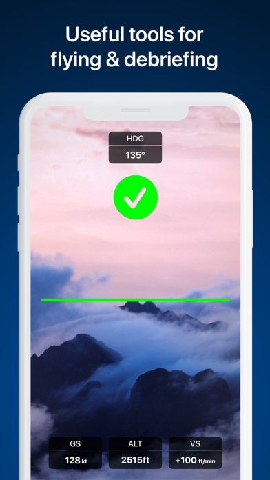
TOOLS & AVIATION CALCULATOR
Use the handy aviation calculator for