Fires: Wildfire News and Atlas
Fires: Wildfire News and Atlas Summary
Fires: Wildfire News and Atlas is a with in-app purchases iOS app in News by Ryan Strouse. Released in Sep 2016 (9 years ago). It has 11.7K ratings with a 4.60★ (excellent) average. Based on AppGoblin estimates, it reaches roughly 28.8K monthly active users and generates around $<10K monthly revenue (100% IAP / 0% ads). Store last updated Oct 13, 2025
Recent activity: 5.00 new ratings this week View trends →
SDK intelligence: AppGoblin detected 1 ad networks(e.g. Google),and 1 development tools integrated into Fires: Wildfire News and Atlas. View full SDK list →
Fires: Wildfire News and Atlas SDKs Summary
Fires: Wildfire News and Atlas was last scanned for SDKs on 2026-06-30. Below is the overview of third-party companies detected in the app. The full list of SDKs, permissions and unknowns is available here.
4.6★
Ratings: 11.7K
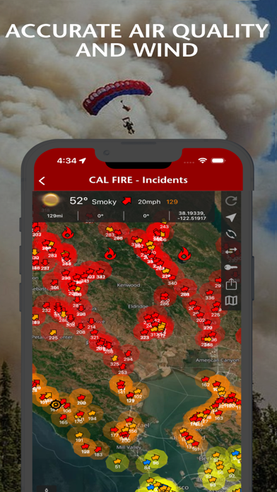
Screenshots


App Description
Stay informed and safe with the most trusted wildfire tracking app. Watch firefighting aircraft in real-time with 3D spheres and flight trails as emergency responders battle blazes. Used by first responders and millions worldwide.
REAL-TIME WILDFIRE & EMERGENCY TRACKING
Live aircraft tracking with color-coded missions and flight paths. Advanced 3D globe powered by WhirlyGlobe technology trusted by air traffic controllers.
- Live wildfire locations, perimeters, containment status
- Aircraft tracking with trails (blue=helicopter water drops, orange=air tankers, green=tactical command)
- Smart push notifications for nearby incidents
- Weather alerts on emergency maps
- Real-time evacuation zones and emergency alerts
- Power outage tracking (California only)
- Offline maps ensure access without cell service
OFFICIAL DATA SOURCES FIREFIGHTERS TRUST
- InciWeb - National Incident Information System
- CAL FIRE - California Department of Forestry
- NIFC - National Interagency Fire Center
- NASA FIRMS - Satellite fire detection
- NOAA - Weather conditions and imagery
- National Weather Service - Red Flag Warnings
- International - NSW RFS, CFA, QFES, CFS (Australia)
COMPREHENSIVE SAFETY INTELLIGENCE
- Global thermal hotspots and satellite imagery
- Real-time wind conditions and fire weather
- Critical weather alerts on emergency maps
- Air quality monitoring and smoke predictions
- Interactive 3D globe with atmospheric rendering
- 80+ offline National Forest and BLM maps
- High-resolution wildfire photography
FIRES ATLAS - PROFESSIONAL GRADE MAPPING
Transform your device into a professional firefighting tool with comprehensive offline mapping. Complete coverage of California, Oregon, Washington, Alaska, Arizona, Nevada.
WHY CHOOSE FIRES?
- Most Comprehensive - Global wildfire coverage with local detail
- Fastest Alerts - Real-time push notifications save lives
- Most Reliable - Offline capability when networks fail
- Professional Grade - Same data sources used by firefighters
Perfect for homeowners in fire-prone areas, outdoor enthusiasts, emergency preparedness, and professional firefighters.
SUBSCRIPTIONS
Subscriptions automatically renew unless auto-renew is turned off at least 24 hours before the end of the current period. Your iTunes account will be charged for renewal within 24 hours of the end of the current period, and identify the cost of the renewal