NavLink HD
NavLink HD Summary
NavLink HD is a free, with in-app purchases iOS app in Maps And Navigation by DigitalYacht Ltd.. Released in Feb 2017 (9 years ago). It has 13 ratings with a 4.23★ (good) average. Based on AppGoblin estimates, it reaches roughly 29 monthly active users and generates around $<10K monthly revenue (100% IAP / 0% ads). Store last updated Apr 3, 2024
NavLink HD SDKs Summary
NavLink HD was last scanned for SDKs on 2026-06-13. No known SDKs were detected. Check the raw list of SDK parts detected here and feel free to request unknown SDKs be added to AppGoblin.
4.23★
Ratings: 13
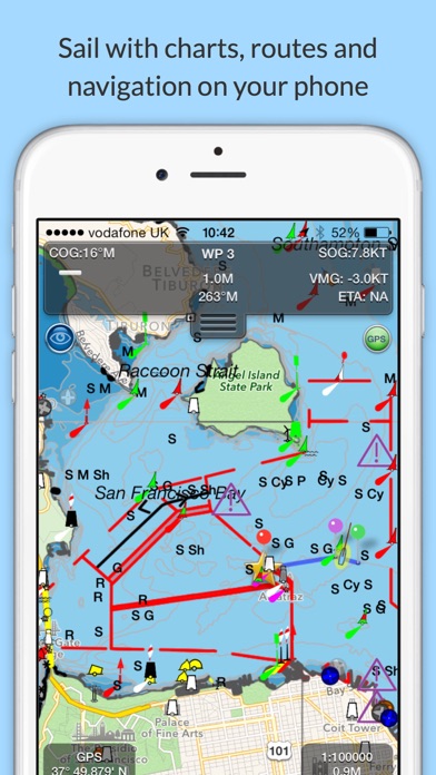
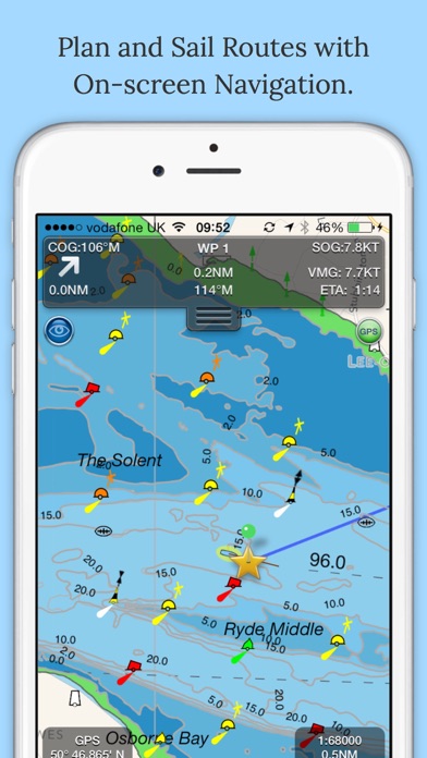
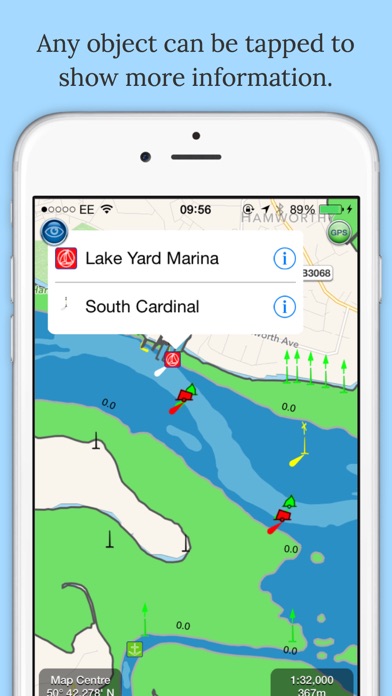
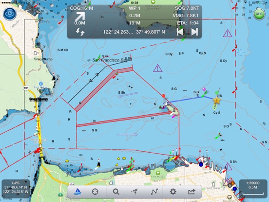
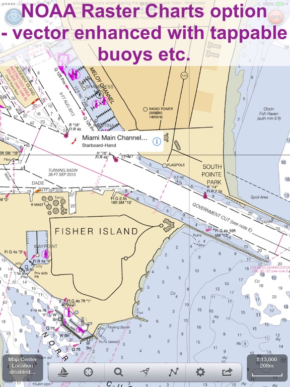
Screenshots

App Description
Marine Navigation App that turns your Apple Device in to a full function chart plotter.
Includes all our navigation, AIS and NMEA instrument and trip planning tools.
A catalog of high resolution vector charts providing coverage across US including US Great Lakes, CA, UK & Ireland, Germany, France, Netherlands, Belgium, Denmark, Croatia and Spain are available via separate In App Purchases.
Free features include:
· Realtime GPS position plotted on the map
· Live AIS ship overlay when connected to compatible wireless AIS system via a wireless NMEA link with CPA and TCPA alarms
· NMEA Wind Speed and Direction gauges
· Waypoints and routes with full route editing and planning function
· Position, COG, SOG, VMG, bearing, distance and ETA displays
· Weather buoy data
· A-B chart ruler for quick and easy bearing and distance measurement
· Favourite Place markers (POIs).
Additional features available via In App Purchase subscription
· Marine Charts - Yearly subscriptions for charts using the latest Hydrographic Office data including automatic updates for a year.
· NavLink Pro - provides live internet AIS feeds for your area and an Augmented Reality HorizonView showing course, route, navaids, AIS targets, POIs and Air Draught on the camera display that makes Nav-Aid and vessel identification simple and reliable.
Plan and sail routes
Instant route and waypoint creation by tapping on screen. Route reverse function and route overview with inter-leg bearing and distance. Share your routes via dropbox and email with other users
NavLink Charting
NavLink utilises the latest S57 based digital mapping and features automatic updates for each year's subscription. With vector mapping, you can manage your layers of data to de-clutter the screen or maximise information. NavLink supports all key charting feature such as buoys, lights, bridges, depth contours, spot depths, depth contours, anchorage and military areas etc.
Interfacing
NavLink is compatible with all Digital Yacht's wireless NMEA devices such as the iAIS, WLN10, WLN10HS, NavLink, iNavHub and PilotLink that stream wireless AIS data to your Apple device
If you have a WiFi-only iPad you will need an external Bluetooth GPS receiver to enable navigation. 3rd Party units are available such as the Garmin Glo.
Please note: Continued use of GPS running in the background can dramatically decrease ba