Imray Navigator
Imray Navigator Summary
Imray Navigator is a with in-app purchases iOS app in Maps And Navigation by FB Imray Laurie Norie & Wilson GmbH. Released in May 2017 (8 years ago). It has 7.00 ratings with a 1.00★ (poor) average. Based on AppGoblin estimates, it reaches roughly 19 monthly active users and generates around $<10K monthly revenue (100% IAP / 0% ads). Store metadata: updated Jun 13, 2025.
Store info: Last updated on App Store on Jun 13, 2025 .
1★
Ratings: 7.00
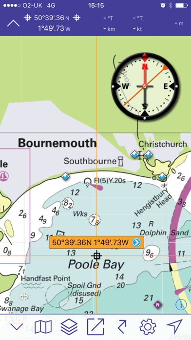
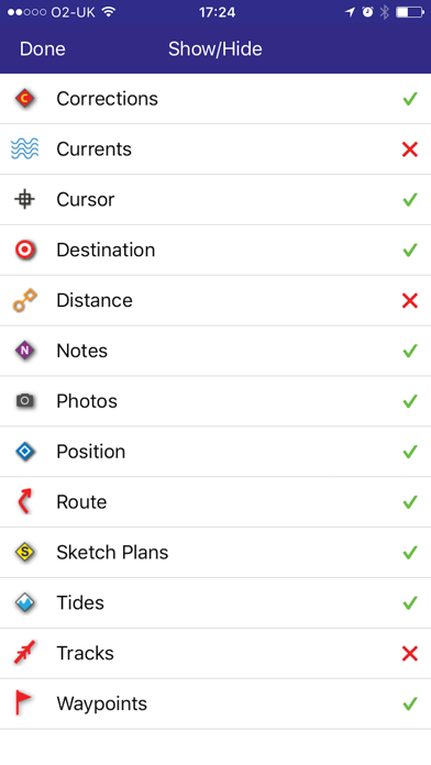
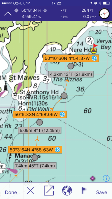
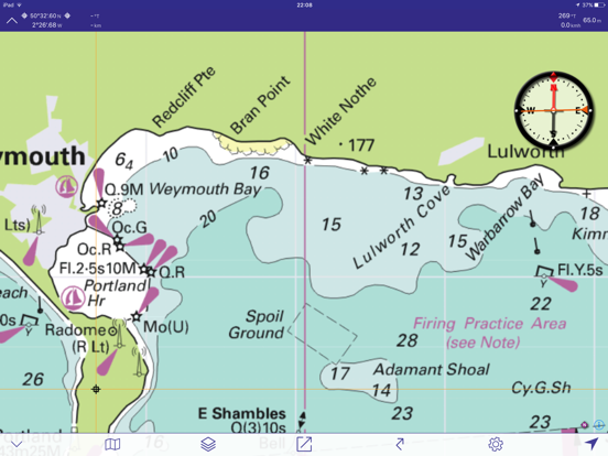
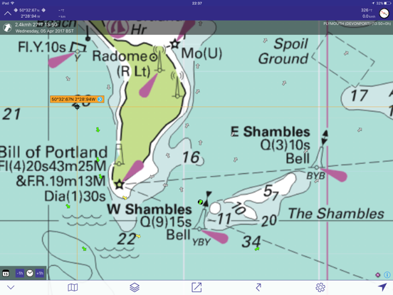
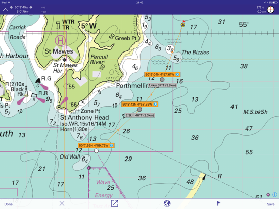
Screenshots
App Description
Imray's marine chart plotter for sailors, divers, canoeists, fishermen and anyone involved with making way at sea.
Nautical charts by Imray and other publishers
Easy to use for passage planning and route creation
Keep up to date with new chart subscriptions for the latest data
Plan your routes and share tracks and waypoints with your crew or friends
Based on the award-winning Marine Imray Charts app
Technical support for this app is available to subscribers. Email support@imray.com
FEATURES
- Award winning raster charts from Imray and other Hydrographic Offices
- Auto-renewable 12-month subscription includes quarterly updates with new chart editions, notes and corrections.
- Waypoints
- Routes: distances, targets, bearings
- Position and destination
- Course to steer, speed and bearing
- Magnetic compass
- Distances, bearings from any point to any point
- Electronic bearing line
- GPS and instruments
- Tides with full functionality from Tides Planner app
- AIS and NMEA functionality from Boat Instruments app
- Aerial photographs (subject to coverage) and harbour plans
- Tracks that you can share with friends
Download Chart Sets from the Chart Store in the app.
Warning: Continued use of WiFi and of GPS running in the background can dramatically decrease battery life.
COVERAGE (CHART SETS)
Tap on the i icon in the Chart Store in the free app to see more detail of coverage areas.
Imray Charts free app: English Channel passage charts.
Imray ID10 North Sea
Imray ID20 English Channel England and France.
Imray ID30 West coast England, Wales, west coast Scotland, Ireland.
Imray ID40 Atlantic France, Iberia and Atlantic Islands.
Imray ID50 Western Mediterranean. Gibraltar to Sicily.
Imray ID60 Central Mediterranean. Adriatic and Ionian Seas.
Imray ID70 Eastern Mediterranean and Aegean Seas.
Imray ID80 Netherlands
Imray ID100 Eastern Caribbean. Virgin Islands to Grenada and Barbados.
Also chart sets derived from official Hydrographic Office charts of Germany, France and the Netherlands.
Tides - inherits permissions (beyond one day predictions) from the Tides Planner app if installed on the same device.
LANGUAGES
English, Dutch, French, German, Italian and Spanish
SUBSCRIPTIONS TO CHART SETS
Before taking out a subscription to Imray Navigator chart sets, please check that your device meets the minimum operating system requirements (Apple iPhone and iP