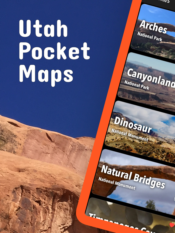
Utah Pocket Maps
Utah Pocket Maps Summary
Utah Pocket Maps is a ad-supported, with in-app purchases iOS app in Travel And Local by Alex Gugel. Released in Oct 2017 (8 years ago). It has 150 ratings with a 4.63★ (excellent) average. Based on AppGoblin estimates, it reaches roughly 211 monthly active users and generates around $<10K monthly revenue (44% IAP / 56% ads). Store metadata: updated May 18, 2026.
Store info: Last updated on App Store on May 18, 2026 .
4.63★
Ratings: 150
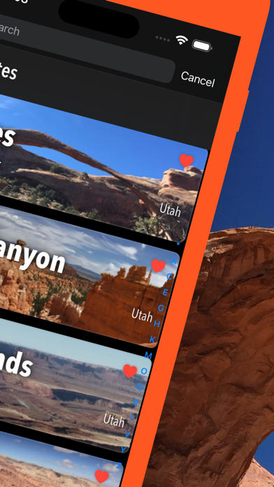
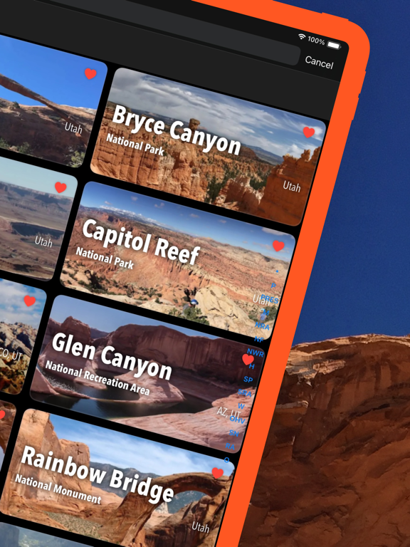
Screenshots


App Description
Be prepared! Plan your next trip to one of the great Utah parks. Download maps and guides before you venture into the Wi-Fi free wilderness.
- 120+ national parks, state parks, monuments, forests
- 180+ neatly folded maps by the National Park Service, Bureau of Land Management, United States Forest Services, and other agencies.
- Motor Vehicle Use Maps (MVUM), Motor Vehicle Travel Maps (MVTM) and visitor maps for Utah national forests.
- 4,100+ campgrounds and campsites
- 2,300+ trails and trailheads
- 41,000+ points of interests
Plan
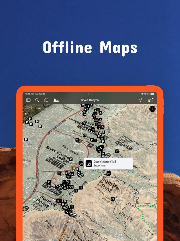
- Download maps, park brochures, and newspapers. These downloads are ready when you are offline and off the grid in the great outdoors.
- Download arbitrary map sections as offline packs.
- Photo galleries, panorama views.
- Share links to parks and maps with friends
Have fun
- GPS and GPX support: record your hikes, import GPX routes, tracks and waypoints for your hiking trails.
- Detailed national park information: alerts, news, visitor centers, campgrounds, driving directions, weather.
- Open your favorite maps app to get a route to the selected park.
- Current weather conditions, easy access to multi-day forecasts, sunrise and sunset times.
- Push notifications for park alerts, park news, weather warnings
So download maps and guides for:
Arches
Bear Ears
Beaver Dam Wash
Bonneville Salt Flats
Bryce Canyon
Burbank Hills
Camp Floyd
Canyonlands
Canyonlands Field
7 Mile Rim Jeep Trail
Klondike Bluffs
Klonzo and Moab Brands
Labyrinth Rims
Mill Canyon Area Designated Route
Capitol Reef
Fremont River
Wayne County West
Cedar Breaks
Cedar City
Colorado Riverways
Amphitheater Loop and Fisher Towers Hiking Trails
Porcupine Rim Mountain Bike Trail
The Moab Daily
Utah Rims Designated Route Map
Conger Mountain
Crack Canyon
Cricket Mountains
Dixie
Escalante
Pine Valley
Powell
Fiddler Butte
Fishlake
Frontier Homestead
Thunderbird Canyon and Iron Hills Trails
Dinosaur
Factory Butte
Fantasy Canyon
Fishlake
Glen Canyon
North Wash
Goblin Valley
Golden Spike / Transcontinental Railroad
Gooseberry Mesa
Goosenecks
San Juan River
Grand Staircase-Escalante
Burr Trail Scenic Backway and Wolverine Loop Road
Cottonwood Road Scenic Backway
Hole-in-the-Rock Scenic Backway
Monument Travel Map
Skutumpah \/ Johnson Canyon Roads
Green River
Gunlock
Horseshoe Can