BaseMap: Hunting GPS Maps
BaseMap: Hunting GPS Maps Summary
BaseMap: Hunting GPS Maps is a with in-app purchases iOS app in Maps And Navigation by BaseMap Inc. Released in Apr 2018 (8 years ago). It has 9.3K ratings with a 4.61★ (excellent) average. Based on AppGoblin estimates, it reaches roughly 23.6K monthly active users and generates around $<10K monthly revenue (100% IAP / 0% ads). Store metadata: updated Apr 4, 2026, version 10.
Recent activity: 3.00 new ratings this week View trends →
Data tracking: SDKs and third-party integrations were last analyzed on May 28, 2026.
Store info: Last updated on App Store on Apr 4, 2026 (version 10).
SDKs, Trackers & Permissions
BaseMap: Hunting GPS Maps was last scanned for SDKs 2026-05-28. Below is the overview of third party companies detected in the app. The full list of raw SDKs, app permissions and unknown SDKs is available here.
AppGoblin saw BaseMap: Hunting GPS Maps uses 1 Ad Networks
AppGoblin saw BaseMap: Hunting GPS Maps uses 7 Development Tools
AppGoblin saw BaseMap: Hunting GPS Maps uses 3 Analytics: Product
AppGoblin saw BaseMap: Hunting GPS Maps uses 1 Analytics: Attribution
AppGoblin saw BaseMap: Hunting GPS Maps uses 1 Business Tools
App Details
App Store
Ads & App-Ads.txt
AppGoblin SDK Scans
4.61★
Ratings: 9.3K
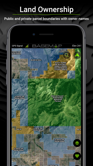
Screenshots


App Description
Guaranteed land ownership maps, mobile hunt planner with draw odds, industry leading GPS tools for hunters and outdoorsmen.
OFFLINE GPS and TRACKING
• Cache maps for offline use without service.
• Save as many offline maps as you want with unlimited caching (Pro).
• Know exactly where you are in real time even without cellular coverage.
MAP LAYERS
• 800+ layers
• Nationwide Color Coded Govt Lands
• Nationwide Private Parcel Boundaries & Owner Names
• Water depths for East coast, West, Coast, Gulf coast, 4,000+ U.S. lakes
• Nationwide Hiking Trails
• Nationwide Wildfires & Timber Cuts
• Nationwide Wilderness & Roadless Areas
• State specific hunting layers including hunting unit boundaries, private hunting opportunities, WMA’s & more
• Multiple TOPO & Satellite Imagery options
• Much more
MOBILE HUNT PLANNER
• Unit filtering
• Draw odds
• Harvest data
• Season dates
• Unit insights
IN-APP 3D SATELLITE IMAGERY
• As close to boots-on-the-ground as you can get
• Tilt & rotate the map to see the terrain from every angle
LRF MAPPING (Laser Rangefinder Mapping)
• Use your rangefinder as a powerful mapping tool
• Precisely mark the exact location of distant targets with ANY rangefinder
• Recover game, build routes, plan stalks, lookup distant property owners and more, all using your rangefinder!
MOBILE GPS
• Know your exact location even without cellular or WiFi service
• See where you are in relation to property boundaries, roads, trails, peaks, or boundaries
• Navigate to trail heads, favorite places, markers, or anything you need to locate with our powerful Search and GoTo features.
XDR (Exact Direction & Range) NAVIGATION
• Easy Point and Go navigation
• Know the exact distance between you and your destination.
HUNTWIND™ & WEATHER CENTER
• Wind forecast to better plan your hunt.
• Know the exact day and time to hunt a particular stand and visualize wind direction and scent drift in relation to your location.
• Forecasts, temperature, moon phase, sunrise/sunset, wind, and more.
LOCATION SHARING
• Know exactly where your hunting partner is located
• Real-time updates
OUTDOOR JOURNAL
• Capture, log, and share all your outdoor adventures with the BaseMap community
• Real-time location sharing so friends can see where you are in case of emergency (connection reqd.)
• SmartMarker