ParrotFields

ParrotFields Summary
ParrotFields is a mobile iOS app in Tools by Pix4D. Released in Dec 2018 (7 years ago). It has 5.00 ratings with a 1.80★ (poor) average. Based on AppGoblin estimates, it reaches roughly 16 monthly active users . Store metadata: updated Aug 6, 2020.
Store info: Last updated on App Store on Aug 6, 2020 .
1.8★
Ratings: 5.00
Screenshots


App Description
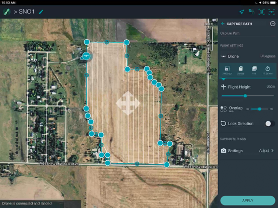
ParrotFields is a mobile app dedicated to making agriculture mapping and scouting quick and simple.
With ParrotFields you can:
- Enjoy fully automatic flights or fly manually over your crops
- Generate NDVI maps in real-time during the flight
- Compare NDVI maps to monitor the evolution of your crops on your mobile device
- Explore areas of interest via unique semi-automated scouting flights
- Capture photos and videos on-demand with the Parrot Skycontroller 2
- Add value to the aerial data captured by adding text annotations and shooting photos
with the app directly from the ground.
ParrotFields is a part of the Parrot Bluegrass Fields bundle, the ultimate solution for agriculture.
Parrot Bluegrass Fields includes:
• 1 Parrot Bluegrass quadcopter drone
• 1 Parrot Sequoia multispectral sensor (integrated in drone)
• 1 Parrot Skycontroller 2
• 1 Parrot Skycontroller 2 charger
• 1 backpack
• 3 batteries
• 1 battery charger
• 4 spare propellers
• 1 USB cable for Micro-USB
• One-year subscription to ParrotFields
• One-year subscription to Pix4Dfields (desktop and cloud)
Usage information
Always ensure you have the latest firmware installed on your drone and ParrotFields is up to date.
Use only in safe environments.
ParrotFields can be used in connection with Parrot Bluegrass. However, this is NO WARRANTY of correct functioning, but merely user information.
Disclaimer
Pix4D SA, the publisher of the ParrotFields App, is not a drone manufacturer and does not provide any representation and/or warranty of any sort as to any drone, or any component thereof, or any of their functionality. ParrotFields uses a SDK furnished by the drone manufacturer over which Pix4D SA has no control or direct interaction whatsoever.
ParrotFields instructs the drone to geographically follow a pre-defined flight plan conceived and entered by the user and does neither manage itself the flight procedure of the drone nor avoid itself obstacles automatically. ParrotFields allows users to take back manual control at any time.
ParrotFields takes images automatically, in accordance with the pre-defined options contained within ParrotFields. However Pix4D SA does not warrant the adequacy of framing of the images taken over the fly-zone.
Under no circumstances shall Pix4D SA, and/or any of its affiliates, be responsible for any lo