Arboreal Tree
Arboreal Tree Summary
Arboreal Tree is a with in-app purchases iOS app in Business by Arboreal AB. Released in Dec 2018 (7 years ago). It has 362 ratings with a 4.27★ (good) average. Based on AppGoblin estimates, it reaches roughly 1.7K monthly active users and generates around $<10K monthly revenue (100% IAP / 0% ads). Store metadata: updated May 22, 2026, version 405.
Data tracking: SDKs and third-party integrations were last analyzed on Mar 5, 2026.
Store info: Last updated on App Store on May 22, 2026 (version 405).
SDKs, Trackers & Permissions
Arboreal Tree was last scanned for SDKs 2026-03-05. Below is the overview of third party companies detected in the app. The full list of raw SDKs, app permissions and unknown SDKs is available here.
AppGoblin saw Arboreal Tree uses 1 Development Tools
AppGoblin saw Arboreal Tree uses 1 Business Tools
App Details
App Store
Ads & App-Ads.txt
AppGoblin SDK Scans
4.27★
Ratings: 362
Screenshots


App Description
Arboreal Tree — Tree Measurement with AR
Measure tree height, diameter, crown shape, and more — using nothing but your iPhone. No laser meters, no extra equipment. Just open the app, walk up to a tree, and let augmented reality do the work.
Arboreal Tree is used by foresters, arborists, researchers, and nature enthusiasts who need accurate, documented tree measurements in the field.
How it works
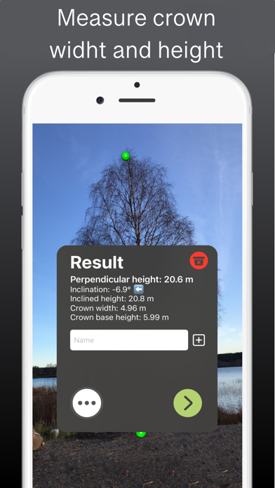
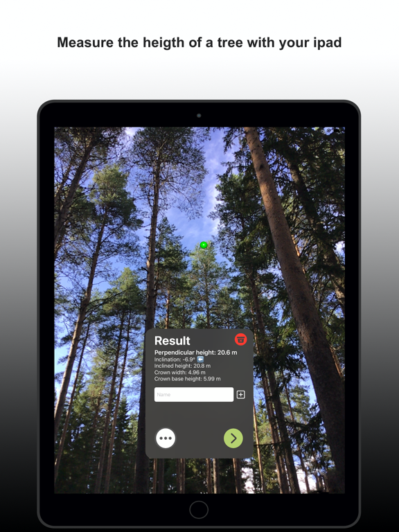
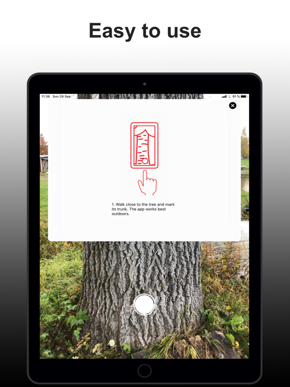
Stand near the tree, mark it with a tap, step back a few meters, and mark the base and top. Height is displayed instantly on screen.
What you can measure
Tree height and crown height
Crown width and crown shape
Trunk diameter and inclination
Point clouds and 3D models
Built for fieldwork
Great accuracy — comparable to laser altimeters
LiDAR support on compatible devices
Imperial and metric units
GPS coordinates saved with every measurement
Export data as .csv or point cloud files
Premium — for professional use
Premium turns Arboreal Tree into a complete field measurement system. Measure multiple trees in a single session with one shared coordinate system, export 3D point clouds to CloudCompare, connect Emlid Reach RX/RX2 for centimetre-level positioning, and sync up to 2,000 high-resolution images to the cloud. REST API available for integration with your own systems.
Trusted by foresters, researchers, and forestry organisations across Europe — including Sveaskog, Skogshubben, Treemetrics, Palos, Icebound, The Navigator Company, and SLU — Swedish University of Agricultural Sciences.
Try 5 free measurements. No subscription required to get started.