Locus Field Assets and Data
Locus Field Assets and Data Summary
Locus Field Assets and Data is a free, with in-app purchases iOS app in Productivity by Jason Simpson. Released in Oct 2019 (6 years ago). It has 6.00 ratings with a 4.50★ (excellent) average. Based on AppGoblin estimates, it reaches roughly 22 monthly active users and generates around $<10K monthly revenue (100% IAP / 0% ads). Store last updated Jul 11, 2024
Locus Field Assets and Data SDKs Summary
App not yet scanned for SDKs.
4.5★
Ratings: 6.00
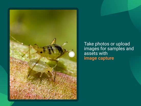
Screenshots

App Description
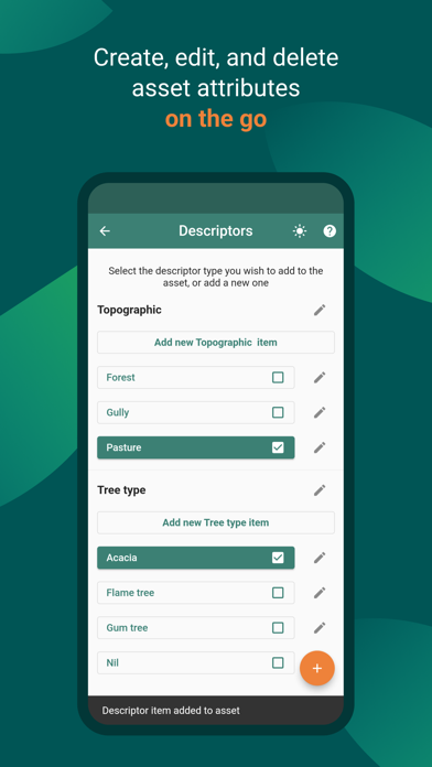
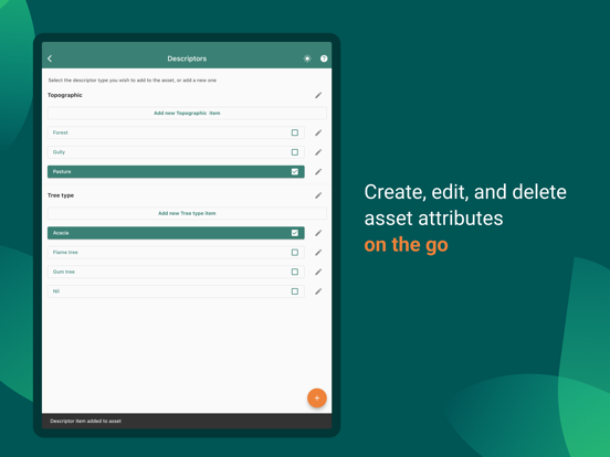
Features at a glance:
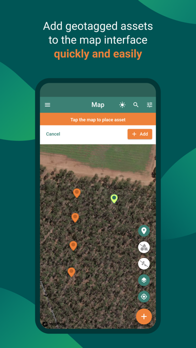
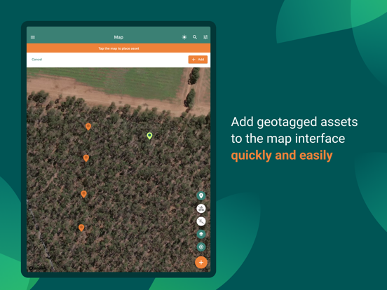
- Create and manage geo-tagged data points (assets)
- Seamlessly collect sample data for assets (automatically time stamped and geotagged)
- Capture images and add them to assets and samples - works offline!
- View and export real-time heatmap showing sample data
- Input and retrieve data by barcode, data matrix code, or manual input
- Draw and measure lines, polygons and circles in the map.
- Real-time visibility of all in-app changes for project members
- Project creation and management of team members
- Offline capabilities for those in remote areas
- Navigation feature (driving or walking) helps you find assets in the field
- In-app data tables to view sample data and asset data.
- Data visualization shows charts and graphs of sample data, descriptors, etc. in real-time
- Export/Share data as .csv to local device, Google Drive, email, SMS etc.
- Multiple map base layers available including Satellite, Street, Terrain, and Monochrome
- Light and dark modes
- Bulk map downloading
- Bulk assets and sample data uploading
- Change asset map pin colors (default and existing)
Locus is an efficient app for field data collection, asset management, and GIS that caters to the needs of researchers, students, and professionals. Whether you are working in Science, Agriculture, Entomology, Geology, Biosecurity or any other industry, Locus can help you seamlessly collect data associated with specific locations or physical objects in the field.
Locus is so agile you can easily create projects and add collaborators, manage field assets, collect sample data, and view it all in real-time. No need to sync project changes between devices - our mobile app does it all in the cloud.
With Locus, you can create and manage geo-tagged data points (assets) and seamlessly collect sample data for assets (automatically time-stamped and geotagged). You can input and retrieve data by barcode or any type of data matrix code which can help you avoid human error.
You can also draw and measure lines, polygons, and circles in the map interface, measure distance along lines and between assets, and calculate areas of polygons and circles, making it easier to work efficiently and accurately.
Locus provides real-time visibility of all in-app changes for project members, allowing team leaders to manage workflows more effectively. Project Owners and Admins have complete c