GPS Coordinates & Map Tools
GPS Coordinates & Map Tools Summary
GPS Coordinates & Map Tools is a ad-supported, with in-app purchases iOS app in Maps And Navigation by ZipoApps. Released in May 2020 (6 years ago). It has 6.00 ratings with a 2.67★ (poor) average. Based on AppGoblin estimates, it reaches roughly 14 monthly active users and generates around $<10K monthly revenue (27% IAP / 73% ads). Store metadata: updated May 5, 2026.
Data tracking: SDKs and third-party integrations were last analyzed on Feb 12, 2025.
Store info: Last updated on App Store on May 5, 2026 .
2.67★
Ratings: 6.00
Screenshots
App Description
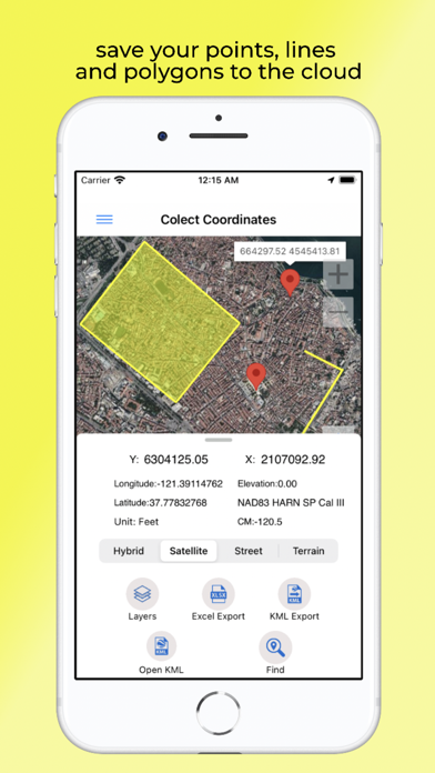
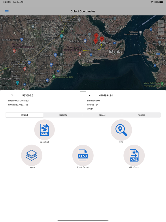
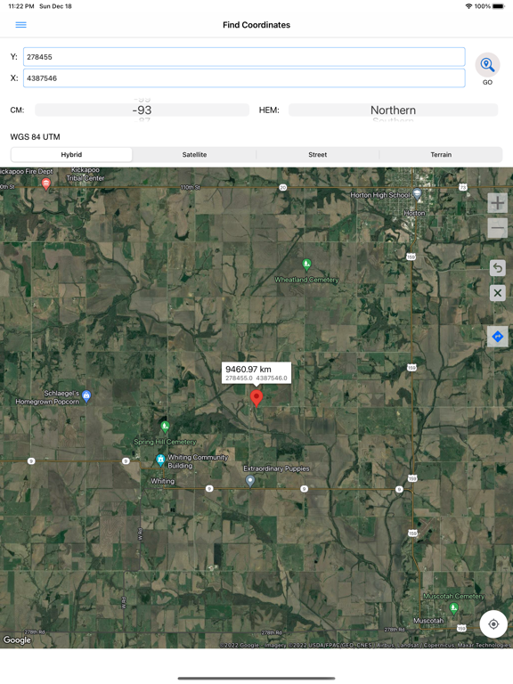
Using the Coordinator app, you can collect coordinate data from land in any coordinate system you choose, from predefined systems.
You can collect GPS coordinates.
You can use the app as a GPS tracker.
You can view the coordinate data on the map.
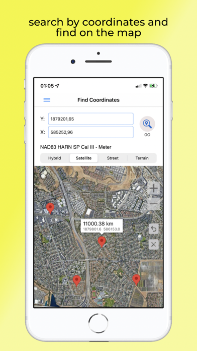
You can search by longitude/latitude.
You can convert an existing coordinate into another coordinate system.
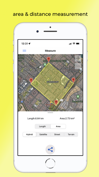
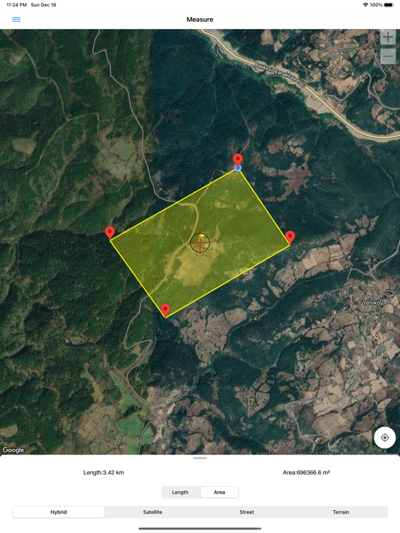
You can display circumference and area measurements for some coordinates by opening the file created earlier. Also, you can measure distances and areas for coordinates marked on the map manually.
You can display a KML file on the map.
The coordinator app contains several useful tools for people interested in coordinates, maps, and geographic information systems (GIS).
The coordinator offers Cloud Database Functions (creating points, lines & polygons; sharing your layers with teammates; working simultaneously with teammates; working offline and synchronizing; etc.), exporting to KML & Excel files, retrieving the elevation value of points, and so on. You can create your layers and share those layers with your teammates. You can instantly see the data created by other friends on the map.
In addition to longitude/latitude, subscribers can find the altitude of a point on the map. Subscribers can use the Coordinator Web app. So you can use the cloud database features of the Coordinator app on your computer's web page and monitor the data instantly. You can view/track and edit cloud database data on the web page. In this way, you can instantly monitor data movements in the mobile app in the field and in the web browser on your computer.
The coordinate systems of the countries where the app is most downloaded are added to the app.
Current list of countries and their coordinate systems defined in this app:
World - GPS(WGS 84)
World - WGS 84 - 6 UTM
United States - "NAD 1983 HARN State Plane Coordinate Systems(meters & feet)" and "Military Grid Reference System (MGRS)"
Algeria - "Nord Sahara 1959 / UTM 6 "
Azerbaijan - "Pulkovo 1942 / Gauss-Kruger 3 " and "Pulkovo 1942 / CS63"
Bulgaria - "Pulkovo 1942(58) GK 6 "
Germany - "DHDN/3 GK" and "ETRS89 UTM 6"
India - "Kalianpur 1975 / India" and "Kalianpur 1975 / UTM 6"
Indonesia - "Indonesia 1974 UTM 6" and "DGN 1995 Indonesia TM3"
Iran - "ED50(ED77) / UTM 6"
Iraq - "Nahrwan 1967 / UTM 6", "ED50 / Iraq National Grid", and "Karbala 1979 / UTM 6"
Israel - "Pale