PIX4Dcatch: 3D scanner

PIX4Dcatch: 3D scanner Summary
PIX4Dcatch: 3D scanner is a with in-app purchases iOS app in Tools by Pix4D. Released in Jun 2020 (5 years ago). It has 1.1K ratings with a 4.62★ (excellent) average. Based on AppGoblin estimates, it reaches roughly 3.5K monthly active users and generates around $<10K monthly revenue (100% IAP / 0% ads). Store metadata: updated May 6, 2026, version 298.1234.
Data tracking: SDKs and third-party integrations were last analyzed on Apr 15, 2026.
Store info: Last updated on App Store on May 6, 2026 (version 298.1234).
PIX4Dcatch: 3D scanner was last scanned for SDKs 2026-04-15. Below is the overview of third party companies detected in the app. The full list of raw SDKs, app permissions and unknown SDKs is available here.
 Google
 Alamofire
 Reachability
 nanopb
 Firebase
 Snap
Snap4.62★
Ratings: 1.1K
Screenshots




App Description
DIGITIZE REALITY
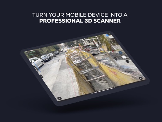
Transform your mobile device into a powerful 3D scanner. Simply point and capture images and LiDAR data to create accurate 3D models ready for professional use.
Pair with a compatible RTK device for centimeter-level accuracy, precise measurements, and geolocation.
Visualize the captured model in the app, upload and export, and view it in AR.
____________________
WORKFLOW
1 – Scan & Capture
Walk around your site. The app automatically gathers data and provides live feedback using iOS LiDAR, ensuring you capture every detail. For enhanced accuracy, use an RTK device compatible with PIX4Dcatch, PIX4D Autotags with a fully automated workflow, or combine both.
2 – Process, Analyze & Share
Process your data by uploading to PIX4Dcloud for online analysis and sharing, or export to PIX4Dmatic for desktop processing. Both platforms offer a 15-day free trial. Projects can also be exported to third-party photogrammetry software.
Measure spaces, document results, and enjoy all the benefits of a detailed 2D/3D model of your surroundings.
3 – View in AR
Experience an immersive augmented-reality view. Display 3D models and GCPs directly in your phone camera in AR.
____________________
USE CASES
• Digitize construction sites
• Measure stockpiles and other objects
• Document underground utilities
• Digitize indoor and outdoor spaces with Autotags
• Visualize and verify 3D models in AR in real time
• Perform single-point measurements with RTK accuracy
____________________
COMPATIBILITY
• Optimized for LiDAR-equipped devices
• All ARKit-enabled devices
• RTK devices: Emlid Reach RX, TopCon HiPer CR, Bad Elf Flex Mini, Bad Elf Flex, Trimble DA2, Leica Zeno FLX100 plus, viDoc
____________________
TIPS & SAFETY
• Keep PIX4Dcatch up to date for optimal performance.
• Operate only in safe environments. PIX4D is not liable for damage, injuries, or legal issues resulting from misuse of the app.
____________________
TERMS OF USE
https://www.apple.com/legal/internet-services/itunes/dev/stdeula/