Orca: Boat GPS, Charts, Routes
Orca: Boat GPS, Charts, Routes Summary
Orca: Boat GPS, Charts, Routes is a with in-app purchases iOS app in Maps And Navigation by Orca Technologies AS. Released in May 2021 (4 years ago). It has 371 ratings with a 4.56★ (excellent) average. Based on AppGoblin estimates, it reaches roughly 1.2K monthly active users and generates around $<10K monthly revenue (100% IAP / 0% ads). Store metadata: updated Mar 24, 2026, version 1343.
Recent activity: 1.00 new ratings this week View trends →
Data tracking: SDKs and third-party integrations were last analyzed on Mar 28, 2026.
Store info: Last updated on App Store on Mar 24, 2026 (version 1343).
Orca: Boat GPS, Charts, Routes was last scanned for SDKs 2026-03-28. Below is the overview of third party companies detected in the app. The full list of raw SDKs, app permissions and unknown SDKs is available here.
4.56★
Ratings: 371
Screenshots


App Description
Access accurate marine charts, intelligent routing, live AIS, and weather forecasts with Orca. Trusted by hundreds of thousands of sailors and powerboaters in the United States and across the world.
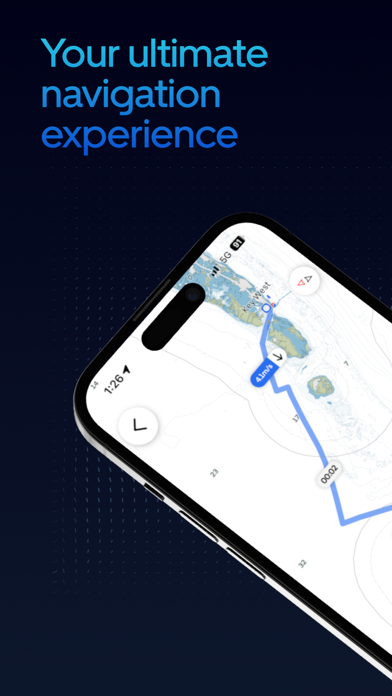
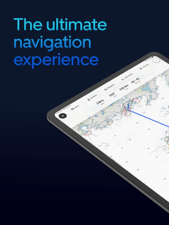
Navigate confidently with clean charts
- Modern and easy-to-read marine charts
- Performant and responsive no matter how fast you zoom, pan, and rotate
- Clear readability with both day and night modes
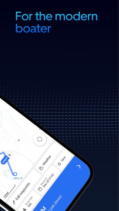
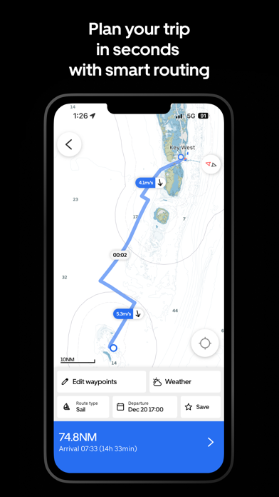
Plan in seconds with smart routing
- Sail routing powered by weather forecasts and your boat’s polar diagram
- Automatic route recalculation if wind or other conditions change
- Engine routing that finds a route to your destination instantly
One step ahead of bad weather
- Weather forecasts for wind, waves, currents, and tides
- Accurate hour-by-hour ECMWF forecasts
- Real-time rain radar forecast with down-to-the-minute accuracy
Stay aware of other vessels
- Global AIS from MarineTraffic for industry-leading coverage
- Live AIS targets with vessel names, images, Closest Point of Approach (CPA), and more
- Easy-to-read vessel icons overlaid directly on the chart
True-to-life satellite charts
- Dock easily with true-to-life marina layouts
- Get a realistic overview to avoid uncharted obstacles
- Boat like a local by seeing where other boats have travelled, moored, and anchored
Works online and offline
- Download charts and view them when boating in areas with no internet access
- Stay protected from unforeseen internet outages and connectivity issues
- Charts load instantly, without having to wait for your cellular network
Upgrade with Orca Core
The Orca App can be used as a standalone planning and navigation system. If you are looking for a truly modern navigation system that gives you complete control of your boat and helps you make better decisions, get an Orca Core to unlock a full chartplotter experience on your mobile device.
The Core is delivered with a high-precision GPS and compass, giving you a more accurate and reliable boating experience.
Connect the Core to your existing NMEA 2000 to view instrument data, AIS targets, and control your autopilot – all from your phone, tablet, and Orca Display.
Trusted by the modern boating community
Sailors, cruisers, powerboaters - hundreds of thousands trust Orca for a clearer, safer, and more confident experience on the water.
Join the modern way of boating. Download Orca today.