Shelter Map (Vindskyddskartan)
Shelter Map (Vindskyddskartan) Summary
Shelter Map (Vindskyddskartan) is a with in-app purchases iOS app in Travel And Local by MangoData AB. Released in Dec 2020 (5 years ago). It has 7.00 ratings with a 4.86★ (excellent) average. Based on AppGoblin estimates, it reaches roughly 14 monthly active users and generates around $<10K monthly revenue (100% IAP / 0% ads). Store metadata: updated Apr 13, 2026.
Store info: Last updated on App Store on Apr 13, 2026 .
4.86★
Ratings: 7.00
Screenshots


App Description
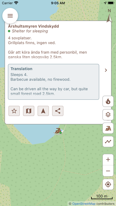
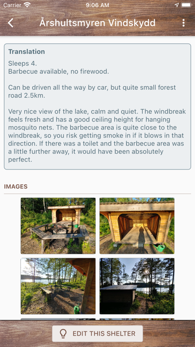
Do you want to immerse yourself in the wilderness and spend the night outdoors? Or perhaps you're just looking for a nice place to have a "fika pause" during a hike? There are plenty of hiking shelters all around, but finding them is usually not easy.
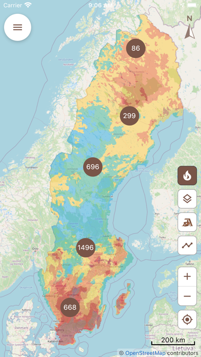
Vindskyddskartan (which means "Shelter map" in Swedish) gives you an easy to use overview of thousands of shelters on a map so you can easily find one near your location. The app is not limited to Sweden - anyone around the word is welcome to contribute to it! In some locations, the app also gives you easy access to current and forecasted fire risk and fire ban status, so you know when, where and how you can safely enjoy a campfire and cook food in nature.
The app is subscription based, but you can try it for free for 3 days before paying anything. If you prefer to own your apps, you can make a one-time purchase and have unlimited lifetime access to the app. All purchases are made from within the app. Subscriptions renew automatically unless cancelled at least 24 hours before the next renewal. Uninstalling the app will not automatically cancel an active subscription. Active subscriptions are managed from the App Store, and of course you may cancel your subscription at any time.
Terms of use
https://vindskyddskartan.se/app-ios-terms-of-use.php
Privacy policy
https://vindskyddskartan.se/app-privacy-policy.php