Dot3D: Precision LiDAR Scanner
Dot3D: Precision LiDAR Scanner Summary
Dot3D: Precision LiDAR Scanner is a with in-app purchases iOS app in Photo And Video by DotProduct LLC. Released in Sep 2022 (3 years ago). It has 132 ratings with a 4.61★ (excellent) average. Based on AppGoblin estimates, it reaches roughly 137 monthly active users and generates around $<10K monthly revenue (100% IAP / 0% ads). Store metadata: updated May 8, 2026, version 6.1.5.0.
Recent activity: 1.00 new ratings this week View trends →
Data tracking: SDKs and third-party integrations were last analyzed on Jun 19, 2026.
Store info: Last updated on App Store on May 8, 2026 (version 6.1.5.0).
4.61★
Ratings: 132
Screenshots


App Description
Stop settling for "good enough" scans. Dot3D is the industry-leading mobile LiDAR solution for professionals who value verifiable accuracy, large-scale reliability, and total data privacy, without the artifacts that plague other 3D apps. From complex construction sites to sensitive crime scenes, Dot3D turns your iPad or iPhone into a professional-grade 3D laser scanner.
REAL ESTATE, AEC & BIM: Capture accurate as-builts of any-size interiors and export point clouds into AutoCAD, SketchUp, Rhino, Revit, ArchiCAD, and more.
CRASH & CRIME FORENSICS: Document scenes with verified accuracy and geo-referencing for courtroom-ready evidence. No cloud uploads required (all processing happens locally on-device).
INDUSTRIAL: Document complex piping, machinery, and MEP systems with ease. Add annotations and high-res camera photos to your scans for additional context.
Key Features:
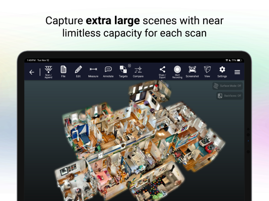
• REAL-TIME 3D SCANNING on your LiDAR-powered device (iPhone/iPad Pro) with virtually unlimited scan size
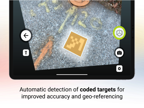
• TARGETING WORKFLOWS (optional) with known reference measurements for highly accurate results
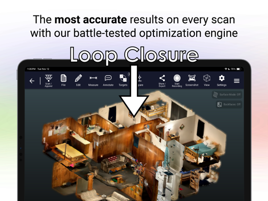
• LOOP-CLOSURE technology eliminates doubles and ghosting artifacts (with or without coded targets)
• GNSS COMPATIBILITY with receivers from Emlid, Trimble, Leica, and more. Add control and geo-reference large outdoor captures
• 3D COORDINATE SYSTEMS: Take full control. Supports local, site-wide and global (geo-referenced) systems.
• NO CLOUD REQUIRED: All data is processed locally
• APPEND NEW SCAN DATA directly into existing Dot3D scans
• 3D MEASUREMENTS and fill-volume calculations: precise and savable
• ANNOTATE 3D locations in your scans during or after capture
• EMBED HIGH-RES PHOTOS from the device camera into your scans for additional context
• CROP OR HIDE any part of the scan, for easy data cleanup
Unlock a wide variety of third-party workflows with Dot3D Pro:
• EXPORT color 3D point clouds: DP, E57, LAS, LAZ, PTS, PTX, PLY, PTG
• EXPORT ORTHOPHOTOS: scaled and geo-referenced
• PROCESS SCAN-TO-BIM using directly connected third-party services
• FRAME-BASED EXPORTS to 3rd party NeRF, gaussian splatting, and photogrammetry software
Our point-and-shoot technology is empowering workforces across a wide range of professional industries in need of accurate and reliable 3D capture solutions: Police departments, government agencies, real estate