iNavX: Marine Navigation
iNavX: Marine Navigation Summary
iNavX: Marine Navigation is a free, ad-supported, with in-app purchases iOS app in Maps And Navigation by NavX Studios LLC. Released in Feb 2019 (7 years ago). It has 27.3K ratings with a 4.70★ (excellent) average. Based on AppGoblin estimates, it reaches roughly 70.7K monthly active users and generates around $<10K monthly revenue (28% IAP / 72% ads). Store last updated Jul 2, 2026
Recent activity: 35 new ratings this week View trends →
SDK intelligence: AppGoblin detected 3 development tools(e.g. nanopb), 2 analytics: product,and 1 ad networks integrated into iNavX: Marine Navigation. View full SDK list →
iNavX: Marine Navigation SDKs Summary
iNavX: Marine Navigation was last scanned for SDKs on 2026-06-26. Below is the overview of third-party companies detected in the app. The full list of SDKs, permissions and unknowns is available here.
4.7★
Ratings: 27.3K
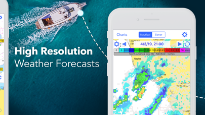
Screenshots


App Description
Marine navigation is made easy with iNavX - the world's #1 handheld Chartplotter. Access marine charts, maps, weather, AIS and more!
iNavX is the only app to give you complete worldwide chart coverage, from all your favorite charts providers, including the ALL NEW iNavX Professional+ Chart series! Fully enabled with one-touch access, iNavX gives users access to the broadest set of marine charts and maps from multiple providers including:
• iNavX Professional+ Charts
• Blue Latitude
• CHS
• Explorer
• Theyr Weather
• Waterway Guide
• … and more
How does iNavX take handheld marine navigation to the next level?
• Sailors - Plan sailing routes with waypoint and route management. Get proactive sail management with GRIB weather forecasts and then keep watch with AIS overlays and integration with your onboard systems. Plus, you can remember your great sailing locations by geotagging photos.
• Boaters - Stay up to date on boating conditions with forecasts that include currents, winds, and swells. Manage your boating equipment with nautical instrument integration and then save great boating routes to share with the track log.
• Anglers - Discover new fishing spots by scouting out holes and inlets. Locate the best fishing conditions by identifying cold fronts and save your best fishing spots with unlimited markers.
Advanced features - iNavX is the most feature rich app available for all sailing and boating needs at a great price:
Advanced Chart Plotter
• Plot your position in real-time using your device's built-in GPS
• Pan, zoom, and rotate charts (including course up)
• Print detailed charts to use in combination with the app
Advanced Navigation
• Create waypoints and plan routes to navigate between them
• Track log allows you to record your route
• Import/export data in KML (Google Earth) or GPX format
Advanced Instrumentation
• Supports NMEA data over TCP/IP (using Wifi)
• Integrates with external GPS, AIS receivers & transponders
• Connect nautical instruments: Depth, Speed, Wind, Engine, Batteries, etc.
Essential Toolkit
• GRIB weather forecast
• Tides/currents
• Anchor alarm
• AIS integration
• Port/navaid search
Download iNavX TODAY and automatically receive a complimentary copy of the official and up-to-date high-resolution NOAA RNC United States marine raster charts.
REVIEWS
“