Iphigénie | Offline Maps

Iphigénie | Offline Maps Summary
Iphigénie | Offline Maps is a with in-app purchases iOS app in Maps And Navigation by Iphigenie. Released in Apr 2010 (16 years ago). It has 41 ratings with a 4.31★ (good) average. Based on AppGoblin estimates, it reaches roughly 115 monthly active users and generates around $<10K monthly revenue (100% IAP / 0% ads). Store last updated May 6, 2026
SDK intelligence: AppGoblin detected 5 development tools(e.g. nanopb), 1 analytics: attribution, 1 ad networks, 1 analytics: product,and 1 business tools integrated into Iphigénie | Offline Maps. View full SDK list →
Iphigénie | Offline Maps SDKs Summary
Iphigénie | Offline Maps was last scanned for SDKs on 2026-06-18. Below is the overview of third-party companies detected in the app. The full list of SDKs, permissions and unknowns is available here.
AppGoblin saw Iphigénie | Offline Maps uses 5 Development Tools
AppGoblin saw Iphigénie | Offline Maps uses 1 Analytics: Attribution
AppGoblin saw Iphigénie | Offline Maps uses 1 Ad Networks
AppGoblin saw Iphigénie | Offline Maps uses 1 Analytics: Product
AppGoblin saw Iphigénie | Offline Maps uses 1 Business Tools
4.31★
Ratings: 41
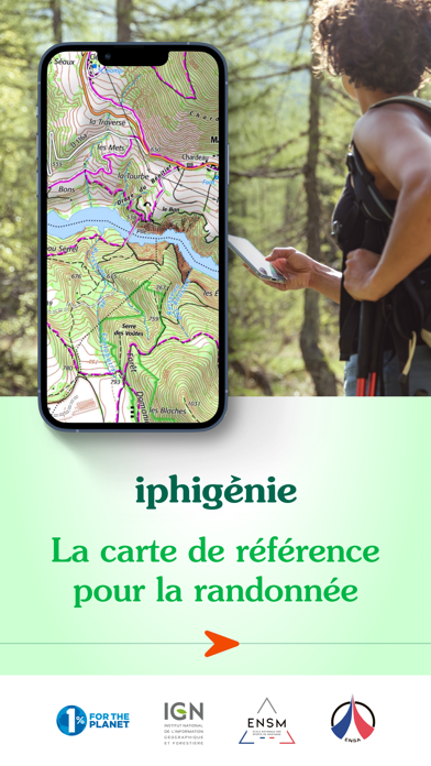
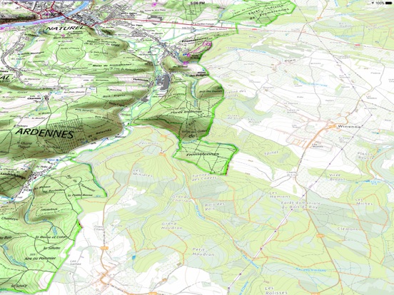
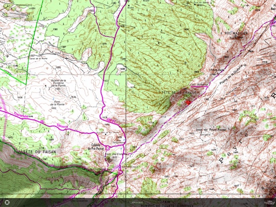
Screenshots
App Description
With more than 80 base maps and overlays, Iphigénie stands out as the benchmark mapping application.
Designed for hiking, trail running, long-distance trekking, Nordic walking, ski touring, snowshoeing, mountain biking, road cycling, and outdoor navigation in general, it brings together everything you need to explore with confidence.
Iphigénie is also committed to 1% for the Planet (1% of our annual revenue is donated to environmental organizations).
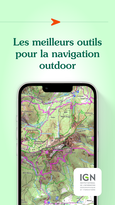
A wide selection of maps and overlays, available even offline
Iphigénie provides access to a broad range of maps: IGN France, IGN Spain, IGN Belgium, swisstopo, Italian Fraternali maps, Geo4Map, Lupo (Apennines), Geoportale Nazionale, OpenStreetMap, OpenTopoMap, BKG (Germany), Kartverket (Norway), Institut Cartogràfic de Catalunya, OpenSnowMap, Utagawa VTT, CyclOSM, as well as aeronautical ICAO charts, geological and mining maps, and glider flight charts.
You can also explore historical maps (19th-century État-Major maps, Paris 1906, Guyana 1780, satellite imagery from 1950–2005) to enrich your navigation references.
The app includes numerous overlays: land registry (cadastre), Petzl tracks, slope angle shading, hiking trails, satellite views and aerial imagery, detailed administrative boundaries (regions, departments, cantons, municipalities, EPCIs), National Forestry Office drone restriction zones, and more.
Most maps and overlays can be downloaded directly to your phone, allowing you to locate yourself and navigate even without an internet connection — including in remote areas. You can also print selected map sections.
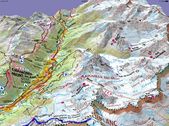
The most precise HD satellite map of the Mont Blanc massif on the market
Explore the Mont Blanc massif with unmatched precision thanks to Iphigénie’s winter HD satellite map.
Specifically designed for ski touring, it provides a clear and detailed view of snow-covered terrain: glaciers, couloirs, relief features, and forested areas are visible with exceptional accuracy to help you better prepare your routes.
Downloadable for offline use. Additional mountain ranges will be available soon.
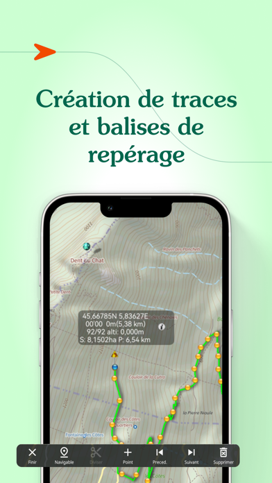
Tools to navigate with confidence
Create, import, and edit your routes. Geolocate yourself on the map background of your choice and add custom waypoints, such as trailheads, mushroom spots, or mountain huts.
Search easily for a place by name or GPS coordinates (feature available in France only).