California Road Report
California Road Report Summary
California Road Report is a with in-app purchases iOS app in Maps And Navigation by Adam Levy. Released in Apr 2010 (16 years ago). It has 7.2K ratings with a 4.67★ (excellent) average. Based on AppGoblin estimates, it reaches roughly 17.4K monthly active users and generates around $<10K monthly revenue (100% IAP / 0% ads). Store metadata: updated Nov 13, 2024, version 4.
Recent activity: 7.00 new ratings this week View trends →
Data tracking: SDKs and third-party integrations were last analyzed on Feb 18, 2026.
Store info: Last updated on App Store on Nov 13, 2024 (version 4).
4.67★
Ratings: 7.2K
Screenshots


App Description
Know before you go with California Road Report, your best app for being informed of what's happening on the highway.
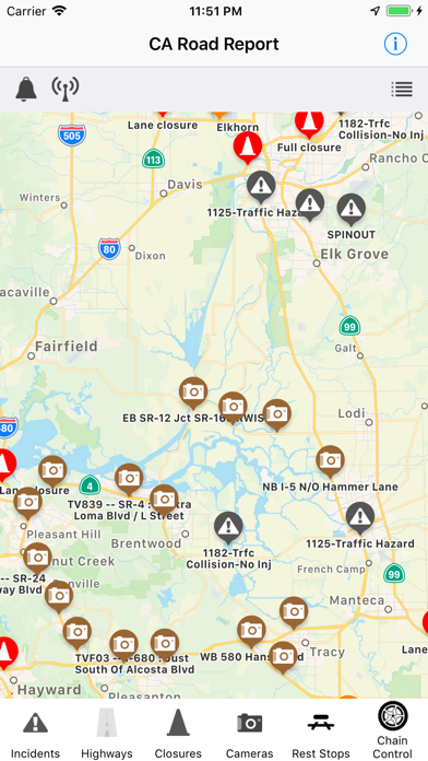
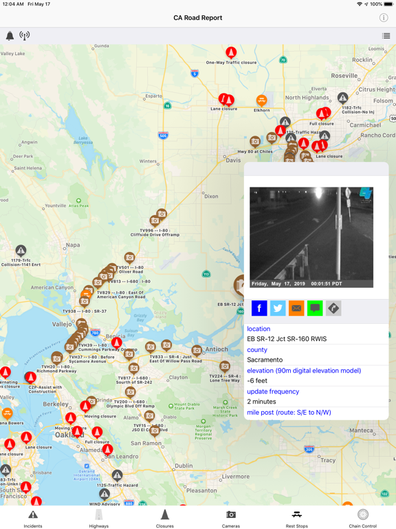
With California Road Report you can view CHP incidents, CalTrans road conditions, chain control, road closures, highway cameras, CalFire incidents, and rest stops in California on your iPhone, iPad, and Apple Watch on the go!
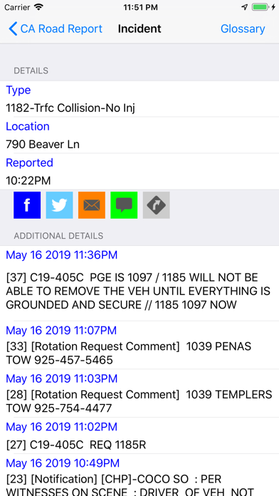
- View CHP Incidents in areas nearby or from a list of selected areas in either list mode or map mode
Each CHP incident reported contains the time of occurrence, location, and details of the incident.
- Hands-Free Mode - With hands-free mode, CHP incidents can now be spoken to you while you drive so you can keep your eyes on the road and still receive CHP reports. (note: Continued use of GPS running in the background can dramatically decrease battery life.)
- Search for CalTrans road conditions on any given highway in California
Ideal for checking chain requirements prior to driving in snowy conditions, knowing if there will be road work, or finding out if a particular stretch of the highway has been closed.
- Find out where chain control is being enforced during snow storms
While in map view you can pan around the state of California to see where chain control is being enforced or scroll through a list of all chain control areas in California.
- Find nearby rest stops
Need to take a break while on a long drive down the 5? Check out nearby rest stops and see their available amenities.
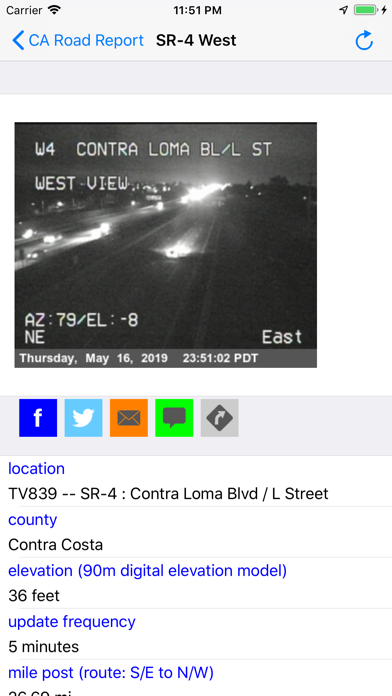
- See highway cameras
See pictures from over 500 highway cameras (with some including live video) in the state of California and also share them on Facebook, X, eMail, and SMS.
- Road Closures
Avoid traffic by knowing which roads are closed or have lane closures.
- CalFire Incidents
See nearby CalFire incidents and check percent contained and number of acres burned.
**** New CarPlay Support ****
You can now see CHP Incidents, road closures, and rest stops while using CarPlay.