Sea Weather Professional
Sea Weather Professional Summary
Sea Weather Professional is a with in-app purchases iOS app in Weather by appdoctors UG. Released in Aug 2010 (15 years ago). It has 9.00 ratings with a 3.22★ (mixed) average. Based on AppGoblin estimates, it reaches roughly 23 monthly active users and generates around $<10K monthly revenue (100% IAP / 0% ads). Store metadata: updated May 31, 2025.
Store info: Last updated on App Store on May 31, 2025 .
3.22★
Ratings: 9.00
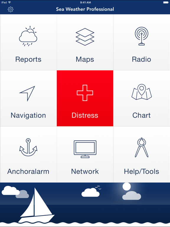
Screenshots


App Description
Sea Weather Professional provides nautical Information for the Atlantic, Pacific, North Sea, Baltic Sea and the Mediterranean Sea for professional planning and navigation. Open data from European & US weather services is enhanced for your mobile device.
Get weather reports, forecasts, maps, and NAVTEX radio messages from many nautical areas. Your One-stop-solution available for all devices (iPhone, iPad & iPod).
FEATURES:
– Marine weather reports and maps for Atlantic, Pacific, North Sea, Baltic Sea and Mediterranean Sea
– e.g. Coastal Weather Report, Shipping Forecast, Station reports, Wind Forecast, 3 Day Sea Weather Preview
– Wind & wave information for all three nautical areas
– NAVTEX radio messages
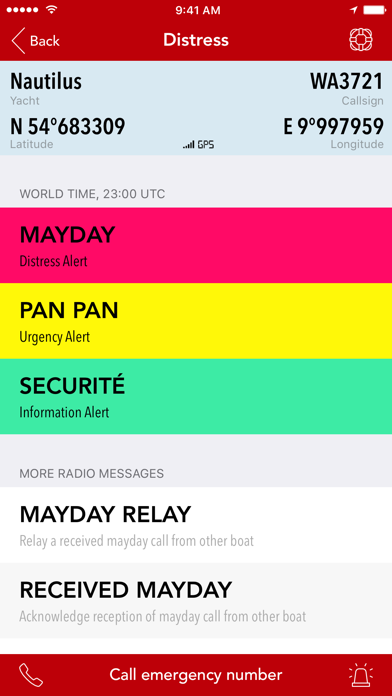
– Distress Assistant for calling MAYDAY / help & sending S O S
– Navigation Head Up Display
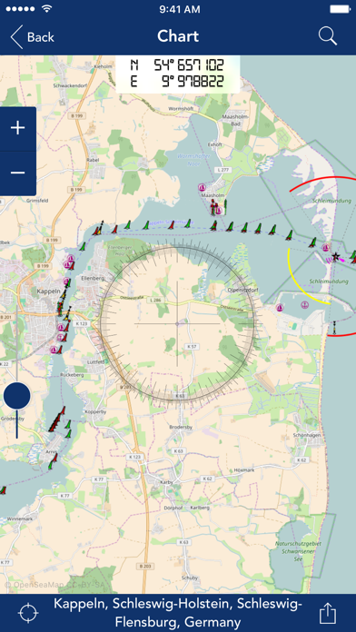
– OpenSeaMap the free nautical sea chart
– Checklists, Windcalculator, Nautical Signal Flags, Morsecodes, Clouds
– Sharing of reports and maps
– Offline Datastorage: Store reports, maps and other resources to access when offline
– Turbo Download: One-tap-update of all weather data (reports, maps, NAVTEX radio messages)
– Night vision: Red-Light-Vision ensures that your eyes keep night vision
– Anchor alarm: Monitor and log safety of your yacht position in background
– Waterlevels: Get access to the latest levels of inshore waterways
– European Reports: Get access to all kind of available marine weather info in Europe
– USA Reports: Reports & maps for United States Atlantic, Pacific & Alaska regions
– Todolist: Keep track of what needs to be done on board & proritize with colorful tags
– Telescope: Use the built in camera to magnify things far away
– Timezones: World Timezones for a lot of major cities
– Morse telegraph: Morse any message via audio or LED flashlight
– Compass: Easy to use compass whenever needed
– Barometer: Measure air pressure & keep history of measurements
– Distress-Voice-Assistant: In case of distress let the app speak for you
– Weatherinformation for cities worldwide
– Unlimited use of Seaweather Professional Nautical Network
– Frequent servicedata updates for the app
REPORTS & MAPS COVER FOLLOWING SEA AREAS:
Atlantic, Pacific, Alaska, East Frisian coast, estuary, Helgoland, North Frisian coast, the river Elbe between Hamburg and Cuxhaven, Flensburg to Fehmarn Fehmarn to the east of Rügen, e