Measure Map Pro
Measure Map Pro Summary
Measure Map Pro is a with in-app purchases iOS app in Tools by Blue Blink One, SL. Released in Jun 2011 (15 years ago). It has 2.2K ratings with a 4.44★ (good) average. Based on AppGoblin estimates, it reaches roughly 3.8K monthly active users and generates around $<10K monthly revenue (100% IAP / 0% ads). Store metadata: updated May 28, 2026.
Store info: Last updated on App Store on May 28, 2026 .
4.44★
Ratings: 2.2K
Screenshots


App Description
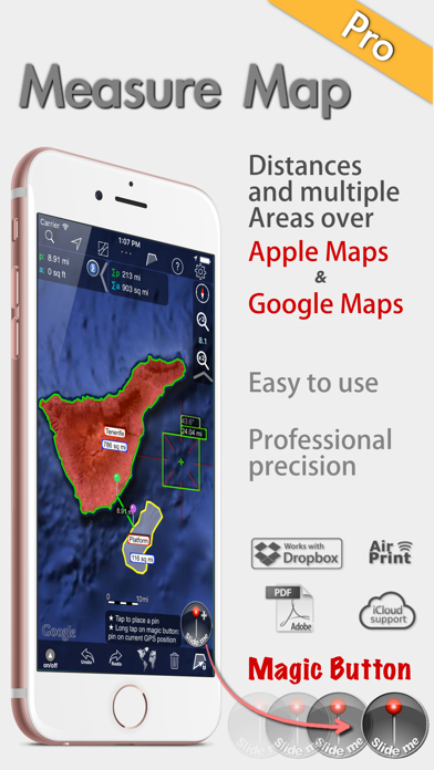
Measure Map Pro lets you quickly and easily measure multiple distances, perimeters and areas with laser sharp precision!. Use it for small areas or large, then share with coworkers. Click “...More” to learn why you should download this App today!
Calculate surface areas, buildings, plots, floors, forest areas or dimensions for fencing, sports tours, trips or anything you need for field work without having to go to the spot to take measurements. Only one finger to calculate with astonishing accuracy all these measurements over satellite images.
That’s what Measure Map Pro is for, to put a powerful, portable measuring tool right in the palm of your hand. Your iPhone, iPod touch or iPad can now provide you with totally precise measurements of any distance, from as small as one tenth of a meter to as big as thousands of kilometers or miles, even taking the curvature of the earth’s surface into account when measuring. It does all that, fast and effortlessly.
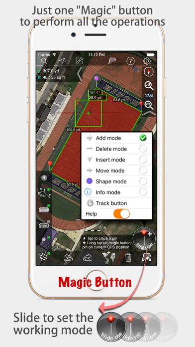
Just one "magic" button for all the operations to easily place points without loosing it's professional accuracy.
Some impressive features you get in Measure Map Pro (some of them via in-app purchase):
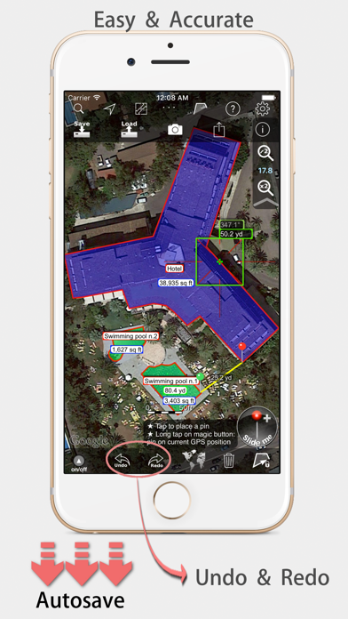
* Autosave
* Attractive, smooth, easy navigation and use
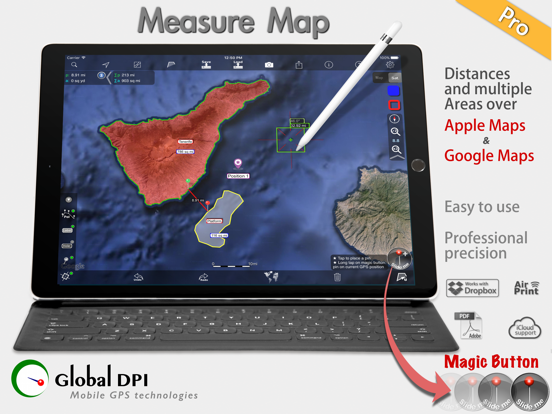
* For iPhone and iPad
* Apple or G00GLE Maps with extra zoom level.
* Displays Maps View: Map, Satellite, Hybrid and Terrain.
* Undo and redo operations as needed
* AirPrint and iCloud support
* More maps with extra zoom level through in-app purchase: Bing, Here, and ArcGIS. And Open Street, Open Cycle, World Street and more in the future
* Operations: Add, delete intermediate pins, insert between pins, move pins, get info.
* Circles and rectangles
* Multiple areas and routes on screen
* Display of altitude above sea level, azimuth and angle
* Calculates azimuth or bearing
* Search for current location, text (villages, places of interest, etc.)
* Length units: meters, kilometers, feet, yards, miles, nautical miles, ken, ri, bù, lǐ
* Surface units: square meters and kilometers, ares, hectares, square foot, square yards, square miles, acres, fanegas (Valencian, Castilian or Colombian), tsubo, bu, so, lí, mǔ
* Intermediate distances between pins can be displayed
* Attach pictures to points
* Ability to select color and thickness of the perimeter line.
* Ability to select the color and transparency of the selected area.
* Working