Canada Weather
Canada Weather Summary
Canada Weather is a mobile iOS app in Weather by Gauld Developments. Released in Sep 2011 (14 years ago). It has 687 ratings with a 4.54★ (excellent) average. Based on AppGoblin estimates, it reaches roughly 1.8K monthly active users . Store last updated Aug 4, 2025
Canada Weather SDKs Summary
App not yet scanned for SDKs.
4.54★
Ratings: 687
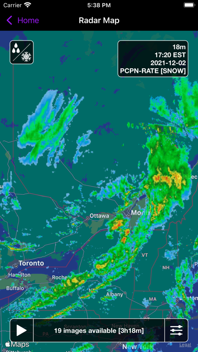
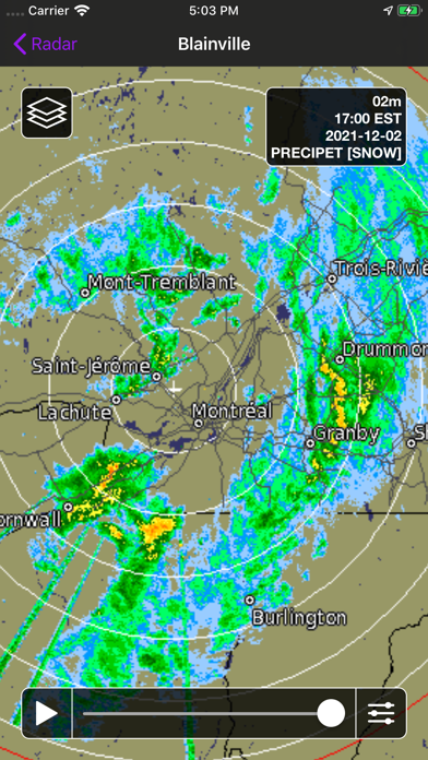
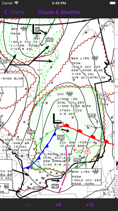
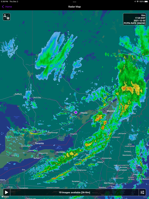
Screenshots
App Description
View Canadian weather radar, satellite imagery, GFA, and surface analysis charts.
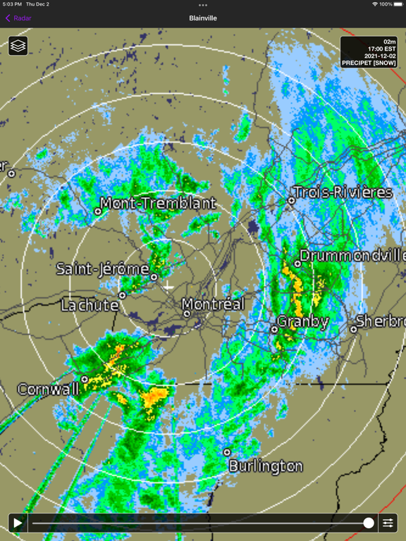
--- Radar Map ----
View radar animations for all of North America (including Alaska & Hawaii) and choose between Precipitation Rate imagery (calibrated for either rain or snow) or Precipitation Type imagery (shows the type of precipitation as rain, snow, mixed, etc). Customize animation speed, delay, radar opacity, and map type.
*Note: Precipitation Type imagery is currently experimental and may not accurately reflect the exact type of precipitation falling in your area.
--- Radar Images ---
Select from a list of 31 stations nationwide and animate up to 100 images calibrated for either rain or snow. Visit the Environment Canada website for a detailed map of radar coverage in your area.
*Note: Fort McMurray is not included since the overlay images were never produced by Environment Canada. Radar coverage in the Fort McMurray area is included in the Radar Map product.
--- Satellite ---
View satellite imagery from the GOES-19 weather satellite in visible light, infrared, and combined. Choose between the Meteorological Society of Canada (MSC) or the US National Oceanic and Atmospheric Administration (NOAA) and animate up to 6 hours of imagery. Coverage includes all of Canada and most of the USA.
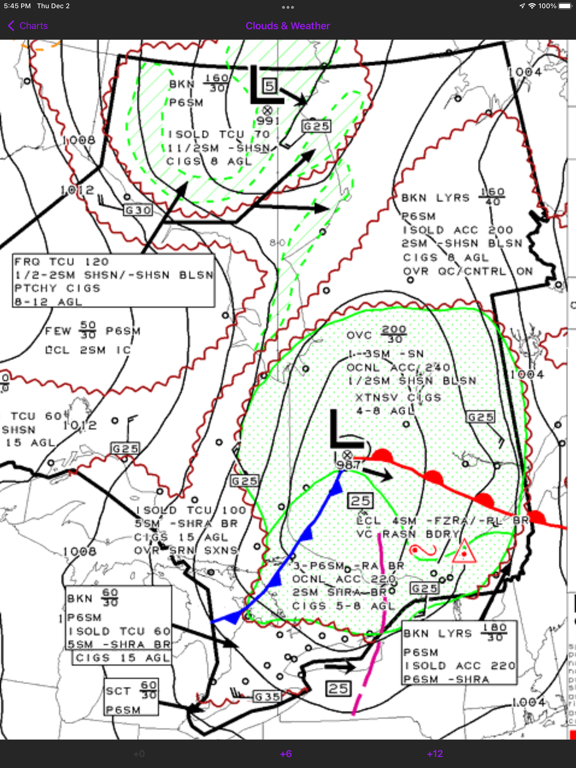
--- Charts ---
View Surface Analysis and Graphical Area Forecast (GFA) charts for all of Canada. The Surface Analysis is a snapshot of the current pressure and frontal systems across Canada. GFAs give you a 12-hour forecast of the expected pressure and frontal systems at a regional level, along with information such as expected precipitation, cloud height & coverage, turbulence, icing, and freezing level. While these charts are typically used by pilots, they offer an excellent look at the current weather systems in a given region.
Quickly switch between 0/+6/+12 GFA images and between "Clouds & Weather" and "Icing, Turbulence, & Freezing Level" images. You can also view GFA pairs side-by-side instead of having to switch between them.
--- Data Providers ---
Radar: Environment Canada
Satellite: Meteorological Service of Canada (MSC), National Oceanic and Atmospheric Administration (NOAA), Cooperative Institute for Research in the Atmosphere (CIRA)
Charts: NAV CANADA