Fulcrum GIS field data capture

Fulcrum GIS field data capture Summary
Fulcrum GIS field data capture is a with in-app purchases iOS app in Business by Spatial Networks, Inc. Released in Oct 2011 (14 years ago). It has 146 ratings with a 4.08★ (good) average. Based on AppGoblin estimates, it reaches roughly 675 monthly active users and generates around $<10K monthly revenue (100% IAP / 0% ads). Store last updated Jul 6, 2026
Recent activity: 1.00 new ratings this week View trends →
Fulcrum GIS field data capture SDKs Summary
App not yet scanned for SDKs.
4.08★
Ratings: 146
Screenshots


App Description
Field teams often struggle with inefficient tools that slow operations and compromise data accuracy. Fulcrum transforms field workflows with intuitive, AI-powered mobile GIS software for seamless data collection, geospatial mobile apps tracking, and process automation.
Unlike traditional GIS mobile apps that require specialized training and are confined to the office, Fulcrum is a field-first solution that empowers both GIS experts and non-GIS team members to easily capture and share geospatial data.
Fulcrum is built for teams that need powerful, flexible tools for field data collection, asset tracking, and process automation. It provides:
- Field process management with real-time GIS mobile data collection for faster, more accurate data capture.
- Mobile data collection applications to streamline surveys, inspections, and compliance tracking.
- Asset data collection software mobile applications to track and manage infrastructure, utilities, and field equipment with precision.
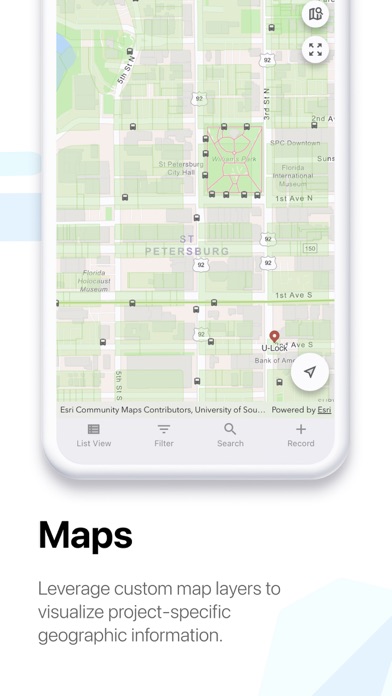
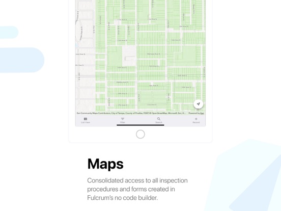
- Geospatial mobile apps for GPS-based field data collection to give teams accurate location data for mapping, reporting, and decision-making.
Why choose Fulcrum?
Fulcrum is trusted by nearly 3,000 companies and 50,000+ users worldwide to digitize inspections, surveys, field data collection, and asset management tasks for industries such as construction, utilities, and environmental services. As an Esri Silver Partner, Fulcrum integrates seamlessly with ArcGIS, helping teams connect field data with their GIS workflows. And as a purpose-built field processes platform, Fulcrum helps teams customize field processes, reduce manual workflows, and capture more accurate, actionable data.
Key features
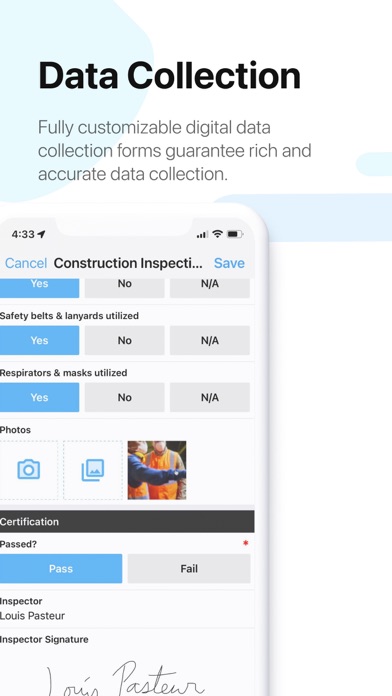
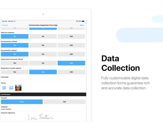
- Drag-and-drop form builder – Create and customize inspection checklists, surveys, and asset tracking forms with no coding required.
- AI-powered voice data entry – Use Audio FastFill for hands-free data collection, reducing manual input and speeding up fieldwork.
- Integrated GIS capabilities – Sync with Esri ArcGIS, export geospatial data in GeoJSON or Shapefiles, and enhance mobile GIS data collection.
- Real-time data sync – Instantly share collected data with your team and integrate with enterprise systems.
- Offline data collection – Capture and store data without connectivity, then sync once back online.
- Advanced security – Protect sensitive data with SOC 2 Type 2 com