Terrain Radar Altimeter
Terrain Radar Altimeter Summary
Terrain Radar Altimeter is a with in-app purchases iOS app in Maps And Navigation by Nestele Engineering. Released in Nov 2012 (13 years ago). It has 856 ratings with a 4.69★ (excellent) average. Based on AppGoblin estimates, it reaches roughly 2.2K monthly active users and generates around $<10K monthly revenue (100% IAP / 0% ads). Store metadata: updated Jan 8, 2024, version 2.
Recent activity: 1.00 new ratings this week View trends →
Data tracking: SDKs and third-party integrations were last analyzed on Mar 12, 2026.
Store info: Last updated on App Store on Jan 8, 2024 (version 2).
4.69★
Ratings: 856
Screenshots

App Description
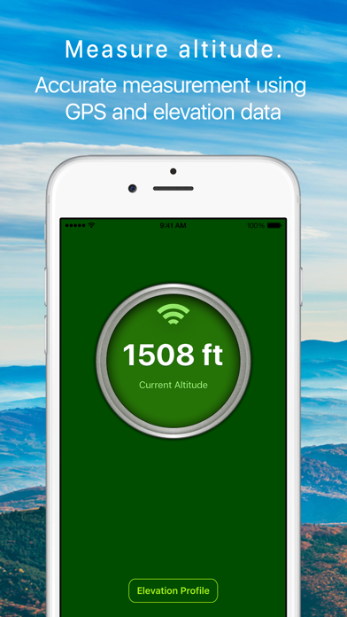
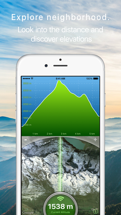
Measure the elevation of each location within a radius of 500 meter. With Terrain Radar Altimeter you can discover the height of hills in front of you or take a look at further away mountains. The unique combination of device sensors and internet-based geo informations makes Terrain Radar to the best altimeter app in the store.
FEATURES:
• High accuracy digital elevation model
• Range up to 500 meter (1600 ft)
• Calculation of altitudes in real time
• Precise elevation chart
• Display in meter or feet
The altitudes are calculated through online services, based on your GPS position and compass direction.
Whether biking, hiking or walking - with this altimeter app every trip is a journey of discovery!