Topo GPS - Topographic maps
Topo GPS - Topographic maps Summary
Topo GPS - Topographic maps is a free, with in-app purchases iOS app in Maps And Navigation by rdzl. Released in Nov 2012 (13 years ago). It has 65.2K ratings with a 4.60★ (excellent) average. Based on AppGoblin estimates, it reaches roughly 161.5K monthly active users and generates around $<10K monthly revenue (100% IAP / 0% ads). Store last updated Jul 10, 2026
Recent activity: -1 new ratings this week View trends →
Topo GPS - Topographic maps SDKs Summary
Topo GPS - Topographic maps was last scanned for SDKs on 2026-07-10. No known SDKs were detected. Check the raw list of SDK parts detected here and feel free to request unknown SDKs be added to AppGoblin.
4.6★
Ratings: 65.2K
Screenshots


App Description
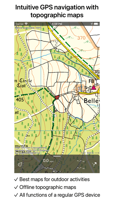
Makes from your iPhone, iPad, Apple Watch and/or Macbook a complete GPS device with detailed topographic maps. Viewed maps will be stored on your device so that Topo GPS can also be used offline.
Why should you buy an expensive GPS device if you can install Topo GPS? Topo GPS contains all functions of a regular GPS device for less money, has a much more detailed map, and is more convenient to operate. The accuracy of the position determination is in favorable conditions about 5 m.
Ideal for walking, hiking, cycling, mountain biking, sailing, horse-riding, geocaching, scouting, trail running and other outdoor activities. Also suited for outdoor professionals.
- Map
* To use Topo GPS you need to buy a map.
* Official topographic maps of many countries, including Great Britain (OS Explorer), New Zealand and Australia are available as in-app purchase.
* Topographic maps are very detailed maps, include height contours and are very suited for outdoor activities.
* All maps of a certain region can be made offline accessible using the map download screen.
* Easy switching between maps.
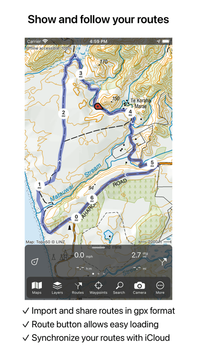
- Routes
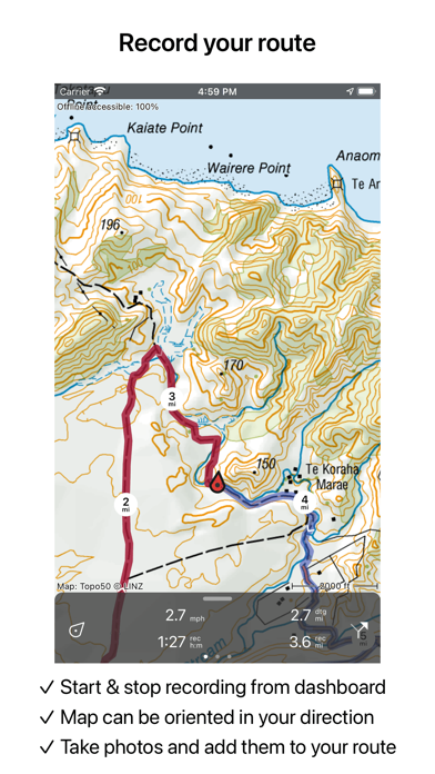
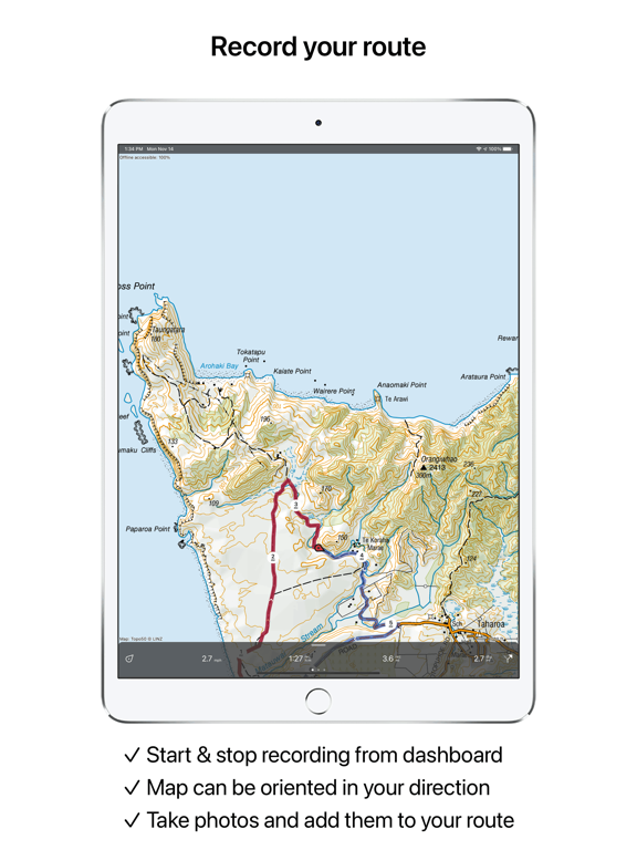
* Recording routes, with pause and restart possibility.
* Planning routes via route points.
* Generating routes
* Editing routes
* Synchronization with your other devices via iCloud.
* Searching routes with filters.
* Routes can be organized into folders.
- Waypoints
* Easy adding by pressing long on map.
* Adding waypoints through address or coordinates.
* Sharing waypoints.
* Editing waypoints.
- Layers
Layers contain information that can be added to and removed from the map.
* Long distance bicycle routes
* Mountainbike routes
- Coordinates
* Easy entering coordinates
* Scanning coordinates
* Supported coordinate systems:
WGS84 decimal, WGS84 degree minutes (seconds), UTM, MGRS, and other country specific coordinate systems.
* Coordinates grid layers
- Intuitive interface
* Clear menu with most important functions.
* Different dashboard panels with distance, time, speed, altitude and coordinates.
* Clear manual at www.topo-gps.com
- Supported file formats:
* gpx, kml/kmz, geojson (all also zip compressed), WFS, csv
If you are recording a route, the GPS will run in the background. Continued use of GPS running in the background can dramatically decrease battery life.
Rdzl, the company behind Topo GPS, does not obtain in any way the position of the user of Topo G