Terrafin Mobile
Terrafin Mobile Summary
Terrafin Mobile is a with in-app purchases iOS app in Weather by Terrafin Satellite Imaging. Released in Dec 2012 (13 years ago). It has 12 ratings with a 3.00★ (mixed) average. Based on AppGoblin estimates, it reaches roughly 31 monthly active users and generates around $<10K monthly revenue (100% IAP / 0% ads). Store metadata: updated Jun 14, 2020.
Data tracking: SDKs and third-party integrations were last analyzed on Feb 13, 2025.
Store info: Last updated on App Store on Jun 14, 2020 .
3★
Ratings: 12
Screenshots

App Description
Terrafin has provided key satellite data online for anglers, divers, and researchers since 1998. Now, Terrafin Mobile gives subscribers easy access to this data from your iPhone or iPad.
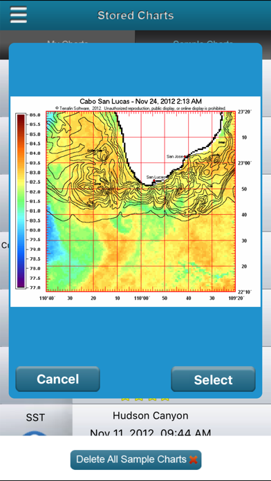
Note: The Terrafin Mobile app installs with an assortment of sample charts, that you can use to try the various features. Access to current data requires an active subscription to the Terrafin website, available @ $109.99/year.
Terrafin Mobile Features:
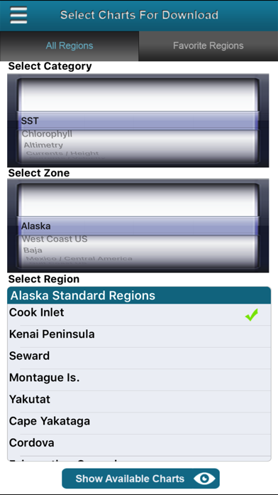
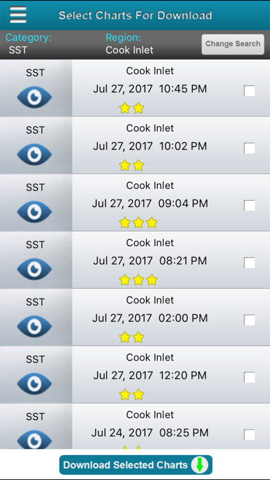
• Browse Terrafin website to easily select charts.
• Charts are downloaded to device for use offline.
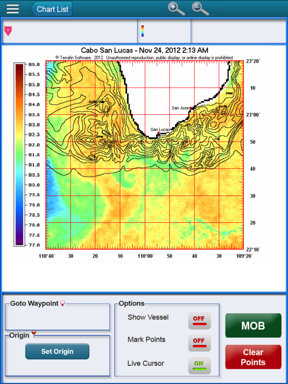
• Tap and drag cursor for accurate positioning.
• Latitude / Longitude / Temperature readings at cursor.
• Mark waypoints.
• Distance & Bearing to waypoint or cursor.
• Real time vessel location and track displayed on chart (GPS enabled device required).
Data available with Terrafin Mobile
• Hi Res (1.1km) Sea Surface Temperature Charts, updated 2-3x daily.
• Hi Res (1.1km) Chlorophyll / Ocean Color Charts, updated daily.
• Altimetry (Sea Surface Height) Charts, updated daily.
• Geostrophic Currents Charts, updated daily.
• CloudFree SST charts, updated daily.
Areas of Coverage:
• U.S. East, West, and Gulf Coasts
• Alaska & Hawaii
• Caribbean & Bermuda
• Mexico, including Baja and Sea of Cortez
• Central America (Pacific Coast)
• Venezuela
• Brazil
• Australia East Coast
SAVE FUEL – SAVE $$$ - CATCH MORE FISH!