Bucephalas
Bucephalas Summary
Bucephalas is a mobile iOS app in Maps And Navigation by Junichiro Seyama. Released in Apr 2013 (13 years ago). It has 1.00 ratings with a 4.00★ (good) average. Based on AppGoblin estimates, it reaches roughly 4.00 monthly active users . Store metadata: updated May 21, 2026.
Store info: Last updated on App Store on May 21, 2026 .
4★
Ratings: 1.00
Screenshots
App Description
【The full version of the Bucephalas series】
This is the full version of the Bucephalas series with the functionality restrictions removed.
A FREE version of this app, Bucephalas Tabula rasa , is also available. You can experience the features of the full version in a real ride using Tabula rasa.
【Dialogue by parroting actions】
Bucephalas recognizes your actions and attempts to interact with you by verbally parroting them back to you.
With a navigation app, you would turn right after the app indicates “right turn”. Bucephalus, on the other hand, will say “right turn" after you turn right. In addition, Bucephalus will also parrot back actions such as "stopped," "resume movement," "retreat," and "turned in the direction of the full moon.
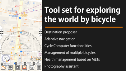
【Functions as a cycle computer】
In designing Bucephalas, it is assumed that the bicycle would be the primary means of transportation. Therefore, it also has basic functions as a cycle computer.
• Multiple bicycle management: Bucephalas can register multiple bicycles and record distance traveled and average speed by body.
• Management of bicycle parts by distance traveled: To manage bicycle parts based on the distance traveled, the user can set up a dedicated total distance meter for specific bicycle parts such as tires and brake shoes.
• Elevation and air pressure of the current location
• Altitude gained, maximum altitude gained, and cumulative altitude gained starting from the coordinates of the app's startup
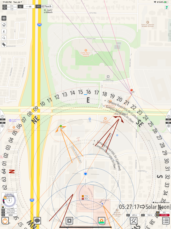
• Voice-guided navigation to the destination
• 3D sound (stereophonic sound) provides direction to the destination.
【Suggestion of destinations on two spatial scales】
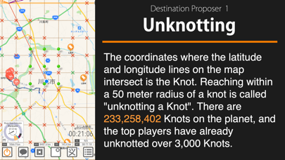
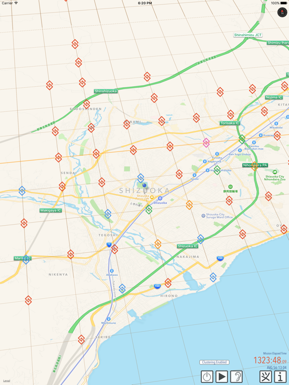
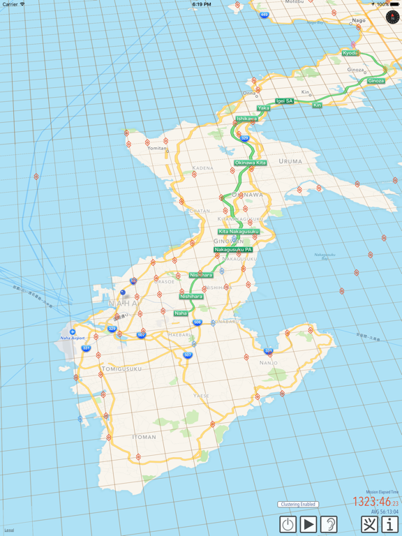
(1) Global Journey = Unknotting Mode
The intersection of a grid of latitude and longitude lines drawn every 1/60th of a degree is called a knot. There are 233,258,402 knots on the entire globe. The objective of Unknotting mode is to reach a circle with a radius of 50 meters centered on the knot.
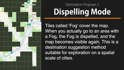
(2) City-Scale Travel = Dispelling Mode
Scaling down the grid of Unknotting to 1/60, the objective is to explore a city from corner to corner. For those who wish to explore the city in even more detail, a movement logging function called Rectangular footprint is provided.
【Destination suggestion method that does not assume a spatial scale】
Mirages are a series of randomly generated coordinates. A Mirage i